In this article, I am presenting information from the National Weather Service and some other parts of NOAA on the North American Monsoon (NAM) which really is the Sonoran Monsoon but we wanted to have our own so we appropriated it. When the Sonoran Monsoon leaks into the U.S. it is called the NAM. The quoted material is indented and my comments are in boxes.

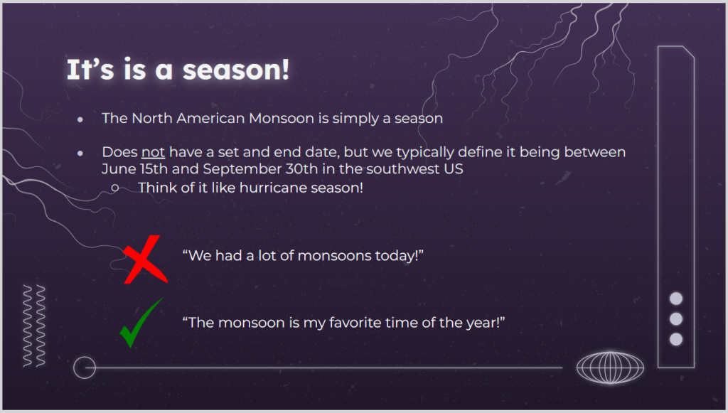
| Yes and no. Yes, it is a season not a single storm. Tucson NWS is Monsoon Headquarters and they had criteria for determining when the Monsoon started and stopped but it was felt that these were too complicated for Americans so they changed to a calendar start and stop time which works well. |
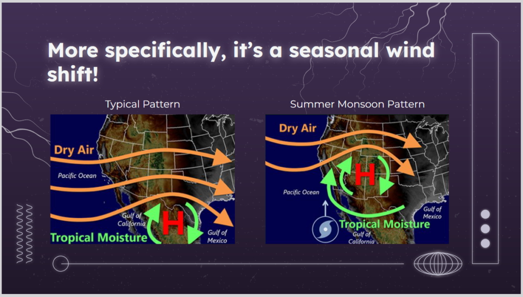
| The starting point for understanding the NAM or pretty much anything in Meteorology is to think about the time of the year. In the winter, the prevailing westerlies and the jet stream dominate weather in the CONUS. In the summer they still have an impact but other mechanisms can come into play. No time in this article to explain it but the ITCZ moves to the north.
I would like to add that the differential heading of land and water in Mexico causes moist air to rise creating thermal low which kind of shoves the high north of it to the north. The mountains also play a role in sometimes blocking air flows and uplifting air masses which causes precipitation. It is quite complex but we are going to simplify it a bit in this article. |
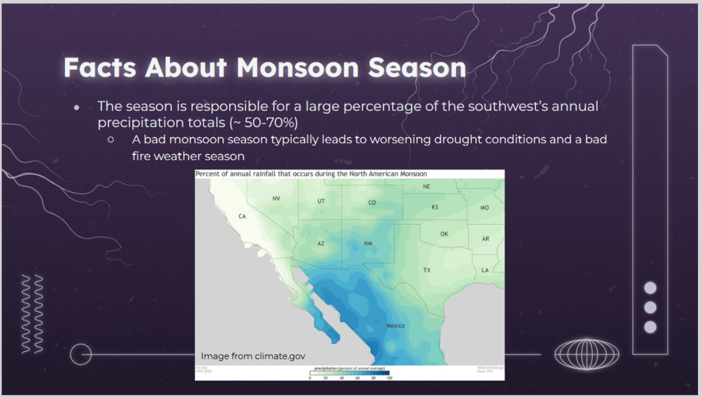
| This map shows the percentage of annual precipitation that arrives during the Monsoon Season. You can see that the NAM is very important to Arizona, New Mexico, Kansas, Western Texas, and the small part of Southeast California. But it is important to many other states as well. It may not provide a disproportionate part of their annual precipitation but a good monsoon versus a poor monsoon has an impact on many states. As you can see, it is even more important to Mexico. |
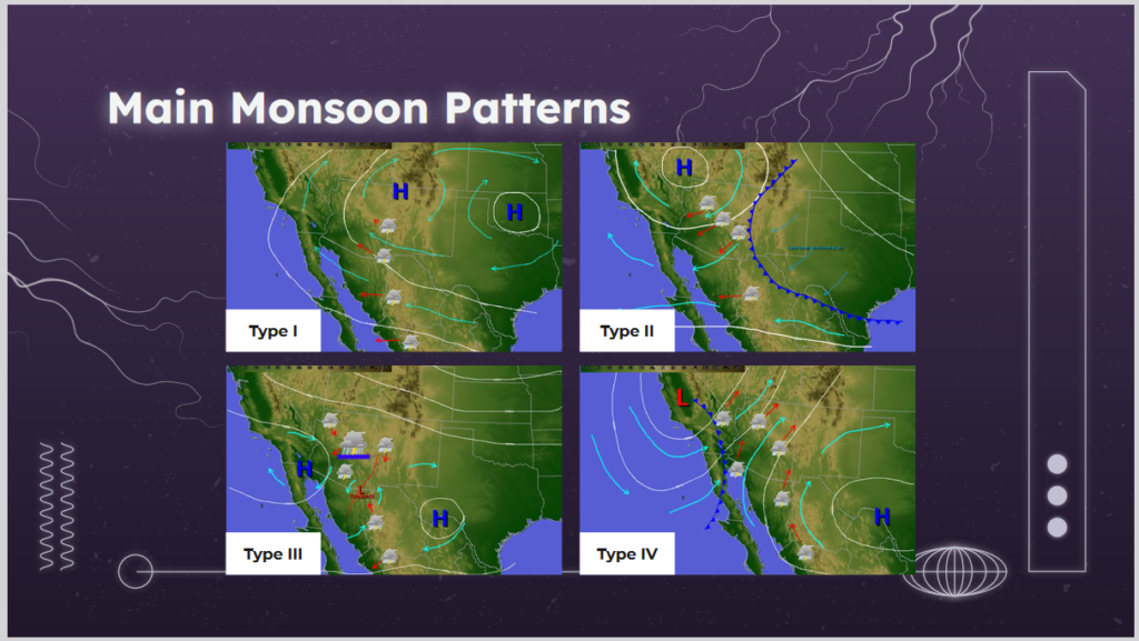
| There are more than four types but these are the main ones. We will go into detail on each of them in the body of this article. But it is really simple when you think about a high being clockwise and a low being counterclockwise. Where you have a low west of a high, the air will be shuttled to the north from Mexico. So first look for the position of the main high-pressure area. Then look for where the low is. You will be able to figure out which way the wind will be blowing. If it is coming from where moisture is, it is likely to rain. |
Some readers will need to click on “Read More” to get to the body of the article.
| These patterns apply to more than the initially studied. But you always need to take into account local geological features such as mountains and water bodies. But the basic principles of wind circulation in Highs and Lows (Coriolis Effect) the characteristics of two mountain ranges in Mexico apply: The Sierra Madre Occidental stands along the western side of the plateau, the Sierra Madre del Sur lies to the south, and the Sierra Madre Oriental stands on the east. We are mostly interested in the Sierra Madre Occidental and Oriental. In some cases, they block the flow of moist air and can cause the moist air to drop most of its moisture in Mexico. |
–
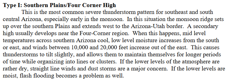
| This is the prototypical Four Corners High pattern. There is a high-pressure center near the Four Corners area where four states intersect. There is another High to the east. There is probably some sort of Low in between. The green lines show the wind flow. I am not sure what the difference is between the green lines and the red lines but it may be altitude. This formation would bring in air from the Gulf of Mexico which usually is moist. The text provides more detail on how this plays out for Arizona. But as you can see a number of States are impacted. Southeast California has a line of mountains so the clouds only sometimes make it to Coastal California. |
I found this time-lapse imagery!
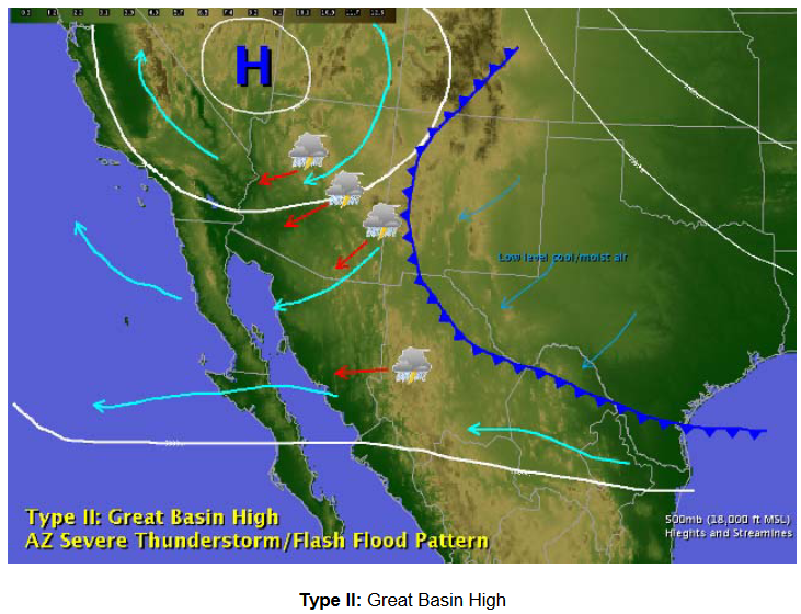
| This comes into play sometimes when the Monsoonal High drifts to the west and better yet also to the northwest. Often there is a trough ( counter-clockwise circulation) to the east. This can lead to colder air being drawn into the Southwest which undercuts the air in place causing it to rise and form clouds. This graphic would work better as an animation that showed the situation developing at different points in time. The key is the re-location of the Monsoonal High that lets other things happen to the east which can then be drawn into the Southwest. |
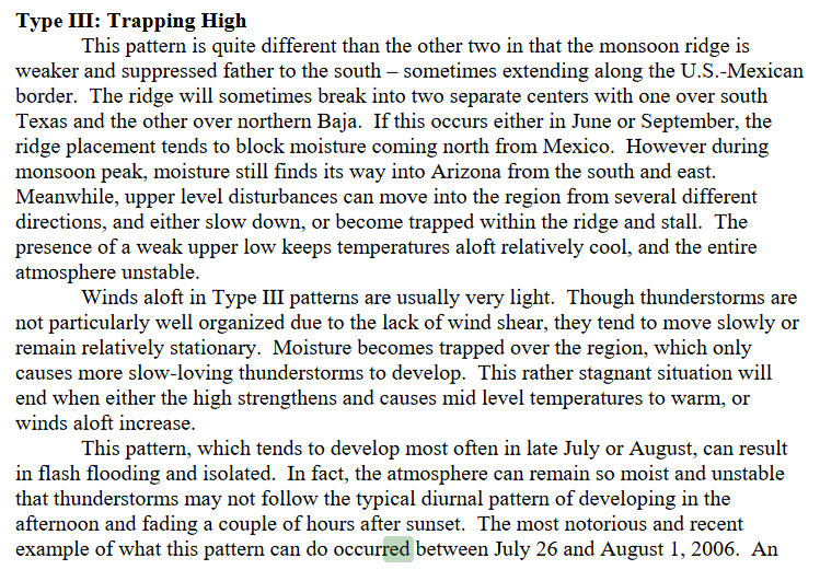
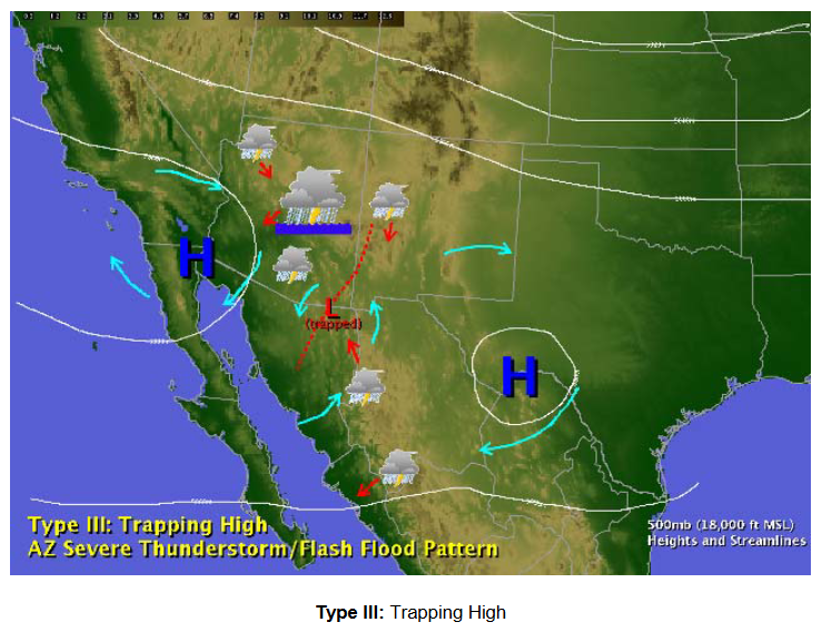
| Here you have the two Highs that form the Monsoonal Ridge (the combination of the two highs) quite far south and separated. The text provides a better explanation. The idea is that clouds get blocked or trapped and hang around for a while which can lead to a lot of rain in one place. |
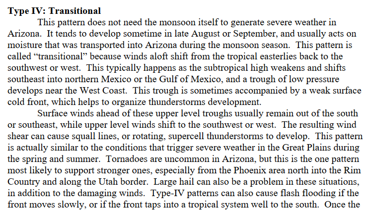
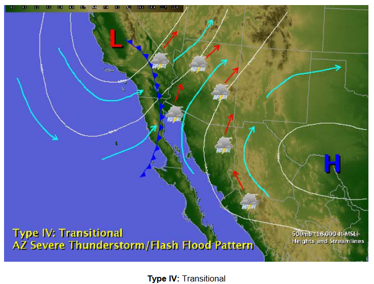
| As the Monsoon matures oven the High moves southeast. The works pretty well to bring in clouds from Mexico. As shown there is also a cold front coming onshore and also creating precipitation. |
Impact of ENSO
ENSO Typically has less impact on the summer than the winter. But it has some impact. Among other impacts are the impact on La Nina and ENSO on Tropical storms. La Nina increases the Chances of tropical storms (including hurricanes) in the Gulf of Mexico. El Nino reduces those chances but increases the chance of Tropical storms in the Eastern Pacific. If they turn inland, the provide additional moisture for NAM.
The Albuquerque Office of NWS provided the following to me.
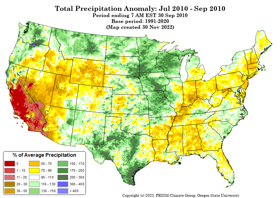
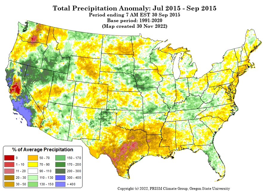
| In the above, they are showing an interesting three-month period July through September. They are looking at two years where there was an abrupt transition from El Nino to La Nina. That is what we are expecting this year. Two years is a small sample but what is shown above is that beyond June, the Monsoon period was wetter than usual in New Mexico and in Eastern Arizona. The Monsoon may have had a slow start but got better. It is a small sample but it shows that it is hard to know for sure what will happen. |
Additional information on NAM can be found HERE, HERE, HERE, HERE, HERE, HERE, HERE, and HERE.
–
| I hope you found this article interesting and useful. |
–
