Weather Outlook for the U.S. for Today Through at Least 22 Days and a Six-Day Forecast for the World: posted December 8, 2024

This article focuses on what we are paying attention to in the next 48 to 72 hours. The article also includes weather maps for longer-term U.S. outlooks (up to four weeks) and a six-day World weather outlook which can be very useful for travelers.

First the NWS Short Range Forecast. The afternoon NWS text update can be found here after about 4 p.m. New York time but it is unlikely to have changed very much from the morning update. The images in this article automatically update.

Short Range Forecast Discussion
NWS Weather Prediction Center College Park MD
Sun Dec 08 2024
Valid 12Z Sun Dec 08 2024 – 12Z Tue Dec 10 2024

…Heavy rain threat emerges across the Deep South late Sunday into
Monday…

…Periods of mixed rain and snow linger from the Great Lakes to northern
New England through Monday night…

…Unsettled and windy weather spreading across the Pacific Northwest this
weekend will reach into the northern Plains as snow/wintry mix by Monday…

…Well above average temperatures will overspread the central and eastern
U.S. as cold air surges into the western U.S….

A major reversal of the weather pattern is forecast to occur across
mainland U.S. during the next couple of days. The remaining cold air
across the eastern U.S. originated from the recent arctic outbreak will be
dispelled by an eastward expanding mild air mass from the central U.S.
Meanwhile, the mild air across the western U.S. in recent days will be
dispelled by a surge of cold air currently advancing through the
northwestern U.S. The upper-level trough responsible for this cold surge
into the western U.S. will first spread mixed rain and snow through the
northern Rockies today behind a cold front along with windy conditions.
Daytime heating will keep the precipitation mainly in the form of rain as
it moves quickly across the northern Plains today. By tonight, colder air
from Canada is forecast to filter south from Canada behind a low pressure
system. This will bring periods of snow into the northern Plains and
areas farther west to the foothills of the northern Rockies through
tonight and into Monday, along with windy conditions. The higher elevations
will receive higher amounts of snow, with the highest snowfall likely near
the northern slopes of the Black Hills where more than a foot of new snow
is possible. Portions of the central Rockies into the Front Range of
Colorado and down into northeastern New Mexico can expect to receive a
period of snow from this system through Monday night into Tuesday morning.

Ahead of the cold front trailing south from the aforementioned low
pressure system, a jet stream sliding across northern Mexico will interact
with a coastal front and a low pressure wave near the western Gulf Coast
to bring an increasing threat of heavy rain farther inland across the
lower Mississippi Valley and then into the Deep South through the next
couple of days. Warmer and more unstable air arriving from the Gulf will
help trigger heavier showers and thunderstorms for the eastern portion of
these areas. The overlapping elements coupled with some recent rainfall
will result in the possibility of scattered instances of flash flooding.
The Weather Prediction Center maintains a Marginal Risk of Excessive
Rainfall across the central Gulf Coast region for Monday into early
Tuesday, with a Sight Risk area from southeastern Louisiana to southern
Mississippi.

Across New England, widespread snowfall is in progress today ahead of a
clipper system moving quickly eastward along a warm front lifting north
across the region. Widespread snowfall of up to 6 inches can be expected
from the Adirondacks eastward through Maine before the snow tapers off
tonight. More snow will then skirt the upper Great Lakes ahead of the
warm front associated with the northern Plains low pressure system, with
6-8 inches expected over the Upper Peninsula of Michigan and the Arrowhead
of Minnesota. A period of rain will sweep across the Ohio Valley Sunday
night, then the Appalachians and the northern Mid-Atlantic on Monday ahead
of the trailing front, followed by the next round of snow across northern
New England Monday night. Mild Atlantic air will keep the precipitation
as rain for southern New England into Tuesday morning.

To get your local forecast plus active alerts and warnings click HERE and enter your city, state or zip code.

Learn about wave patterns HERE.

Then, looking at the world and of course, the U.S. shows here also. Today we are looking at precipitation.

Please click on “Read More” below to access the full Daily Report issued today.

Cloud Seeding to Enhance Precipitation – Economic Considerations – December 7, 2024

Global Warming and Population Growth, create a need for more water.

There are a number of different ways to address a shortage of water:

  1. Get equal value from less water  (Conservation)

  2. Find more water from surface and groundwater  sources

  3. Have more precipitation (Increase the velocity of water)

We previously addressed (2) based on an excellent presentation by an expert in that area. We will discuss conservation in the future, particularly with respect to agriculture. There are major opportunities to achieve increased water use efficiency in agriculture.

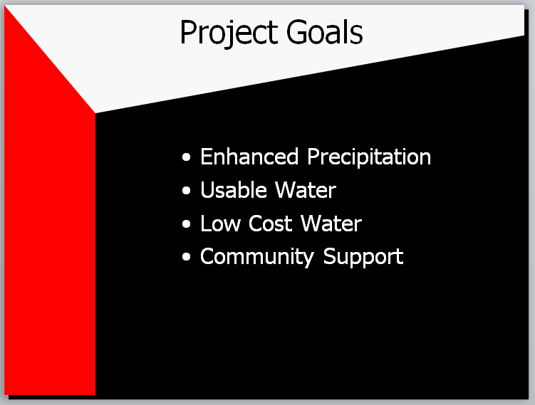
In this article, we discuss “Finding More Water by Using Cloud Seeding to Increase Precipitation”.

Recently I published an article on using cloud seeding to increase precipitation.  It is included (with some updates) in it’s entirety in Part II of this article.  But to define what we are talking about the next two images are important.

Weather modification with cloud seeding was discovered by General Electric at the Schenectady New York Laboratory.  Initially, on July 14, 1946, they used Dry Ice. Of course, prior to that time, there were other attempts at increasing precipitation. The science is discussed in Part  II of this article but the general approach is to assist clouds in converting the moisture in clouds to become snow (or in the tropics large raindrops) so that in both cases they are heavy enough to fall from the clouds to the ground.  Importantly, precipitation in general soon returns to the atmosphere so the water molecules are available to precipitate again and again. Cloud seeding speeds up the process slightly.

Cloud seeding can be used for three different purposes:  Precipitation enhancement, hail suppression, and fog dispersal.  In this prior article, I focused on precipitation enhancement. The discussion in Part I of this article would apply to all three purposes and most projects of any sort since it is general economic theory.

Part I

In this new article, I want to discuss the economics of cloud seeding to increase precipitation.  For a proposed cloud seeding project it is important to know whether or not it is economically justifiable and if implemented continues to be economically justified. We discussed that to some extent in the earlier article which is included in Part II of this article. We know that where conditions are appropriate,  cloud seeding can increase the precipitation over what is called the target area. The reason for this is that natural precipitation processes are very inefficient. That is why precipitation occurs in many parts of the world that are many miles from the source of the moisture that is in the atmosphere. The atmosphere can hold a lot of water.

Hydrologic Cycle

It is important to remember that water is a compound that is almost impossible to destroy.  States view the consumption of water in agriculture as a depletion of the state’s water resource but evaporation and transpiration of plants in the process of photosynthesis returns the water to the atmosphere where it can precipitate and benefit others in the same state or other states or other nations. This can be repeated over and over again. Precipitation over oceans or water run-off into oceans makes that water unusable {other than importantly marine life) unless it is purified. However, the water is not destroyed and can be recovered and used (usually in arid areas like Israel).  Most of our precipitation comes from clouds that form over large bodies of water. So it is best to view all of this as a hydrologic cycle. Moisture evaporating from bodies of water or the ground or from plants enters the atmosphere. Under certain conditions moisture forms clouds. Again, under certain conditions, some of the moisture in clouds precipitates. Precipitation often provides value to people and the environment but mostly  (groundwater is an exception that we do not cover in this article) rather quickly returns to the atmosphere to provide the moisture necessary to form clouds and another round of precipitation. This is a process that is called the “hydrologic cycle”.

Velocity of the Hydrologic Cycle

Cloud seeding speeds up the process which means that individual molecules of water end up providing benefits more times in a year.  This process is not widely understood by the general public. In a way, it is analogous to the money supply. If there is more economic activity.  For simplicity consider a situation where printed currency is the only form of money. When the economy is good, a given unit of currency  (for example a one-dollar bill) will pass through the hands of more people than when the economy is less good. So increasing the velocity of money is often a good thing.  Within narrow limits, we can increase the velocity of the hydrologic cycle and increase the contribution of water to society.

Selection of cloud seeding projects

We know that we can increase the process of precipitation from clouds and the water being used or wasted but either way returning to the atmosphere to precipitate somewhere else. The questions addressed in this article are when is the effort to do this both economical and easily recognized as being economical?

Some information on my background

Years ago, I taught a graduate-level course in Engineering Economics. The focus of the course was applications in information systems but the theory is the same for any endeavor. I did not wish to teach this course but the Vice President of the consulting firm from which I  derived most of my income was also the Dean of the Management School of a significant educational entity (which is now part of NYU) and he insisted that I teach this course (based on my educational background and much experience with doing economic analysis) and I pretty much had no choice but to do so. I enjoyed it but it meant that most of Friday and Saturday every other week was tied up traveling to a neighboring state to teach this course. Teaching the course made me realize that what is basic microeconomic theory is difficult for many people involved in technology development to comprehend.

So it is with some trepidation that I address the topic in this article.

Economic analysis of potential and operational cloud seeding  projects

Generally, projects that do not produce more value than the cost are non-economic. I  will not address the exceptions to this rule because it devolves into a semantic issue of how one defines value.

But even if the approach produces more value than the cost you still have to look at:

  • Who benefits and
  • Who pays

If the payor and beneficiary are different,  there can be problems. [In healthcare it is even more difficult because there is usually a third party involved i.e. the insurance company. That creates a very complicated situation which I addressed in a project done for the Robert Wood Johnson Foundation. There are some aspects of that three-way situation with cloud seeding also.]

There can be other factors which complicate the analysis. This is especially pertinent in the U.S. West where most cloud seeding takes place. In most cases, the allocation of the water supply is based on the Priority Doctrine (PD).  This means that with cloud seeding, the identity of the beneficiary is often not known.  If more water is available it goes to those who otherwise would not receive water because their priority would not have been high enough. Priority is usually determined by who put the water to use first. That may not seem to be an optimal way to do things but it tends to avoid violence since it is easier to determine who put the water to use first than to agree on which uses are better for society than other uses.

Often there is an exception namely that precipitation that falls on your land can be used by the land owner or the land owner’s designated (typically a renter of the land) as long as the water does not leave the boundaries of the property.  If it leaves the property it typically enters the public water supply and the Priority Doctrine takes over. However, the specific rules vary by state in the  U.S.

A  further complication is what are called interstate river compacts which are agreements among states concerning the distribution of the available water supply. The reason this is important concerning cloud seeding is the beneficiary may be in another state. Two important interstate river compacts are the Colorado River Compact and the Rio Grande River Compact. Both of these also have delivery requirements to Mexico. There are many other interstate river compacts. In general, each one has its own rules.

Thus there are two major categories of beneficiaries:

a. A  beneficiary who puts the additional water to beneficial use

b. A  governmental entity that is obligated to deliver water downstream for the benefit of other beneficiaries. This can be considered an indirect beneficiary or a facilitator.

Looking at things from a different perspective the major beneficiaries of water are:

  • Farmers
  • Ranchers
  • Municipalities especially with regard to their need to deliver water to people and for other uses within a municipality
  • Ski resorts (they need snow  that falls from clouds or water to make snow
  • Hydroelectric facilities to generate electricity.
  • Commercial and industrial users who are not getting their water delivered to them by municipalities.
  • Recreation
  • The environment

Some of the above consume the water and others simply use it and pass it on (hydroelectric and ski resorts). For those who from a legal perspective consume water, that water generally returns to the atmosphere or is treated and reused. So our use of language can be somewhat inconsistent with science when it comes to water.

Implications

In some cases, the payor/funder of a cloud seeding project is also the beneficiary. That is the simple case since the payor can decide if the cost is worth the benefit.

In many cases, the payor of a cloud seeding project is an indirect beneficiary. That is often the case with the interstate river compacts and it is generally difficult to get projects funded that assist states in meeting their compact obligations.

Further Discussion

The economics of cloud seeding are complicated. One way of looking at this is that cloud seeding often resembles infrastructure.  When a road or bridge is built it usually is not clear exactly who will benefit. Generally, the consideration is whether or not the community or state or the U.S. will benefit. If funded with tax money (or borrowing which usually translates into property taxes) some will have paid for something that does not benefit them but others, and some will benefit many times more than their taxes.

In many cases, cloud seeding is like that. But in some cases, the direct beneficiary can be identified. Perhaps the best example of that would be ski resorts. They benefit from more snow falling from clouds thus having to make less snow. Hydroelectric in some cases is much like the ski resort example. The hydroelectric utility or the users of the electricity generated benefit and they can often recognize the value of cloud seeding to increase the generation of electricity. But on the Colorado River, it is often unclear who would be the beneficiary of more cloud seeding since there are so many different beneficiaries of there being more water in the river. A special case is when the delivery requirements of the interstate river compact are not being met and the two alternatives are to find more water or use less water.

So there is often a combination of private and public funding of cloud seeding. As a general rule, the greater the distance of the cloud seeding project from the beneficiaries the more difficult it is to have taxpayers or local government entities see the value to them of such a cloud seeding project.

The Prior Article which explains Cloud Seeding now follows as  Part II.

Some will need to click on “Read More” to access the full article.

Weather Outlook for the U.S. for Today Through at Least 22 Days and a Six-Day Forecast for the World: posted December 7, 2024

This article focuses on what we are paying attention to in the next 48 to 72 hours. The article also includes weather maps for longer-term U.S. outlooks (up to four weeks) and a six-day World weather outlook which can be very useful for travelers.

First the NWS Short Range Forecast. The afternoon NWS text update can be found here after about 4 p.m. New York time but it is unlikely to have changed very much from the morning update. The images in this article automatically update.

Short Range Forecast Discussion
NWS Weather Prediction Center College Park MD
Sat Dec 07 2024
Valid 12Z Sat Dec 07 2024 – 12Z Mon Dec 09 2024

…Periods of mixed rain and snow linger from the Great Lakes to northern
New England through the weekend…

…Heavy rain threat emerges across the Deep South late Sunday into
Monday…

…Unsettled and windy weather spreading across the Pacific Northwest this
weekend will reach into the northern Plains as snow by Monday…

…Arctic air across the eastern U.S. will give way to above normal
temperatures by Monday…

As an arctic high pressure system moderates and retreats across the
eastern portion of the country, unsettled weather will emerge and expand
across the Deep South as well as the Pacific Northwest. Moisture
returning behind the high pressure system today will begin to interact
with an upper-level trough and a coastal front just off the Texas coast.
This will result in expanding areas of light to moderate rain with
embedded thunderstorms across the eastern two-thirds of Texas today. The
entire system will shift northeastward on Sunday before evolving into a
heavy rain threat across the lower Mississippi Valley toward the Tennessee
Valley by late Sunday into early Monday. A couple of inches of rain is
expected in this general vicinity with locally higher amounts through
Monday morning.

Meanwhile, periods of mixed rain and snow are expected to linger across
the Great Lakes and into northern New England where a clipper low pressure
system is forecast to track along a nearly stationary arctic front. Up to
a foot of new snow is possible near the Canadian border in these areas.

The Pacific Northwest is entering a period of increasingly unsettled
weather as a rather dynamic upper trough arrives from the Pacific.
Low-elevation rain and high-elevation heavy snow can be expected for the
Cascades and northern Idaho as the weekend progresses with windy
conditions. The mountain snow and low-elevation rain will progress
farther inland into the northern Rockies early Sunday as a low pressure
system begins to develop across the northern High Plains into Alberta
Province of Canada. Winter Storm Warnings and Advisories are active
across the northern Rockies through Saturday where several inches of
snowfall and some icing potential will create hazardous travel conditions.
Meanwhile, much of the remainder of the western U.S. will remain dry and
milder than normal as high pressure dominates. By Sunday night into
Monday morning, a low pressure system is forecast to track across the
northern Plains with snow and wind. Mainly light snowfall amounts are
expected for North Dakota into Montana, with high amounts enhanced by
local terrains.

Low temperatures in the 20s as far south as the Florida Panhandle this
morning have prompted Freeze Warnings for portions of northern Florida
into Georgia. High temperatures will begin to moderate across the East by
Sunday as anomalously mild temperatures across the central U.S. shift
eastward into the region. Highs should be in the 60s and 70s Sunday across
the Southeast and 50s and 40s across the Mid-Atlantic and Northeast, while
50s and 60s will expand across the northern and central Plains Sunday
afternoon ahead of the developing low pressure system.

To get your local forecast plus active alerts and warnings click HERE and enter your city, state or zip code.

Learn about wave patterns HERE.

Then, looking at the world and of course, the U.S. shows here also. Today we are looking at precipitation.

Please click on “Read More” below to access the full Daily Report issued today.

Weather Outlook for the U.S. for Today Through at Least 22 Days and a Six-Day Forecast for the World: posted December 6, 2024

This article focuses on what we are paying attention to in the next 48 to 72 hours. The article also includes weather maps for longer-term U.S. outlooks (up to four weeks) and a six-day World weather outlook which can be very useful for travelers.

First the NWS Short Range Forecast. The afternoon NWS text update can be found here after about 4 p.m. New York time but it is unlikely to have changed very much from the morning update. The images in this article automatically update.

Short Range Forecast Discussion
NWS Weather Prediction Center College Park MD
Fri Dec 06 2024
Valid 12Z Fri Dec 06 2024 – 12Z Sun Dec 08 2024

…More lake-effect/lake-enhanced snow downwind from Lakes Erie and
Ontario…

…Arctic air currently engulfing much of the eastern U.S. will gradually
moderate over the next couple of days…

…Dry and milder than average temperatures in the western U.S. will
spread into the northern and central U.S. through the next couple of
days…

Under an intense surge of arctic air, Friday morning will begin with the
coldest temperatures so far this season across much of the central and
eastern U.S. with blustery conditions and a piercing wind chill. The
persistent flow of arctic over the relatively warm waters of the Great
Lakes has continued to bring lake-effect snows downwind into the Snow
Belt. By later today into tonight, another clipper currently forming
along the arctic front will spread more snow across the Great Lakes from
northwest to southeast. By Saturday, still another clipper will bring
more widespread snowfall across the upper Great Lakes, reaching into the
lower lakes Saturday night. Milder air could change some of the snow to
rain Saturday afternoon near the western fringe of these areas. As much
as two additional feet of new snow is possible near the eastern shore of
Lake Ontario through the next couple of days. Lighter snowfall amounts
can be expected elsewhere along the Snow Belt.

After a morning with wind chills possibly falling below zero across the
mountains of the Applachains, conditions are expected to improve through
the next couple of days as southwesterly winds begin to bring milder air
from the western U.S. into the northern and central Plains. The most
drastic recovery will be found over the northern High Plains where high
temperatures could top 60 degrees by Saturday afternoon.

The retreating arctic high pressure system that brings the milder air into
the northern U.S. will also bring increasing moisture into Texas. It
appears that rain will expand in coverage across southern to eastern Texas
through Saturday ahead of an upper trough. Additional influx of moisture
from the Gulf of Mexico could begin to raise the threat of heavy rain from
eastern Texas into Louisiana by early on Sunday.

After a tranquil Friday, increasingly unsettled weather is expected for
the Pacific Northwest by the weekend. Rain showers and some high elevation
snow will return to Washington State and Oregon by Saturaday as the next
front moves through. The mountain snow and low-elevation rain will
progress farther inland, reaching into the northern Rockies by early
Sunday as a low pressure system begins to develop across the northern High
Plains into Alberta Province of Canada. Much of the remainder of the
western U.S. will remain dry and milder than normal as high pressure
dominates the region. High temperatures will be in the 80s across the
Southwest while 70s and 60s will prevail from southern California to the
Pacific Northwest.

To get your local forecast plus active alerts and warnings click HERE and enter your city, state or zip code.

Learn about wave patterns HERE.

Then, looking at the world and of course, the U.S. shows here also. Today we are looking at precipitation.

Please click on “Read More” below to access the full Daily Report issued today.

Weather Outlook for the U.S. for Today Through at Least 22 Days and a Six-Day Forecast for the World: posted December 5, 2024

This article focuses on what we are paying attention to in the next 48 to 72 hours. The article also includes weather maps for longer-term U.S. outlooks (up to four weeks) and a six-day World weather outlook which can be very useful for travelers.

First the NWS Short Range Forecast. The afternoon NWS text update can be found here after about 4 p.m. New York time but it is unlikely to have changed very much from the morning update. The images in this article automatically update.

Short Range Forecast Discussion
NWS Weather Prediction Center College Park MD
Thu Dec 05 2024
Valid 12Z Thu Dec 05 2024 – 12Z Sat Dec 07 2024

…Heavy lake-enhanced/lake-effect snow downwind from Lakes Erie and
Ontario on Thursday and Friday; Moderate to heavy snow over parts of New
England on Thursday; light to moderate snow over parts of the Central
Appalachians on Thursday and Friday…

…Light to moderate lake-effect snow for the Upper Peninsula of Michigan
and the west coast of the Lower Peninsula on Thursday and Friday…

…Temperatures will be 10 to 20 degrees below average over parts of the
Ohio Valley and the Mid-Atlantic…

A storm over southeastern Canada will move eastward to far eastern Canada
by Friday morning. The system will produce heavy lake-enhanced then heavy
lake-effect snow downwind from Lakes Erie and Ontario on Thursday and
Friday. Additionally, in the wake of the storm, light to moderate
lake-effect snow will develop over parts of the Upper Peninsula of
Michigan and the west coast of the Lower Peninsula of Michigan on Thursday
and Friday. Further, moderate to heavy snow will be created on Thursday
over parts of New England. By Friday, scattered light snow will be over
New England and then the snow will end by Friday evening. Furthermore,
light to moderate snow will develop over parts of the Central Appalachians
on Thursday and Friday.

Moreover, the strong arctic cold front will sweep across the Mid-Atlantic
and the Northeast on Thursday. The boundary will create snow squalls
accompanied by intense bursts of heavy snowfall and gusty winds, producing
dangerous travel conditions due to whiteouts and icy roads.

In addition, wind gusts up to 50 mph will spread into the Central
Appalachians, Mid-Atlantic, and Northeast on Thursday. These winds may
cause power outages, down tree branches, and result in hazardous commutes.

Moreover, after the storm, high pressure over the Northern Plains will
move southeastward to the Tennessee Valley by Saturday. The high pressure
will usher in cold temperatures over parts of the Ohio Valley and the
Mid-Atlantic, bringing temperatures of 10 to 20 degrees below average.

Meanwhile, return flow off the Gulf of Mexico will create scattered
showers and thunderstorms over parts of the Central Gulf Coast on
Thursday. On Friday, scattered showers and thunderstorms will develop over
parts of the Southern High Plains.

Elsewhere, lingering stagnant air conditions will be over parts of the
Pacific Northwest, leading to areas of dense fog and poor air quality.
However, an approaching front over the Eastern Pacific will usher moisture
into the Pacific Northwest, creating light rain over parts of the
Northwest Coast late Friday night into Saturday.

To get your local forecast plus active alerts and warnings click HERE and enter your city, state or zip code.

Learn about wave patterns HERE.

Then, looking at the world and of course, the U.S. shows here also. Today we are looking at precipitation.

Please click on “Read More” below to access the full Daily Report issued today.

Weather Outlook for the U.S. for Today Through at Least 22 Days and a Six-Day Forecast for the World: posted December 4, 2024

This article focuses on what we are paying attention to in the next 48 to 72 hours. The article also includes weather maps for longer-term U.S. outlooks (up to four weeks) and a six-day World weather outlook which can be very useful for travelers.

First the NWS Short Range Forecast. The afternoon NWS text update can be found here after about 4 p.m. New York time but it is unlikely to have changed very much from the morning update. The images in this article automatically update.

Short Range Forecast Discussion
NWS Weather Prediction Center College Park MD
Wed Dec 04 2024
Valid 12Z Wed Dec 04 2024 – 12Z Fri Dec 06 2024

…Heavy snow for the Upper Peninsula of Michigan and the northern Lower
Peninsula on Wednesday…

…Heavy lake-enhanced snow downwind from Lakes Erie and Ontario on
Wednesday and Thursday; Heavy snow over parts of Northern New England;
light to moderate snow over parts of the Central Appalachians on
Wednesday…

…Temperatures will be 10 to 15 degrees below average over parts of the
Mid-Atlantic and the Southeast…

On Wednesday, high pressure over the Southeast will move southeastward off
the Southeast Coast by Wednesday night. The high pressure will create cold
temperatures over parts of the Mid-Atlantic and the Southeast, bringing
temperatures of 10 to 15 degrees below average.

Meanwhile, low pressure just north of Lake Superior will move eastward to
Southeast Canada by Friday. The storm will produce heavy snow over the
Upper Peninsula of Michigan and the northern Lower Peninsula of Michigan
through Thursday morning. Moreover, heavy lake-enhanced snow will develop
downwind of Lakes Erie and Ontario through Friday. Additionally, heavy
snow will develop over New England through Friday too.

Furthermore, light snow will develop over parts of the Northern
Plains/Upper Mississippi Valley and the Ohio Valley from Wednesday through
Friday. Moderate to heavy snow will develop over parts of the Central
Appalachians through Friday. Rain will also develop over the coastal parts
of New England through Thursday afternoon and then change over to snow.

Moreover, weak return flow off the Gulf of Mexico will create scattered
showers and thunderstorms over parts of the West/Central Gulf Coast
through Wednesday and Thursday. Some of the rain will be moderate to heavy
over parts of the Western Gulf Coast. Therefore, the WPC has issued a
Marginal Risk (level 1/4) of excessive rainfall over parts of the Western
Gulf Coast through Thursday morning. The associated heavy rain will
create localized areas of flash flooding, affecting areas that experience
rapid runoff with heavy rain.

Rain will also expand along the Eastern Gulf Coast into the Southeast on
Thursday and into parts of the Southern High Plains Thursday night into
Friday.

Elsewhere, upper-level ridging will create stagnant air conditions over
parts of the Pacific Northwest, leading to areas of dense fog and poor air
quality. However, an approaching front over the Eastern Pacific will usher
moisture into the Pacific Northwest, creating light rain over parts of the
Northwest Coast late Wednesday night into Friday.

To get your local forecast plus active alerts and warnings click HERE and enter your city, state or zip code.

Learn about wave patterns HERE.

Then, looking at the world and of course, the U.S. shows here also. Today we are looking at precipitation.

Please click on “Read More” below to access the full Daily Report issued today.

Weather Outlook for the U.S. for Today Through at Least 22 Days and a Six-Day Forecast for the World: posted December 3, 2024

This article focuses on what we are paying attention to in the next 48 to 72 hours. The article also includes weather maps for longer-term U.S. outlooks (up to four weeks) and a six-day World weather outlook which can be very useful for travelers.

First the NWS Short Range Forecast. The afternoon NWS text update can be found here after about 4 p.m. New York time but it is unlikely to have changed very much from the morning update. The images in this article automatically update.

Short Range Forecast Discussion
NWS Weather Prediction Center College Park MD
Tue Dec 03 2024
Valid 12Z Tue Dec 03 2024 – 12Z Thu Dec 05 2024

…Heavy snow for the Upper Peninsula of Michigan and the northern Lower
Peninsula on Tuesday and Wednesday…

…Lake-effect and lake-enhanced snow downwind from Lakes Erie and Ontario
on Tuesday and Wednesday; Moderate to heavy snow over parts of Northern
New England; light to moderate snow over parts of the Central Appalachians
on Wednesday…

…Temperatures will be 10 to 15 degrees below average over parts of the
Ohio Valley, the Mid-Atlantic, and the Southeast…

On Tuesday, high pressure over the Middle Mississippi Valley will slowly
move southeastward off the Southeast Coast by Wednesday night. The high
pressure will create cold temperatures over parts of the Ohio Valley, the
Mid-Atlantic, and the Southeast, bringing temperatures of 10 to 15 degrees
below average.

Meanwhile, low pressure over West-Central Canada will move southeastward
to Quebec, Canada, by Thursday. The storm will produce heavy snow over the
Upper Peninsula of Michigan and the northern Lower Peninsula of Michigan
through Thursday. Moreover, lake-effect snow will continue downwind from
Lakes Erie and Ontario on Tuesday. Them on Wednesday, moderate to heavy
lake-enhanced snow develops downwind of Lakes Erie and Ontario through
Thursday.

Furthermore, light snow will develop over parts of the Northern
Plains/Upper Mississippi Valley Tuesday through Thursday. Moreover, as the
front moves over the Ohio Valley into the Northeast/Mid-Atlantic, light to
moderate snow will develop over parts of the Ohio Valley and the Central
Appalachians on Wednesday into Thursday. Additionally, moderate to heavy
snow will develop over parts of Northern New England on Wednesday. Light
to moderate snow will develop over other parts of Southern New England and
the Northeast. Rain will also develop over the coastal parts of New
England.

Moreover, weak return flow off the Gulf of Mexico will create scattered
showers and thunderstorms over parts of the West/Central Gulf Coast
through Wednesday and rain over parts of the Lower Mississippi/Tennessee
Valleys and Southeast Wednesday into Thursday.

Elsewhere, upper-level ridging will create stagnant air conditions over
parts of the Pacific Northwest, leading to areas of dense fog and poor air
quality. However, an approaching front over the Eastern Pacific will usher
moisture into the Pacific Northwest, creating light rain over parts of the
Northwest Coast Wednesday night into Thursday. Furthermore, a High Wind
Watch will be in effect over parts of the Northern Rockies through late
Tuesday morning.

To get your local forecast plus active alerts and warnings click HERE and enter your city, state or zip code.

Learn about wave patterns HERE.

Then, looking at the world and of course, the U.S. shows here also. Today we are looking at precipitation.

In case  you  missed the December update we posted yesterday, this graphic summarizes it.

NOAA provided a combination of the Updated Outlook for the New Month and the Three-Month Outlook.

The top pair of maps are again the Updated Outlook for the new month. There is a temperature map and a precipitation map. The bottom row shows the three-month outlooks which includes December. I think the outlook maps are self-explanatory. The full article posted on December  2 can be accessed HERE.

Please click on “Read More” below to access the full Daily Report issued today.

NOAA Updates their Mid-Month Forecast for December 2024 on November 30, 2024 – Major Changes. – Posted on December 2, 2024

At the end of every month, NOAA updates its Outlook for the following month which in this case is December of 2024. We are reporting on that tonight. In this article, I refer to December 2024 as “The New Month”.

There have been significant changes in the Outlook for the new month and these are addressed in the NOAA Discussion so it is well worth reading.  We provided the prior Mid-Month Outlook for the new month for comparison. It is easy to see the substantial changes in the weather outlook by comparing the Mid-Month and Updated Maps. My comments are in a box.

The article includes the Drought Outlook for the new month. NOAA also adjusted the previously issued three-month Drought Outlook to reflect the changes in the new month’s Drought Outlook. We also provide the Week 2/3 Tropical Outlook for the World. The Tropical Outlet includes both direct and indirect potential impacts to the Southern Tier of CONUS. We also include a whole set of forecasts for parts of the new month. These are both useful and provide a crosscheck on the validity of the new month’s Outlook. The whole should be equal to the sum of its parts.

The best way to understand the updated outlook for the new month is to view the maps and read the NOAA discussion. I have highlighted the key statements in the NOAA Discussion.

I am going to start with graphics that show the updated Outlook for the new month and the earlier Mid-Month Outlook for the new month. This is followed by a graphic that shows both the Updated Outlook for the new month and the previously issued three-month outlook for the three-month period that includes the new month. So you get the full picture in three graphics.

Here is the updated Outlook for December 2024.

For Comparison Purposes, Here is the earlier Mid-Month Outlook for November

It is important to remember that the maps show deviations from the current definition of normal which is the period 1991 through 2020.  So this is not a forecast of the absolute value of temperature or precipitation but the change from what is defined as normal or to use the technical term climatology.

It is a substantial change from what was issued on November 21, 2024. Remember, it is the first set of maps that are the current outlook for December which is the new month.  One expects some changes  10 days later. However, the changes to the updated new month Outlook are very significant.  This then gives us some reason to question the (November 21, 2024) three-month NDJ temperature and precipitation Outlooks which are shown in the following graphic.

NOAA provided a combination of the Updated Outlook for the New Month and the Three-Month Outlook.

The top pair of maps are again the Updated Outlook for the new month. There is a temperature map and a precipitation map. The bottom row shows the three-month outlooks which includes the new month. I think the outlook maps are self-explanatory.

To the extent that one can rely on a forecast, we would conclude that January and February will be very different than December. You can subtract December from the three-month Outlook and divide by two to get a combined January/February Outlook.

However given the major change in the new Outlook outlook from what was issued on November 21,  2024, we might not trust the three-month Outlook issued on November 21, 2024. Something to think about. But the major factor is the projected slower onset of La Nina. Thus this change may be consistent with the pattern the NOAA has been predicting although they have been playing catch-up.

I am still not convinced that there will be a La Nina Winter. Thus I am somewhat skeptical about the NOAA Outlooks.

Some readers may need to click “Read More” to read the rest of the article.  Some will feel that they have enough information. But there is a lot more information in the rest of this article.

Weather Outlook for the U.S. for Today Through at Least 22 Days and a Six-Day Forecast for the World: posted December 2, 2024

This article focuses on what we are paying attention to in the next 48 to 72 hours. The article also includes weather maps for longer-term U.S. outlooks (up to four weeks) and a six-day World weather outlook which can be very useful for travelers.

First the NWS Short Range Forecast. The afternoon NWS text update can be found here after about 4 p.m. New York time but it is unlikely to have changed very much from the morning update. The images in this article automatically update.

Short Range Forecast Discussion
NWS Weather Prediction Center College Park MD
Mon Dec 02 2024
Valid 12Z Mon Dec 02 2024 – 12Z Wed Dec 04 2024

…Heavy lake-effect snow continues downwind from Lake Erie through
Wednesday…

…Light snow over parts of the Middle Mississippi Valley, Southern Ohio
Valley, and Southern Appalachians on Monday; moderate to heavy snow over
parts of the Upper Peninsula of Michigan on Tuesday evening into
Wednesday…

…Temperatures will be 10 to 15 degrees below average over parts of the
Northern/Central Plains to the Ohio Valley and the Mid-Atlantic…

High pressure over Central Canada/Northern Plains will settle
southeastward to the Southeast by Wednesday. The high pressure will also
usher cold air over parts of the Northern/Central Plains to the Ohio
Valley and the Mid-Atlantic, bringing temperatures of 10 to 15 degrees
below average. Additionally, Freeze Warnings will be over parts of the
Southeast.

The upper-level troughing will continue over parts of the Lower Great
Lakes and Northeast through Tuesday afternoon. The continued cold air
streaming over the Great Lakes will produce light to moderate lake-effect
snow over the Upper Peninsula of Michigan and the west coast of the Lower
Peninsula of Michigan through Monday. Moreover, heavy lake-effect snow
will continue downwind from Lake Erie through Wednesday. Light to moderate
lake-effect snow will continue downwind of Lake Ontario into Wednesday.

Moreover, a wave of low pressure will create light snow over parts of the
Middle Mississippi Valley, Southern Ohio Valley, and Southern Appalachians
on Monday. On Tuesday evening, an approaching area of low pressure over
Central Canada will create moderate to heavy snow over parts of the Upper
Peninsula of Michigan into Wednesday.

Meanwhile, weak return flow off the Gulf of Mexico will create scattered
showers and thunderstorms over parts of the West Gulf Coast through
Wednesday. Elsewhere, upper-level ridging will create stagnant air
conditions over parts of the Pacific Northwest, leading to areas of dense
fog and poor air quality. Furthermore, there is a High Wind Watch over
parts of the Northern Rockies from Monday afternoon into Tuesday morning.

To get your local forecast plus active alerts and warnings click HERE and enter your city, state or zip code.

Learn about wave patterns HERE.

Then, looking at the world and of course, the U.S. shows here also. Today we are looking at precipitation.

Please click on “Read More” below to access the full Daily Report issued today.

Weather Outlook for the U.S. for Today Through at Least 22 Days and a Six-Day Forecast for the World: posted December 1, 2024

This article focuses on what we are paying attention to in the next 48 to 72 hours. The article also includes weather maps for longer-term U.S. outlooks (up to four weeks) and a six-day World weather outlook which can be very useful for travelers.

First the NWS Short Range Forecast. The afternoon NWS text update can be found here after about 4 p.m. New York time but it is unlikely to have changed very much from the morning update. The images in this article automatically update.

Short Range Forecast Discussion
NWS Weather Prediction Center College Park MD
Sun Dec 01 2024
Valid 12Z Sun Dec 01 2024 – 12Z Tue Dec 03 2024

…Heavy lake-effect snow starts to wind down over the Upper Great Lakes
later on Sunday…

…Heavy lake-effect snow continues downwind from Lake Erie through
Tuesday…

…Light to moderate snow over parts of the Northern Plains and
Upper/Middle Mississippi Valley and Central Appalachians on Sunday; on
Monday, light to moderate snow over parts of the Southern Ohio Valley…

…Temperatures will be 10 to 15 degrees below average over parts of the
Northern Plains to the Ohio Valley and the eastern third of the country...

High pressure over Central Canada will settle southeastward to the Middle
Mississippi Valley by Tuesday. The high pressure will also usher cold air
over parts of the Northern Plains to the Ohio Valley and across the
eastern third of the country, bringing temperatures of 10 to 15 degrees
below average. Freeze Warning will be over the Central/Eastern Gulf Coast
States.

The upper-level troughing over the Upper Midwest/Upper Great Lakes into
the Northeast will weaken Monday into Tuesday. The cold air streaming over
the Great Lakes will produce heavy lake-effect snow over the Upper
Peninsula of Michigan through Monday morning. Lighter snowfall will
develop over most of the west coast of the Lower Peninsula of Michigan.
However, heavy lake-effect snow will develop over the parts of the
northern Lower Peninsula of Michigan near the Traverse City to Gaylord
regions and will start to taper off on Monday into Tuesday. Moreover,
heavy lake-effect snow will continue downwind from Lakes Erie through
Tuesday. The heavy lake-effect snow will continue downwind of Lakes
Ontario on Sunday and taper off on Monday into Tuesday.

Moreover, upper-level energy will produce light to moderate snow over
parts of the Northern Plains and Upper/Middle Mississippi Valley on
Sunday. Furthermore, a wave of low pressure will create light to moderate
snow over parts of the Central Appalachians on Sunday. On Monday, a second
wave of low pressure will create light snow over parts of the Southern
Ohio Valley into the Tennessee Valley. A third wave of low pressure over
West-Central Canada will initiate light snow over parts of the Upper
Midwest by Tuesday morning.

Meanwhile, weak return flow off the Gulf of Mexico will create light rain
over parts of the Western Gulf Coast on Sunday and scattered showers and
thunderstorms on Monday. Elsewhere, upper-level ridging over parts of the
West Coast will create stagnant air conditions over the valley locations
from interior California into the Pacific Northwest, leading to areas of
dense fog and poor air quality.

To get your local forecast plus active alerts and warnings click HERE and enter your city, state or zip code.

Learn about wave patterns HERE.

Then, looking at the world and of course, the U.S. shows here also. Today we are looking at precipitation.

Please click on “Read More” below to access the full Daily Report issued today.