Updated at 3:22 p.m. EST Tuesday January 24, 2023
Here is what we are paying attention to in the next 48 to 72 hours. This article also includes World weather forecasts.
It also includes links for longer-term outlooks and sometimes we show the maps that one finds if one clicks on those links. But we can not update all of those maps each day so look at the date and the duration of the period of time involved. If you want a more up-to-date map, click on the provided link which may be located in a table of links. If the date in the title of the article is not today’s date. just go to Econcurrents.com and look for today’s weather article.
We start with the U.S. Information.
Short Range Forecast Discussion
NWS Weather Prediction Center College Park MD
205 PM EST Tue Jan 24 2023Valid 00Z Wed Jan 25 2023 – 00Z Fri Jan 27 2023
…Developing storm to have widespread impacts over the next few days
across large areas to the east of the Mississippi River……Much more tranquil weather on tap for the western half of the nation…
First, the 48-Hour Forecast (It is a 48 to 72 Hour Forecast actually)
Daily weather maps. I try to keep the below three maps updated. The Day 1 map updates twice a day and the Day 2 and 3 maps update only once a day. I will be doing the updating during the period described in the title of the article but if you happen to read this article later, you can get updates by clicking HERE.
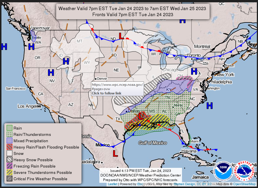
TUESDAY AFTERNOON, EVENING, AND OVERNIGHT
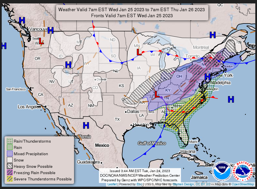
WEDNESDAY
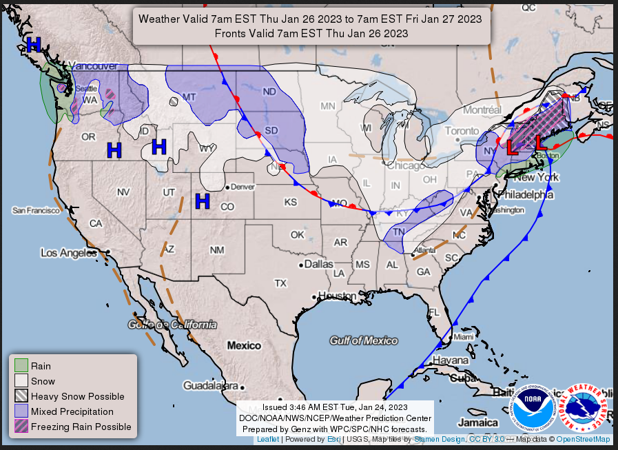
THURSDAY
This animation shows how things may play out over the next 60 hours. To update click here.
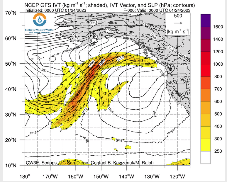
ATMOSPHERIC RIVERS
Continuation of the NWS Short Range Forecast (It is updated by NWS twice a day and these updates can be found here. We post at least one of those updates daily, sometimes both. The Highlights are shown in the lede paragraph of this article.
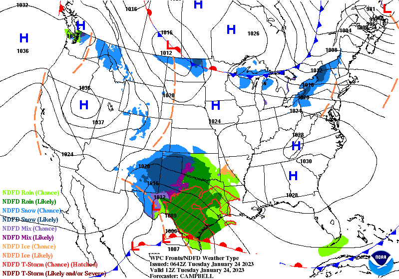
A developing storm across the western Gulf coast Tuesday afternoon will be
pushing northeastward tonight into the Lower Mississippi Valley, through
the Ohio Valley and Lower Lakes on Wednesday and into the Northeast by
early Thursday.  This storm will be multi faceted and have significant
impacts across a large portion of the nation from the Gulf coast into the
Northeast.  A well defined area of precipitation Tuesday afternoon over
the Southern Plains will be expanding northeastward with time.  Heavy
rains, isolated flash flooding and severe thunderstorms are possible
across portions of the western to central Gulf coast from Tuesday
afternoon into Tuesday night, spreading into the eastern Gulf coast and
Southeast during Wednesday.  Heavy rains are also possible Wednesday into
early Thursday across the major urban corridor from Richmond, DC,
Baltimore, Philadelphia, NYC into Boston.


On the north and northwest side of this storm, heavy snows are likely from
northwest Texas across much of Oklahoma into northern Arkansas, Southern
Missouri and southern Illinois from Tuesday afternoon into Tuesday
night/early Wednesday.  This heavy snow potential will then push
northeastward across portions of the Mid-West, Lower Lakes, northern
Mid-Atlantic, Western/ Upstate/ Northern NY State and northern New England
from Wednesday into early Thursday.  Across all of these areas, winter
storm warnings, advisories and watches are currently in effect.
Widespread snowfall accumulations of 4 to 8"+ expected across these areas,
with locations in northern New England having the potential for
accumulations of 8 to 12".  The expected snowfall will have moderate to
major impacts from the Southern Plains into the Mid Mississippi Valley,
Mid West, portions of northern NY State into northern New England with
snow covered roads, reduced visibility resulting in dangerous traveling
conditions.  In addition, the combination of the heavy snow and gusty
winds may result in downed trees and power outages. This snowfall will
bring some relief from the "snow drought" for portions of the Mid-West,
northern Mid-Atlantic, New York State and central to northern New England
where snowfall totals this season are well below average.

Tranquil weather on tap for much of the western U.S. from the High Plains,
across the Rockies and into the West Coast.  Much of this region will be
dry over the next few days, save for some light to locally moderate
snowfall amounts through the Rockies and across the Northern Plains. No
signs of any additional precipitation for water soaked area of California
through the remainder of this week.
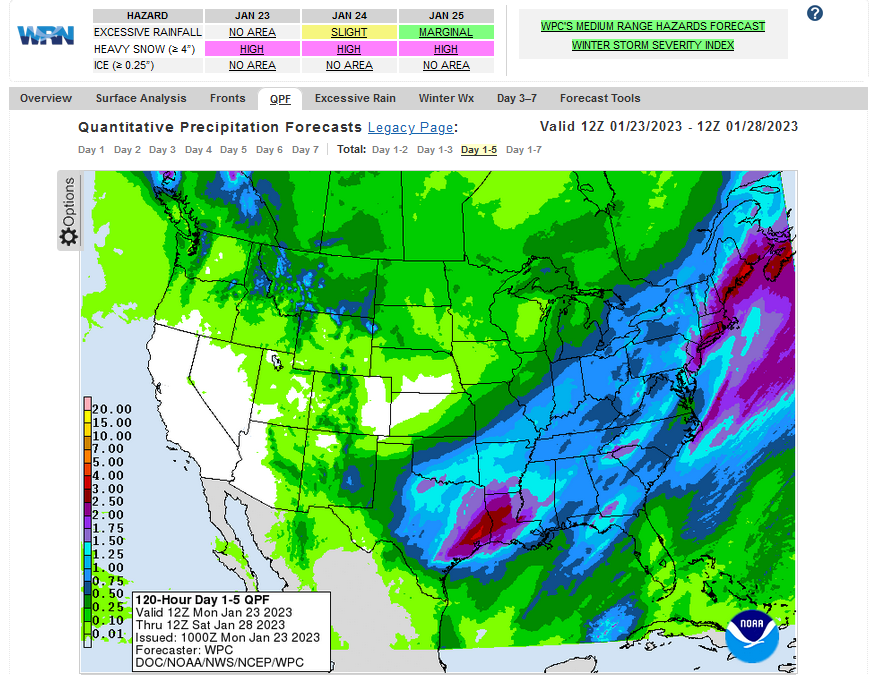
Below is the current five-day cumulative forecast of precipitation (Updates can be found HERE)
Now we look at Intermediate-Term “Outlook” maps for three time periods. Days 6 – 10, Days 8 – 14, and Weeks 3 and 4. An outlook differs from a forecast based on how NOAA uses these terms in that an “outlook” presents information as deviation from normal and the likelihood of these deviations.
Below are the links to obtain updates and additional information. They are particularly useful if you happen to be reading this article significantly later than when it was published. I always try to provide readers with the source of the information in my articles.
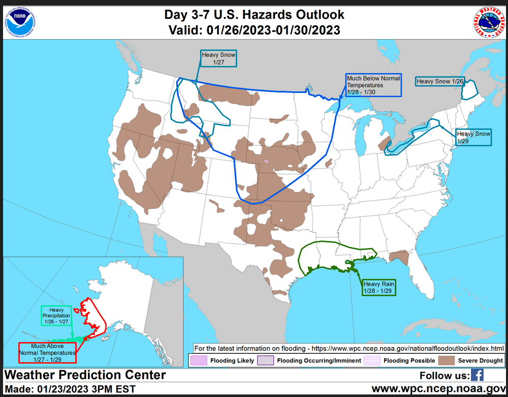
HAZARDS OUTLOOKS
Click here for the latest complete Day 3 -7 Hazards forecast which updates only on weekdays. Once a week probably Monday or Tuesday I will update the images. I provided the link for readers to get daily updates on weekdays. Use your own judgment to decide if you need to update these images. I update almost all the images Friday Night for the weekend edition of this Weather Report. So normally readers do not need to update these images but if the weather is changing quickly you may want to.

Month to Date Information
Temperature month to date can be found at https://hprcc.unl.edu/products/maps/acis/MonthTDeptUS.png
Precipitation month to date can be found at https://hprcc.unl.edu/products/maps/acis /MonthPNormUS.png
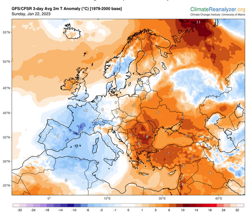
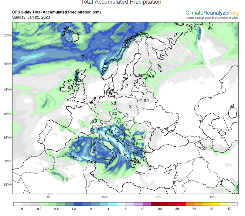
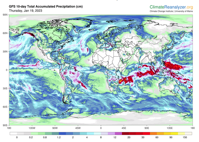
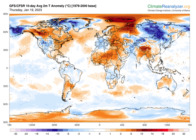
World Forecast
Below are the current precipitation forecast and the 10-Day forecasts for temperature and precipitation. Updates and additional information can be obtained HERE
Much of this information is provided by the University of Maine. They draw upon many different sources.
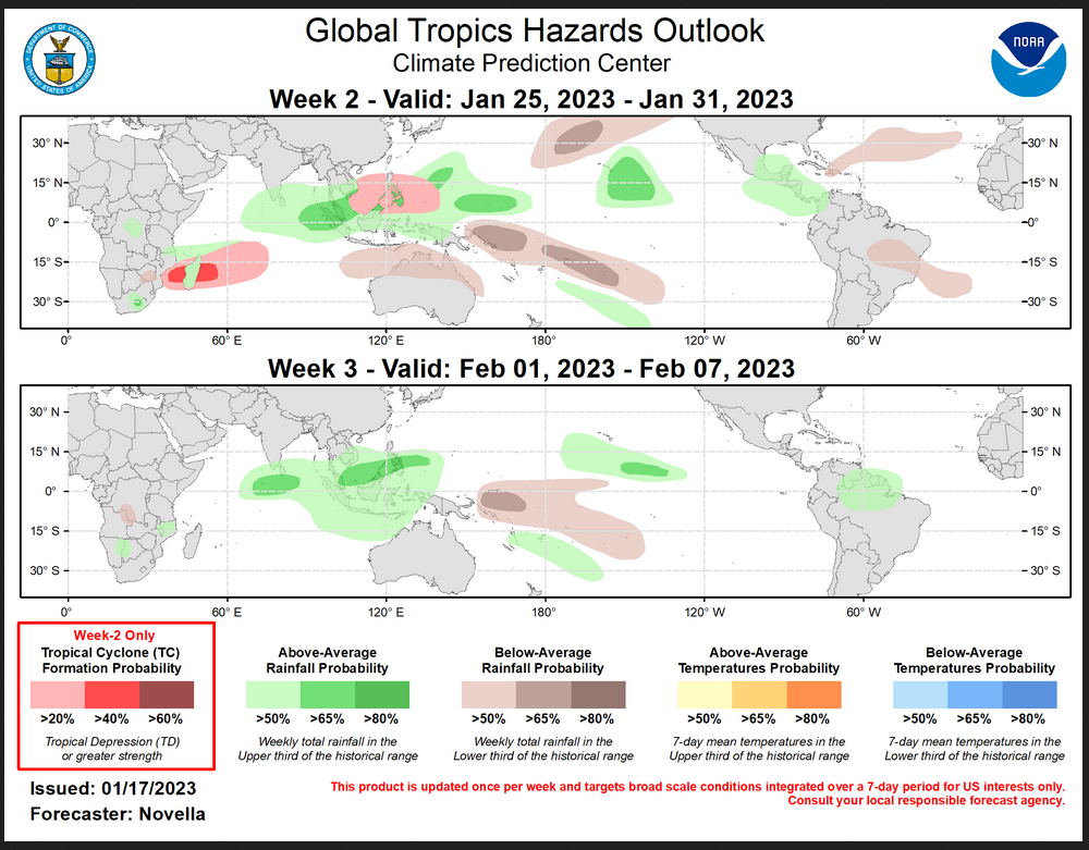
 Worldwide Tropical Forecast (This is a NOAA Product)
This graphic updates on Tuesdays) If it has not been updated, you can get the update by clicking here Readers will only have to do that if they are reading this article much later than the date of it being published.-
| I hope you found this article interesting and useful. |