Ice Coverage Nearly Nonexistent Across the Great Lakes, as the Historical Peak Approaches: Posted on February 27, 2024

This article is mostly excerpted from a post by Haley Thiem on Climate.Gov which you can access HERE. I am calling it Global Warming News but it may just be natural variation. But I think we should look at this as possibly related to Global Warming.

 Author’s Note: This is a typical graphic used in meteorology and hydrology. The individual years are shown but may be difficult to see as they are faint but the average of the prior 50 years is clearly visible.  The blue line shows this year to date (February 15, 2024). It is clearly unusual. Is it unusual enough to conclude that it is outside of the range of Post Industrial Revolution Climate? I do not know. If this pattern shows up a few more times some will draw that conclusion. And for sure the winter is not yet over and I think it is snowing there right now.  Whether it is cold enough for ice to form I do not know. Since we are comparing the current to a 50 year average, I have categorized this as climate rather than weather but others may see it differently.

To read the remainder of the article most will need to click on “read more”

Today Through the Fourth Friday (22 to 28 days) Weather Outlook for the U.S. and a Six-Day Forecast for the World: posted February 27, 2024

It is difficult to find a more comprehensive Weather Outlook anywhere else with the ability to get a local 10-day Forecast also.

This article focuses on what we are paying attention to in the next 48 to 72 hours. The article also includes weather maps for longer-term U.S. outlooks and a six-day World weather outlook which can be very useful for travelers.

First the NWS Short Range Forecast. The afternoon NWS text update can be found here but it is unlikely to have changed very much. The images in this article automatically update.

Short Range Forecast Discussion
NWS Weather Prediction Center College Park MD
Tue Feb 27 2024
Valid 12Z Tue Feb 27 2024 – 12Z Thu Feb 29 2024

…Heavy snow returns over parts of the Cascades, the Northern
Intermountain Region, and Northern Rockies on Wednesday…

…Heavy snow over parts of the Upper Mississippi Valley and moderate to
heavy snow over the Cascades to Central Rockies on Tuesday…

…Light to moderate snow over the Great Lakes, Central Appalachians, and
Northeast on Wednesday…

…There is a Slight Risk of severe thunderstorms over parts of the Ohio
Valley/Great Lakes on Tuesday…

A strong winter storm and cold front will continue to progress through the
West, reaching the Central Rockies on Tuesday. Furthermore, the storm will
create near-blizzard conditions, resulting in dangerous travel. Snowfall
rates of 1-2 inches per hour will move into the Great Basin and Central
Rockies on Tuesday. These snow rates combined with winds gusting 50-65 mph
will produce near-blizzard conditions with significantly reduced
visibility and snow-covered roads leading to dangerous travel. Further,
significant snow accumulations will occur across the Colorado Rockies
southward into the San Juans and Sangre de Cristos; there is a high chance
(greater than 70%) of more than 8 inches of snow in the higher elevations.

In addition, widespread snow squalls are expected to develop along the
path of the cold front from Utah to Wyoming and Colorado on Tuesday. Where
snow squalls occur, intense snow rates will produce rapid drops in
visibility and icing on roadways, resulting in dangerous travel.

In addition, much colder air will move in behind the strong cold front.
Temperatures will fall into the teens and single digits Tuesday morning
throughout the Intermountain West.

Another powerful storm will move over the West, producing a significant
winter storm over the Pacific Northwest late Wednesday into Thursday, as
heavy snow returns to the Northern Cascades and Northern Intermountain
Region.

Meanwhile, on Tuesday, a front extending from the Upper Great Lakes to the
Central Rockies will create heavy snow over parts of the Upper Mississippi
Valley and moderate to heavy snow over the Upper Great Lakes. Ahead of the
front, southerly wind will bring warm temperatures of 15 to 30 degrees
above average to the Southern Plains to the Great Lakes. The warm and dry
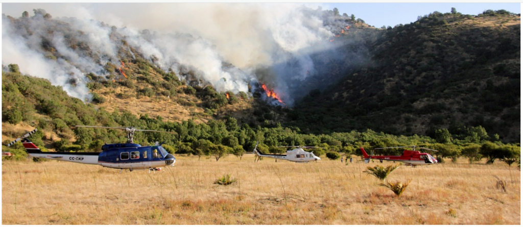
conditions with gusty winds across the Southern Plains have resulted in an
Elevated Risk of Fire Weather (level 1/3) from the Storm Prediction Center
on Tuesday.

Additionally, moisture from the Western Gulf of Mexico will stream
northward over the Southern Plains, Middle/Lower Mississippi Valley, and
Ohio Valley. The moisture will aid in creating showers and severe
thunderstorms over parts of the Ohio Valley. Therefore, the SPC has issued
a Slight Risk (level 2/5) of severe thunderstorms over parts of the Ohio
Valley, Middle Mississippi Valley, and Great Lakes through Wednesday
morning. The hazards associated with these thunderstorms are frequent
lightning, severe thunderstorm wind gusts, hail, and a few tornadoes.
Further, there is an increased threat of hail two inches or greater over
parts of southwestern Michigan, most of Illinois and Indiana, plus
southeastern Missouri.

Moreover, as the robust front moves across the Great Lakes to the East
Coast, moderate to heavy snow will develop over the Great Lakes into the
Northeast, with light to moderate snow over the Central Appalachians on
Wednesday into Thursday morning. Ahead of the snow, showers and
thunderstorms will develop over parts of the Northeast. The boundary will
also create showers and thunderstorms over parts of the Eastern Ohio
Valley, Central Appalachians, into the Mid-Atlantic and Southeast.

Elsewhere, upper-level energy moving into the Southwest and Southern
Rockies will produce scattered showers and thunderstorms from Wednesday
afternoon into Thursday morning.

To get your local forecast plus active alerts and warnings click HERE and enter your city, state or zip code.

Above is a 72 hour animation of the forecast. Learn about wave patterns HERE.

Then, looking at the world and of course, the U.S. shows here also. Today we are looking at precipitation.

Please click on “Read More” below to access the full report issued today.

Increasing Prevalence of Hot Drought Across Western North America Since the 16th Century: Posted February 26, 2024

In this case, the actual paper is available to be read. This should always be the case. If the U.S. Government is paying for research that research should not be behind a paywall. It is not the role of the U.S. government to create business opportunities for publications. I think that doing so is illegal. In this case, the full paper is open source and I provide the introduction to the paper and the link to get the full download. It is not easy reading.

To read more most will need to click on “Read More”. This is not a new finding but it supports some earlier papers some of which we have reported on. It is not a pretty picture and it is somewhat surprising as warmer water should in theory create a wetter atmosphere but during drought, the soil dries out and this seems to be happening more often than in the past so it is one more negative impact of Global Warming.

Today Through the Fourth Friday (22 to 28 days) Weather Outlook for the U.S. and a Six-Day Forecast for the World: posted February 26, 2024

It is difficult to find a more comprehensive Weather Outlook anywhere else with the ability to get a local 10-day Forecast also.

This article focuses on what we are paying attention to in the next 48 to 72 hours. The article also includes weather maps for longer-term U.S. outlooks and a six-day World weather outlook which can be very useful for travelers.

First the NWS Short Range Forecast. The afternoon NWS text update can be found here but it is unlikely to have changed very much. The images in this article automatically update.

Short Range Forecast Discussion
NWS Weather Prediction Center College Park MD
Mon Feb 26 2024
Valid 12Z Mon Feb 26 2024 – 12Z Wed Feb 28 2024

…Heavy snow over parts of the Cascades, the Northern Intermountain
Region, Northern/Central Rockies, Sierra Nevada Mountains, and higher
elevations of the Great Basin…

…Moderate to heavy snow over parts of the Upper Midwest…

…There is a Slight Risk of severe thunderstorms over parts of the Ohio
Valley/Great Lakes on Tuesday…

A strong winter storm and cold front will move across the Pacific
Northwest to the Central Rockies by Tuesday evening. The strong cold front
will continue progressing through the region, reaching the Northern
Rockies on Monday and the Central Rockies on Tuesday.

The storm will create near-blizzard conditions, resulting in dangerous
travel. Snowfall rates of 1-2 inches per hour are expected over the Oregon
Cascades and Northern Rockies Monday before spreading into the Great Basin
and Central Rockies Tuesday. These snow rates combined with winds gusting
50-65 mph will produce near-blizzard conditions with significantly reduced
visibility and snow-covered roads leading to dangerous travel.

Moreover, significant snow accumulations are expected, with snow totals
greater than 2 feet are expected (greater than 80% chance) in the Cascades
through Tuesday, with locally as much as 4 feet possible in the highest
terrain. Elsewhere across the Intermountain West, there is a high chance
(greater than 70%) of more than 1 foot of snow in the higher elevations.
Lowering snow levels to near sea level will also produce some
accumulations onto the valley floors.

Furthermore, widespread snow squalls are expected to develop along the
path of the cold front on Monday and Tuesday. Where snow squalls occur,
intense snow rates will produce rapid drops in visibility and icing on
roadways, resulting in dangerous travel.

In addition, much colder air will move in behind the strong cold front.
Temperatures will fall into the teens and single digits by Tuesday morning
along and east of the Rockies.

Meanwhile, southerly wind will bring warm temperatures to the Plains ahead
of the strong cold front. The warm and dry conditions with gusty winds
across the Southern High Plains have resulted in a Critical Risk of Fire
Weather (level 2/3) from the Storm Prediction Center on Monday, which is
likely to continue into Tuesday.

Additionally, moisture from the Western Gulf of Mexico will stream
northward over the Southern Plains, Middle/Lower Mississippi Valley, and
Ohio Valley. The moisture will aid in creating scattered light rain
showers over parts of the Ohio Valley. By Tuesday, the moisture will
produce showers and severe thunderstorms over parts of the Ohio Valley.
Therefore, the SPC has issued a Slight Risk (level 2/5) of severe
thunderstorms over parts of the Ohio Valley, Middle Mississippi Valley,
and Great Lakes from Tuesday through Wednesday morning. The hazards
associated with these thunderstorms are frequent lightning, severe
thunderstorm wind gusts, hail, and a few tornadoes. Further, on Tuesday,
there is an increased threat of hail two inches or greater over parts of
northern Illinois and Indiana, plus northwestern Ohio.

Moreover, as the strong front moves out of the Rockies onto the Plains,
light to moderate snow will develop over parts of the Northern
Plains/Upper Mississippi Valley on Monday. Moderate to heavy snow will
develop overnight Monday into Tuesday over northern Minnesota. Similarly,
overnight Tuesday into Wednesday, light to moderate snow will develop over
part of the western U.P. of Michigan. Elsewhere, showers and thunderstorms
will move into parts of the Central Appalachians and northern
Mid-Atlantic, with showers and thunderstorms extending into parts of the
Lower Mississippi Valley Tuesday night into Wednesday.

To get your local forecast plus active alerts and warnings click HERE and enter your city, state or zip code.

Above is a 72 hour animation of the forecast. Learn about wave patterns HERE.

Then, looking at the world and of course, the U.S. shows here also. Today we are looking at precipitation.

Please click on “Read More” below to access the full report issued today.

Today Through the Fourth Friday (22 to 28 days) Weather Outlook for the U.S. and a Six-Day Forecast for the World: posted February 25, 2024

It is difficult to find a more comprehensive Weather Outlook anywhere else with the ability to get a local 10-day Forecast also.

This article focuses on what we are paying attention to in the next 48 to 72 hours. The article also includes weather maps for longer-term U.S. outlooks and a six-day World weather outlook which can be very useful for travelers.

First the NWS Short Range Forecast. The afternoon NWS text update can be found here but it is unlikely to have changed very much. The images in this article automatically update.

Short Range Forecast Discussion
NWS Weather Prediction Center College Park MD
Sun Feb 25 2024
Valid 12Z Sun Feb 25 2024 – 12Z Tue Feb 27 2024

…Heavy snow over parts of the Cascades, the Northern Intermountain
Region, Northern/Central Rockies, and higher elevations of the Great
Basin…

…Light snow over parts of the Northeast and snow over the Northern
Plains on Monday...

…Heavy snow over parts of the Sierra Nevada Mountains on Monday…

A strong winter storm and cold front will move into the Northwest on
Sunday and progress southeastward into the Northern Rockies on Monday.
Heavy mountain snow over the Cascades will impact the passes by late
Sunday, with greater than 80% chance of at least a foot of snow above
1500ft through early Tuesday. In addition, snowfall will sometimes become
heavy, with rates of 1-2 inches per hour, along with windy conditions,
creating areas of blowing snow and drifting snow and significantly
reducing visibility.

Furthermore, snow squalls are likely along the path of the cold front on
Monday over the Northern Intermountain Region/Rockies, which could create
a rapid drop in visibility and icing on roadways, leading to dangerous
travel. Additionally, much colder air behind the strong cold front will
drop temperatures into the teens and colder by Tuesday morning.

Further, the system will produce coastal rain over the Northwest, with
snow levels lowering to near sea level after the front passes. Overnight
Sunday, rain will move into parts of California, with higher-elevation
snow. Moreover, on Monday, heavy snow will impact the Sierra Nevada
Mountains. A wave of low pressure will move over parts of the Northern
Plains by Monday evening as snow develops over the region. There is also a
risk of rain/freezing rain moving over parts of the Upper Mississippi
Valley.

Meanwhile, moisture from the Western Gulf of Mexico will stream northward
over the Southern Plains, Middle/Lower Mississippi Valley, and Ohio
Valley. The moisture will aid in creating scattered light rain showers
over parts of the Ohio Valley overnight Sunday into Monday. By Tuesday,
the moisture will produce showers and thunderstorms over parts of the Ohio
Valley. Furthermore, upper-level energy will assist in creating light snow
over parts of the Northeast overnight Sunday into Monday evening.

To get your local forecast plus active alerts and warnings click HERE and enter your city, state or zip code.

Above is a 72 hour animation of the forecast. Learn about wave patterns HERE.

Then, looking at the world and of course, the U.S. shows here also. Today we are looking at precipitation.

Please click on “Read More” below to access the full report issued today.

An Unexpected Decline in Spring Atmospheric Humidity in the Interior Southwestern United States and Implications for Forest Fires: Posted on February 24, 2024

I think this is about Global Warming But I am not sure. NOAA funds or partial funds research but then you have to pay to see it and for sure to publish it which I think is illegal but that is how the government works.

This appears to be very important.  It would have been nice to have access to the full paper but one can buy a copy for not a lot of money.

Corresponding author: Tess W.P. Jacobson, tessj@ldeo.columbia.edu

Image credit: Pixabay

To read more you probably have to click on “Read More”.

Today Through the Fourth Friday (22 to 28 days) Weather Outlook for the U.S. and a Six-Day Forecast for the World: posted February 23, 2024

It is difficult to find a more comprehensive Weather Outlook anywhere else with the ability to get a local 10-day Forecast also.

This article focuses on what we are paying attention to in the next 48 to 72 hours. The article also includes weather maps for longer-term U.S. outlooks and a six-day World weather outlook which can be very useful for travelers.

First the NWS Short Range Forecast. The afternoon NWS text update can be found here but it is unlikely to have changed very much. The images in this article automatically update.

Short Range Forecast Discussion
NWS Weather Prediction Center College Park MD
Fri Feb 23 2024
Valid 12Z Fri Feb 23 2024 – 12Z Sun Feb 25 2024

…Light snow over parts of Northern New England on Saturday…

…Light snow over parts of the Upper Midwest to the Central
Appalachians…

…Rain along the East Coast from the Mid-Atlantic to the Southeast on
Saturday…

A front along the East Coast will move eastward off the East Coast by
Friday evening. The system will create snow over parts of Northern New
England and rain over Southern New England through Friday evening. In
addition, showers and thunderstorms will develop over parts of the
Southeast through late Friday night.

Meanwhile, a second front extending from the Upper Great Lakes to the
Northern Plains will move southward to the Gulf Coast States by Sunday and
eastward off the Northeast Coast by Saturday morning. A wave of low
pressure over southern Wisconsin will move southeastward to the Central
Appalachians by Saturday. On Friday, the system will produce light snow
over parts of the Northern Plains, Upper Mississippi Valley, and Upper
Great Lakes. Overnight Friday, the slight snow will move into parts of the
Ohio Valley and the Lower Great Lakes into parts of the Northeast. On
Saturday light snow will develop over parts of the Central Appalachians
and Southern Appalachians overnight Saturday. Light rain will develop over
parts of the southern Mid-Atlantic overnight Saturday, ending by Sunday.

Furthermore, upper-level energy moving over the Pacific Northwest to the
Northern Plains will create light snow over parts of the Northern
Intermountain Region/Northern Rockies through Saturday evening. A third
front will also move southward out of South-Central Canada into the
northern Plains/Upper Mississippi Valley by Sunday morning. Scattered
light snow will develop over parts of the Northern High Plains overnight
Saturday.

To get your local forecast plus active alerts and warnings click HERE and enter your city, state or zip code.

Above is a 72 hour animation of the forecast. Learn about wave patterns HERE.

Then, looking at the world and of course, the U.S. shows here also. Today we are looking at precipitation.

Please click on “Read More” below to access the full report issued today.

Colorado River Basin Mid-February, 2024 Water Supply Forecast Discussion – Posted February 22, 2024

The mission of the National Weather Service Colorado Basin River Forecast Center (CBRFC) is to produce river, flood, and water supply forecasts for the Colorado Basin and the Great Basin in support of saving lives and property and to enhance the region’s environment and economy.

In this article, I am providing a summary of their Water Supply Forecast Discussion released on January 17, 2024.  The situation is not very good. However, due to a wet winter last winter, the reservoirs are mostly in good shape.

I have also included information on the current BOR reservoir storage levels including some that are outside of the Colorado River Basin.

The image below shows part of the area covered in the CBRFC Report.  The map shown here is only the Colorado Basin. The Eastern Great Basin is to the west of this map. The maps shown in the article cover both basins but are not as scenic as this map.

Map showing both the Colorado Basin and Eastern Great Basin.

Most of the information presented in this part of the article is from a summary report (Link) issued by the Colorado River Basin Forecast Center. February 16, 2024, Water Supply Forecast Discussion
The Colorado Basin River Forecast Center (CBRFC) geographic forecast area includes the Upper Colorado River Basin (UCRB), Lower Colorado River Basin (LCRB), and Eastern Great Basin (GB). It is one of many similar organizations within the National Weather Service. They are all different. In the future, I will try to pay more attention to some of the other River Forecasting Centers but they do not all go out of their way to provide reports to the Media. But the Colorado River is a special situation in a way due to the problems complying with the Colorado River Compact. But all our rivers are important.

At this time of the year,  we are still hopefully adding to the snowpack for future snowmelt. Additional information is available on the Center website (click HERE), there are certain graphics that update daily. And now I provide the main part of their new forecast discussion summary. I am copying directly from their document. My comments are in boxes. At the end of the report I provide addition “Tea Cup” diagrams of many USBOR Reservoirs. I also provide two very interesting forecasts for two of the most import reservoirs Lake Powell and Lake Mead.


The CBRFC weather forecast is for a changing weather pattern.  For updated weather forecasts go to econcurrents.com 

and look for the most recent “Today Through the Fourth Friday (22 to 28 days) Weather Outlook for the U.S.” in the list of Recent Posts.

Please click on “Read More” to read the rest of this article.

Today Through the Fourth Friday (22 to 28 days) Weather Outlook for the U.S. and a Six-Day Forecast for the World: posted February 22, 2024

It is difficult to find a more comprehensive Weather Outlook anywhere else with the ability to get a local 10-day Forecast also.

This article focuses on what we are paying attention to in the next 48 to 72 hours. The article also includes weather maps for longer-term U.S. outlooks and a six-day World weather outlook which can be very useful for travelers.

First the NWS Short Range Forecast. The afternoon NWS text update can be found here but it is unlikely to have changed very much. The images in this article automatically update.

Short Range Forecast Discussion
NWS Weather Prediction Center College Park MD
230 AM EST Thu Feb 22 2024

Valid 12Z Thu Feb 22 2024 – 12Z Sat Feb 24 2024

…Pleasantly mild across most of the country through the end of the
week…

…Showers and thunderstorms from the Gulf Coast to the Ohio Valley on
Thursday…

Showers and thunderstorms are forecast to develop across the Ohio Valley
and the Mid-South during the day on Thursday ahead of an approaching cold
front. The greatest rainfall totals with this event are expected roughly
from northern Kentucky to western Pennsylvania, where the combination of
moisture and atmospheric forcing will be the greatest. Isolated to
scattered coverage is expected across much of the Southeast U.S. and into
the Mid-Atlantic region, and possibly some mixed precipitation across
interior portions of the Northeast U.S. and snow for northern New England
going into Thursday night and Friday. Improving weather conditions are
likely by late Friday for most of the East Coast as the cold front moves
offshore.

It will feel more like March and early April across much of the nation to
close out the week, especially across the Plains and Midwest where highs
could easily be 10-20 degrees above late February averages. Widespread
60s and 70s will be common from Texas to the Deep South both Thursday and
Friday, and 50 degree highs could reach as far north as southern Minnesota
and southern Wisconsin on Thursday. A return to reality arrives in time
for the weekend as a cold front from central Canada brings more
January-like readings for the northeastern quadrant of the nation, while
the Great Plains continue to remain mild.

Elsewhere across the continental U.S., a mainly dry weather pattern can be
expected through Saturday with perhaps a few snow showers across portions
of the central and northern Rockies, and rain showers for portions of
western Oregon and Washington on Thursday. There may also be a few light
snow showers with the cold front crossing the Ohio Valley region Friday
night and the central Appalachians on Saturday, but nothing major
expected. Elevated fire weather conditions are forecast by the Storm
Prediction Center across portions of southwestern Texas owing to increased
winds and low humidity in the vicinity of a cold front passing though the
region.

To get your local forecast plus active alerts and warnings click HERE and enter your city, state or zip code.

Above is a 72 hour animation of the forecast. Learn about wave patterns HERE.

Then, looking at the world and of course, the U.S. shows here also. Today we are looking at precipitation.

Please click on “Read More” below to access the full report issued today.

Today Through the Fourth Friday (22 to 28 days) Weather Outlook for the U.S. and a Six-Day Forecast for the World: posted February 21, 2024

It is difficult to find a more comprehensive Weather Outlook anywhere else with the ability to get a local 10-day Forecast also.

This article focuses on what we are paying attention to in the next 48 to 72 hours. The article also includes weather maps for longer-term U.S. outlooks and a six-day World weather outlook which can be very useful for travelers.

First the NWS Short Range Forecast. The afternoon update can be found here if I have not updated it.

Short Range Forecast Discussion
NWS Weather Prediction Center College Park MD
Wed Feb 21 2024
Valid 12Z Wed Feb 21 2024 – 12Z Fri Feb 23 2024

…Rain and snow impacts across California come to an end today…

…Above average temperatures across the lower 48 into late week…

…Critical Fire Weather day over portions of the Southern High Plains on
Wednesday…

Rain and snow showers will gradually weaken across the state of California
today before coming to an end tonight. In the meantime, snow showers will
produce 6-12 inches of new snow for the Intermountain West and Central
Rockies. Surface cyclogenesis over the lee of the Rockies will support
strong west/southwesterly winds carrying dry air out of the Southwest and
into the Southern High Plains this afternoon. Thus, the Storm Prediction
Center issued a Critical Risk of Fire Weather over portions of
southeastern New Mexico into far western Texas.

The upper-level trough responsible for the unsettled weather in the West
will quickly move across the Rockies today and into the Plains by
Thursday. This will spawn a low pressure system over the Central/Southern
Plains which will tap some moisture from the Gulf of Mexico as it moves
across the Mississippi Valley. This interaction will produce rain showers
and scattered thunderstorms across the Midwest/Ohio Valley on Thursday.

Meanwhile, an upper ridge will generate temperatures that are well above
average across the Plains and Mississippi Valley today. Temperatures will
be anywhere from 20-30 degrees above average in these areas. Southerly
flow will send mild temperatures streaming into the East Coast on Thursday
ahead of the approaching low pressures system. The Florida peninsula will
remain below average temperature-wise through the end of the week.

To get your local forecast plus active alerts and warnings click HERE and enter your city, state or zip code.

Above is a 72 hour animation of the forecast. Learn about wave patterns HERE.

Then, looking at the world and of course, the U.S. shows here also. Today we are looking at precipitation.

Please click on “Read More” below to access the full report issued today.