Today Through the Fourth Friday (22 to 28 days) Weather Outlook for the U.S. and a Six-Day Forecast for the World: posted September 9, 2024

This article focuses on what we are paying attention to in the next 48 to 72 hours. The article also includes weather maps for longer-term U.S. outlooks and a six-day World weather outlook which can be very useful for travelers.

First the NWS Short Range Forecast. The afternoon NWS text update can be found here after about 4 p.m. New York time but it is unlikely to have changed very much from the morning update. The images in this article automatically update.

Short Range Forecast Discussion
NWS Weather Prediction Center College Park MD
Mon Sep 09 2024
Valid 12Z Mon Sep 09 2024 – 12Z Wed Sep 11 2024

…Heavy rain and a risk of flash flooding expected throughout much of the
Gulf Coast and Florida Peninsula into midweek…

…Potentially dangerous heat forecast across southern California and the
Southwest today…

…Elevated to critical fire weather concerns as well as Air Quality
Alerts remain across much of the Great Basin…

A stationary front extending from the Florida Peninsula through the
northern Gulf of Mexico along with a gradually organizing area of low
pressure in the southwest Gulf of Mexico (labeled Potential Tropical
Cyclone Six by the National Hurricane Center) will continue to produce
areas of heavy rain and the risk of flash flooding through midweek. For
today, the heaviest rainfall is anticipated over portions of southern
Texas, the central Gulf Coast, and much of the Florida Peninsula, mainly
associated with scattered showers and thunderstorms near the stationary
boundary. This may lead to isolated flash flooding concerns mainly
concentrated to urban locations. By Tuesday and more pronounced on
Wednesday, increased moisture content and organized bands of thunderstorms
associated with Potential Tropical Cyclone Six are forecast to reach the
western and central Gulf Coast. This will increase the risk of heavy
rainfall and considerable flash flooding. At the moment, the greatest risk
for rainfall amounts up to 12 inches and numerous flash floods are
forecast throughout southern Louisiana. Life-threatening storm surge and
damaging winds are also possible from the Upper Texas Coast to the
Louisiana coastline as the system is forecast to reach hurricane strength
in the northwest Gulf of Mexico by midweek. Residents should ensure they
have their hurricane plan in place and check www.nhc.noaa.gov for the
latest forecast.

Dangerous heat is in the forecast for at least one additional day for
southern California and parts of the Southwest. Highs into the upper 90s
and triple digits have prompted Excessive Heat Warnings and Heat
Advisories to be issued, with a cooling trend set to commence by midweek.
The combination of above average temperatures, dry vegetation, and gusty
winds have resulted in elevated to critical fire weather concerns
throughout much of the Intermountain West through the next couple of days.
Additionally, current wildfires continue to pump smoke into the atmosphere
of the northern Great Basin, leading to poor air quality. This smoke is
also forecast to extend eastward in the mid-to-upper levels of the
atmosphere through the northern Plains and Ohio Valley, creating
noticeably hazy skies.

Elsewhere, well above average temperatures are expected across the
north-central U.S. as highs return to the upper 80s and low 90s, which
equates to around 10-15 degrees above average. Cooler, fall-like
temperatures will kickoff the new workweek throughout the Ohio Valley and
East until temperatures return to near normal by Wednesday as the dominant
high pressure system in place slowly slides eastward to the western
Atlantic.

While notable precipiation should be mostly sparse across the Lower 48
outside of the Gulf Coast, a few areas of locally heavy rain are possible
across the Northeast and Northwest through Wednesday. Isolated severe
thunderstorms are possible throughout Upstate New York today as a weak
cold front dives across the region, with some storms potentially
containing damaging wind gusts. Increasing precipitation chances are also
forecast to spread into the Northwest and Northern Rockies as a deep upper
low swings eastward from the northeast Pacific.

cone graphic

To get your local forecast plus active alerts and warnings click HERE and enter your city, state or zip code.

Learn about wave patterns HERE.

Then, looking at the world and of course, the U.S. shows here also. Today we are looking at precipitation.

Please click on “Read More” below to access the full Daily Report issued today.

Today Through the Fourth Friday (22 to 28 days) Weather Outlook for the U.S. and a Six-Day Forecast for the World: posted September 8, 2024

This article focuses on what we are paying attention to in the next 48 to 72 hours. The article also includes weather maps for longer-term U.S. outlooks and a six-day World weather outlook which can be very useful for travelers.

First the NWS Short Range Forecast. The afternoon NWS text update can be found here after about 4 p.m. New York time but it is unlikely to have changed very much from the morning update. The images in this article automatically update.

Short Range Forecast Discussion
NWS Weather Prediction Center College Park MD
Sun Sep 08 2024
Valid 12Z Sun Sep 08 2024 – 12Z Tue Sep 10 2024

…Dangerous heat continues to impact portions of southern California and
the Southwest through Monday…

…Heavy rain and scattered instances of flash flooding remain possible
along the Gulf Coast and parts of the Southeast over the next several
days…

…Below average temperatures forecast across much of the Midwest and East
through the beginning of the week…

Potentially dangerous and record-breaking heat is forecast to continue
across southern California as highs soar into the upper 90s and triple
digits away from the immediate coastline. Excessive Heat Warnings remain
in effect through Monday as a gradual cooldown commences on Tuesday. Highs
into the triple digits are also forecast throughout the remainder of the
Desert Southwest, but not considered as anomalous as values forecast
across southern California. Elsewhere, above average temperatures are
anticipated across the northern Great Basin and northern Plains as
upper-level ridging slides eastward. Heat will wane across eastern
Washington and neighboring states by Tuesday as the core of the
late-summer temperatures concentrate over the northern Plains. Highs in
the north-central U.S. are forecast to reach into the low-to-mid 90s early
this week, which equates to around 10 to 20 degrees above average for this
time of year. Additionally, sultry heat and humidity will impact southern
Florida once again today, where Heat Advisories have been issued due to
maximum heat indices forecast to near 110 degrees. Remember to follow
proper heat safety by staying hydrated, limiting strenuous outdoor
activity during peak daytime heating, and checking on vulnerable
individuals.

Much of the Nation is anticipated to be void of notable precipitation over
the next few days, with the Gulf Coast and parts of the Southeast being
the lone exception. A lingering stationary front and developing area of
low pressure in the western Gulf of Mexico will focus heavy rainfall
potential from the coastal Carolinas to the Florida Peninsula and entire
Gulf Coast region. Scattered flash flooding is possible where the heaviest
rainfall occurs, with urban and low-lying areas most at risk to flooding
impacts. Otherwise, isolated flash flooding is also possible in parts of
the Intermountain West through early this week due to widely scattered
thunderstorms developing in tandem with daytime heating.

Large surface high pressure extending from the southern Plains to the
Midwest and East throughout Tuesday will not only supply sunny and dry
conditions for much of the Lower 48, but well below average temperatures
as well. In fact, daily record lows are possible between the Midwest and
Mid-Atlantic this morning as temperatures dip into the 40s for most
locations. Patchy frost is possible in low lying protected areas. As this
autumnal airmass moderates somewhat early this week, afternoon
temperatures will gradually warm back into the mid-80s by Tuesday.

To get your local forecast plus active alerts and warnings click HERE and enter your city, state or zip code.

Learn about wave patterns HERE.

Then, looking at the world and of course, the U.S. shows here also. Today we are looking at precipitation.

Please click on “Read More” below to access the full Daily Report issued today.

Today Through the Fourth Friday (22 to 28 days) Weather Outlook for the U.S. and a Six-Day Forecast for the World: posted September 7, 2024

This article focuses on what we are paying attention to in the next 48 to 72 hours. The article also includes weather maps for longer-term U.S. outlooks and a six-day World weather outlook which can be very useful for travelers.

First the NWS Short Range Forecast. The afternoon NWS text update can be found here after about 4 p.m. New York time but it is unlikely to have changed very much from the morning update. The images in this article automatically update.

Short Range Forecast Discussion
NWS Weather Prediction Center College Park MD
Sat Sep 07 2024
Valid 12Z Sat Sep 07 2024 – 12Z Mon Sep 09 2024

…Dangerous heat continues to impact portions of the West this weekend…

…Heavy rain and scattered instances of flash flooding are possible along
the Gulf Coast and parts of the Southeast…

…Below average temperatures to settle in across much of the Midwest and
East through the beginning of next week…

A few more days of record-breaking and dangerous heat are in store for
parts of the West as well above average temperatures linger underneath a
weakening upper-level high pressure system. Areas most likely to
experience major to extreme HeatRisk (levels of heat that affect anyone
without effective cooling or adequate hydration) through Sunday include
southern California, the Desert Southwest, and the northern Great Basin.
These regions are also where Excessive Heat Warnings and Heat Advisories
remain in effect. High temperatures in the Southwest are expected to soar
into the upper 90s and triple digits, with 110s in the typically hottest
desert locations through at least Monday. Highs into the upper 90s are
forecast to simmer the northern Great Basin before a gradual cooling trend
commences by early next week, with the anomalously warm temperatures
forecast to shift eastward into the northern Plains. Residents and
visitors are advised to continue following proper heat safety. This
includes staying hydrated and avoiding extended periods of time outdoors
during the hottest parts of the day. Poor air quality will also remain a
concern for parts of the Great Basin as wildfire smoke continues to
overspread the region.

A stationary front extending from off the Southeast coastline to the
northern Gulf of Mexico will continue to provide a focus for numerous
showers and thunderstorms over the next few days as its moisture gradient
gets reinforced by a separate approaching cold front sinking southward
across the Deep South today. Areas of locally heavy rain and scattered
flash floods are possible from the coastal Carolinas to the central Gulf
Coast, including northern and central Florida. Greater concentration of
tropical downpours are anticipated to reorient to southern Texas by Monday
as an area of low pressure develops in the Bay of Campeche and ushers
elevated atmospheric moisture westward to the western Gulf Coast.

Elsewhere, a cold front sweeping across the East Coast today will produce
scattered showers and thunderstorms throughout the Northeast. Behind this
frontal boundary and underneath potent high pressure, below average and
crisp temperatures are expected to overspread much of the Great Lakes,
Midwest, and East this weekend. Widespread lows into the 40s will lead to
a few chilly mornings, with several daily record lows possible between
Missouri and New Jersey on Sunday. Patchy frost cannot be ruled out for
some locations. Conversely, southern Florida will remain hot and humid
this weekend as high temperatures rise into the low-to-mid 90s, while heat
indices approach 110 degrees.

To get your local forecast plus active alerts and warnings click HERE and enter your city, state or zip code.

Learn about wave patterns HERE.

Then, looking at the world and of course, the U.S. shows here also. Today we are looking at precipitation.

Please click on “Read More” below to access the full Daily Report issued today.

Today Through the Fourth Friday (22 to 28 days) Weather Outlook for the U.S. and a Six-Day Forecast for the World: posted September 6, 2024

This article focuses on what we are paying attention to in the next 48 to 72 hours. The article also includes weather maps for longer-term U.S. outlooks and a six-day World weather outlook which can be very useful for travelers.

First the NWS Short Range Forecast. The afternoon NWS text update can be found here after about 4 p.m. New York time but it is unlikely to have changed very much from the morning update. The images in this article automatically update.

Short Range Forecast Discussion
NWS Weather Prediction Center College Park MD
Fri Sep 06 2024
Valid 12Z Fri Sep 06 2024 – 12Z Sun Sep 08 2024

…Dangerous heat continues to impact large sections of the West into this
weekend…

…Heavy rain and instances of flash flooding are likely throughout the
central Gulf Coast and Southeast over the next few days…

…Showers and isolated severe thunderstorms possible from the Ohio Valley
to the Lower Great Lakes today…

An upper level high pressure system is expected to continue aiding well
above average and potentially dangerous temperatures throughout the West
into the first full weekend of September. Highs today are forecast to soar
into the triple digits for much of the Southwest and interior California,
with 110s in the typically hottest locations of the Desert Southwest.
Meanwhile, daily high temperature records are possible in the Northwest
where mid-to-upper 90s are in the forecast. A minimal relaxing of the
extreme heat should be felt throughout much of the West and Southwest on
Saturday, but with temperatures remaining above average. The core of the
anomalous heat will shift to the northern Great Basin and northern Rockies
as parts of eastern Oregon and Washington experience another day with
highs well into the 90s. Poor air quality will also remain an issue
throughout parts of the northern Great Basin as wildfire smoke continues
to plague the region. Residents and visors are advised to follow proper
heat safety, which includes checking on vulnerable individuals.

Not much heavy precipitation to speak of throughout the Nation over the
next few days besides along the Gulf Coast and parts of the Southeast. A
lingering stationary front and a couple waves of low pressure will provide
a focus for tropical downpours over already saturated soils. The greatest
threat for heavy rainfall turning into flash flooding impacts are forecast
across southeast Louisiana today, where a Moderate Risk (level 3/4) of
Excessive Rainfall has been issued. Several inches of rain occurring
within a very short period of time could lead to numerous flash floods
here. A scattered flash flood threat also extends eastward along and just
north of the stationary front into northern Florida and southern Georgia.
This frontal boundary is expected to gradually sink southward by Saturday
as an area of low pressure exits off the Southeast coastline, with a
persisting isolated flash flood potential extending from the central Gulf
Coast and northern Florida to the coastal Carolinas. Remember, most flood
fatalities occur within vehicles… turn around, don’t drown.

Elsewhere, a cold front sweeping across the Ohio Valley and Lower Great
Lakes will usher in below average temperatures throughout the Great Lakes,
Midwest, before reaching the East Coast by this weekend, while also
producing areas of showers and thunderstorms. A few storms could produce
locally gusty winds and hail today in the Ohio Valley and nearby Lake Erie
region. Scattered showers are expected to progress eastward along the cold
front on Saturday and dampen weekend plans throughout the Interior
Northeast and sections of New England by Saturday evening.

To get your local forecast plus active alerts and warnings click HERE and enter your city, state or zip code.

Learn about wave patterns HERE.

Then, looking at the world and of course, the U.S. shows here also. Today we are looking at precipitation.

Please click on “Read More” below to access the full Daily Report issued today.

Today Through the Fourth Friday (22 to 28 days) Weather Outlook for the U.S. and a Six-Day Forecast for the World: posted September 5, 2024

This article focuses on what we are paying attention to in the next 48 to 72 hours. The article also includes weather maps for longer-term U.S. outlooks and a six-day World weather outlook which can be very useful for travelers.

First the NWS Short Range Forecast. The afternoon NWS text update can be found here after about 4 p.m. New York time but it is unlikely to have changed very much from the morning update. The images in this article automatically update.

Short Range Forecast Discussion
NWS Weather Prediction Center College Park MD
Thu Sep 05 2024
Valid 12Z Thu Sep 05 2024 – 12Z Sat Sep 07 2024

…Very heavy rain and the threat for scattered to numerous instances of
flash flooding continues for the Gulf Coast states the next couple of
days…

…Dangerous heat wave intensifies over the Southwest and West Coast…

Heavy rain and flash flooding remain in the forecast along the Gulf Coast
as a stationary front and coastal low drive multiple days of widespread
showers and thunderstorms across the region. The elongated area of low
pressure and front from the north-central to western Gulf will keep the
greatest focus for repeated rounds of storms moving onshore over the
central Gulf Coast and upper Texas Gulf Coast today (Thursday),
potentially spreading a bit further northward into the Lower Mississippi
Valley. Very moist Gulf air continues to contribute to very efficient
downpours with these storms, approaching 2-3″ per hour in some cases,
exacerbating the threat for heavy totals and flash flooding. There is now
a Moderate Risk (level 3/4) of Excessive Rainfall for southeastern
Louisiana where prior days rainfall has lead to very wet antecedent
conditions and brings a locally greater threat for scattered to numerous
instances of flash flooding, especially for the urban areas around greater
New Orleans. A broader Slight Risk (level 2/4) is in place across the
region for additional scattered instances of flash flooding. An
approaching upper-level wave will help to shift the focus for heavy
rainfall a bit eastward on Friday as the front begins to meander away from
the western Gulf and lift northward into southern Georgia, leading to
decreasing rain chances further West. Another Slight Risk of Excessive
Rainfall extends from the central Gulf Coast eastward through the Florida
Panhandle into southern Georgia where a similar threat for intense heavy
downpours with repeated rounds of storms will lead to several inches of
rain, and the potential for scattered instances of flash flooding.
Temperatures will remain well below average across the region north of the
frontal boundary and in the presence of widespread rain and cloud cover
with mostly upper 70s and low 80s. Some locations may only reach into the
low 70s Friday. On the other hand, it will be hot south of the front
across the Florida Peninsula, with highs in the low 90s. A Heat Advisory
is in place for South Florida where the combination of heat and humidity
will lead to heat indices in the 105-110 degree range.

A dangerous heat wave will intensify over the Southwest and West Coast the
next couple of days with a strong upper-level ridge now settled over the
region. Forecast high temperatures Thursday and Friday range from the 110s
for the Desert Southwest, low 100s to near 110 for southern California,
mid-100s for the central California Valleys, and the 90s to low 100s for
central/northern California and into the Pacific Northwest. Several
record-tying/breaking highs are possible across the Pacific Northwest.
Widespread heat-related warnings and advisories are in place given the
heightened threat for heat-related illness to anyone without efficient air
conditioning or adequate hydration. While not quite as hot, highs will be
well above average and potentially uncomfortable even for some immediate
coastal locations with temperatures reaching into the 80s.

Elsewhere, a broad area of showers and thunderstorms is expected ahead of
a pair of cold fronts passing through the Upper Midwest/Great Lakes,
Central Plains, and central/southern High Plains and adjacent Rockies. The
greatest chance for some moderate to locally heavy rainfall will be under
the influence of an upper-level trough over the Upper Midwest/Great Lakes,
and where upslope flow enhances storms over the southern Rockies. A few
isolated instances of flash flooding will be possible in the southern
Rockies given recent rains and some more sensitive burn scars. Storm
chances with moderate to locally heavy rainfall will continue ahead of the
front as it pushes eastward through the Great Lakes overnight Thursday and
into the Lower Great Lakes/Upper Ohio Valley on Friday. Some storms may
begin to spread into the Northeast and Mid-Atlantic by early Saturday
morning. Temperature-wise, the passing cold front will bring well below
average, Fall-like temperatures to the Northern Plains and Upper Midwest
Thursday, with highs in the 60s to low 70s. Temperatures will be rather
chilly for the Upper Great Lakes by Friday as highs drop into the 50s.
Conditions will be much warmer ahead of the front Thursday over the
Midwest and Ohio Valley with highs in the mid-80s to low 90s. The
approaching front will bring temperatures down into the 70s for portions
of the Midwest Friday. Mild conditions will continue for much of the East
Coast through Friday with highs in the upper 70s to low 80s.

To get your local forecast plus active alerts and warnings click HERE and enter your city, state or zip code.

Learn about wave patterns HERE.

Then, looking at the world and of course, the U.S. shows here also. Today we are looking at precipitation.

Please click on “Read More” below to access the full Daily Report issued today.

Today Through the Fourth Friday (22 to 28 days) Weather Outlook for the U.S. and a Six-Day Forecast for the World: posted September 4, 2024

This article focuses on what we are paying attention to in the next 48 to 72 hours. The article also includes weather maps for longer-term U.S. outlooks and a six-day World weather outlook which can be very useful for travelers.

First the NWS Short Range Forecast. The afternoon NWS text update can be found here after about 4 p.m. New York time but it is unlikely to have changed very much from the morning update. The images in this article automatically update.

Short Range Forecast Discussion
NWS Weather Prediction Center College Park MD
Wed Sep 04 2024
Valid 12Z Wed Sep 04 2024 – 12Z Fri Sep 06 2024

…Heat wave builds over the Southwest and the West Coast this week…

…Heavy rain and flash flood potential continues for the Gulf Coast
states the next couple of days…

An upper-level ridge building northward over the West Coast will help to
expand and intensify a heat wave over the region through the next few
days. Forecast highs today (Wednesday) range from the upper 100s to
mid-110s in the Desert Southwest, the mid-90s to low 100s for southern and
central California, and the mid-90s to low 100s for portions of the
Pacific Northwest. Temperatures soar even higher on Thursday, with highs
into the 110s for the Desert Southwest, the 100s to near 110 in southern
California, the mid-100s for the central California Valleys, and the low
100s for portions of the Pacific Northwest. Widespread heat-related
warnings and advisories are in place as the threat for heat-related
illness and impacts will increase today and especially on Thursday. This
heat will be dangerous to anyone without effective air conditioning or
sufficient hydration. While not quite as hot, temperatures will also be
well above average along the immediate Pacific Coast, with highs into the
80s for many locations.

Heavy rain and the threat for flash flooding will remain in the forecast
for the Gulf Coast states this week as a stationary front and coastal low
drive multiple days of widespread showers and thunderstorms across the
region. The placement of the elongated area of low pressure in the western
Gulf will keep the focus for the most widespread rainfall over portions of
the central and upper Texas Gulf Coasts, and possibly a bit further north
into the Lower Mississippi Valley. Extremely moist Gulf air will lead to
very heavy downpours (upwards of 2-3″ per hours rates) with continued
rounds of storms moving onshore. Forecast areal average rainfall totals
are in the 3-5″ range, with locally higher amounts of 7″+ possible, most
likely near the immediate coast. A Slight Risk of Excessive Rainfall
(level 2/4) is in place for the region both today and tomorrow given the
threat for scattered instances of flash flooding. Storms will also
increase along the southeastern Atlantic Coast today and Thursday, and
daily thunderstorm chances will continue for the Florida Peninsula. The
passage of the frontal boundary to the coast and widespread storms and
clouds will keep temperatures down across Texas and the Southeast the next
couple of days, with highs generally in the 80s. Conditions will be hotter
south of the boundary in Florida with temperatures into the 90s. A Heat
Advisory is in place for South Florida today as the combination of highs
into the 90s and high humidity will lead to heat indices in the 105-110
degree range.

Elsewhere, much of the eastern U.S. outside of the the South will be dry
with generally mild temperatures. Early Fall-like highs in the 70s are
expected throughout New England, the Mid-Atlantic, and Carolinas through
Thursday. An upper-level ridge passing over the Midwest will bring
temperatures back up into the mid- to upper 80s over the next couple of
days. An approaching upper-level trough/surface frontal system will bring
shower and thunderstorm chances to portions of the Central/Northern Plains
and Upper Midwest today, with the greatest storm coverage and chance for
some more moderate rainfall in the Upper Midwest and the central High
Plains/adjacent Rockies. The frontal system will push further
southeastward on Thursday, bringing storm chances to the Great Lakes,
Central Plains, and central/southern High Plains/adjacent Rockies. Once
again, the greatest storm coverage and heavier rainfall will be focused to
the north over the Great Lakes and to the southwest over the
central/southern High Plains and adjacent Rockies. Some isolated flash
flooding will be possible over the southern Rockies given more sensitive
soils from recent rainfall and over any burn scars.

To get your local forecast plus active alerts and warnings click HERE and enter your city, state or zip code.

Learn about wave patterns HERE.

Then, looking at the world and of course, the U.S. shows here also. Today we are looking at precipitation.

Please click on “Read More” below to access the full Daily Report issued today.

Today Through the Fourth Friday (22 to 28 days) Weather Outlook for the U.S. and a Six-Day Forecast for the World: posted September 3, 2024

This article focuses on what we are paying attention to in the next 48 to 72 hours. The article also includes weather maps for longer-term U.S. outlooks and a six-day World weather outlook which can be very useful for travelers.

First the NWS Short Range Forecast. The afternoon NWS text update can be found here after about 4 p.m. New York time but it is unlikely to have changed very much from the morning update. The images in this article automatically update.

Short Range Forecast Discussion
NWS Weather Prediction Center College Park MD
Tue Sep 03 2024
Valid 12Z Tue Sep 03 2024 – 12Z Thu Sep 05 2024

…Areas of heavy rain and the potential for flash flooding continue in
Texas and along the Gulf Coast the next couple of days…

…One more day of late-Summer heat for the north-central U.S. Tuesday
before focus shifts to a building heat wave in the West Wednesday…

Thunderstorms capable of producing heavy rainfall will persist across
portions of Texas and along the Gulf and southeastern Atlantic Coasts this
week as very moist Gulf air pools around a quasi-stationary frontal
boundary lingering through the region. A passing upper-level disturbance
will lead to more widespread storms once again today (Tuesday) over
portions of central Texas where a locally greater threat for some flash
flooding will exist, with a Slight Risk of Excessive Rainfall (level 2/4)
outlooked for the region. Further east along the central Texas Gulf Coast,
very moist, onshore flow aided by a stubborn coastal low and continued
rounds of storms moving inland will bring further heavy downpours that
could lead to several inches of rainfall. A Slight Risk of Excessive
Rainfall has been included here as well as wet antecedent conditions from
rainfall over the past few days will increase the threat for some
additional instances of flash flooding in the area. The upper-level
disturbance will lift northeastward on Wednesday, increasing storm
coverage over the central Gulf Coast and possibly north into the Lower
Mississippi Valley. Another Slight Risk of Excessive Rainfall is in place
given the threat for heavy downpours and scattered flash flooding. Storms
will also increase along the southeastern Atlantic Coast by Wednesday, and
daily thunderstorm chances will continue for the Florida Peninsula.

Further north, an upper-level trough and associated surface cold front
will bring showers and thunderstorms to the northern Rockies today. Some
locally heavy downpours will be possible with an isolated threat of flash
flooding over central Idaho and southwestern Montana. Ahead of this
system, an upper-level ridge over the northern/central High Plains will
lead to another day of well above average, hot late-Summer temperatures,
particularly over the northern High Plains. Forecast highs are into the
90s, with some upper 90s possible for the western Dakotas. The approaching
system from the west will help to bring temperatures back down to average
Wednesday, with highs in the low to mid-80s. Showers and storms are
expected with the passage of the system, particularly over the central
High Plains. Storms chances will also spread into the Upper Midwest as the
system continues east Wednesday night.

Attention in the mid- to late week will turn to a building heatwave over
the West. A strong ridge will settle in over the West Coast following the
passage of the upper-trough over the northern tier, with highs on Tuesday
already beginning to climb into the upper-90s and low 100s over interior
California and 100s to 110s in the Desert Southwest. Then, on Wednesday,
temperatures will soar into the low 100s over interior California and into
the 90s in the Pacific Northwest. While not as hot, much above average
temperatures are expected for coastal areas too, with highs into the low
80s for some locations. Heat-related warnings and advisories have been
issued for the Desert Southwest and central/southern California outside of
the immediate coast given a heightened risk for heat-related illness,
especially for those without access to effective air conditioning.
Elsewhere, most of the eastern U.S. outside of the the South will be dry
with generally mild temperatures. Early Fall-like highs in the 70s are
expected throughout New England, the Mid-Atlantic, and Carolinas.

To get your local forecast plus active alerts and warnings click HERE and enter your city, state or zip code.

Learn about wave patterns HERE.

Then, looking at the world and of course, the U.S. shows here also. Today we are looking at precipitation.

Please click on “Read More” below to access the full Daily Report issued today.

Today Through the Fourth Friday (22 to 28 days) Weather Outlook for the U.S. and a Six-Day Forecast for the World: posted September 2, 2024

This article focuses on what we are paying attention to in the next 48 to 72 hours. The article also includes weather maps for longer-term U.S. outlooks and a six-day World weather outlook which can be very useful for travelers.

First the NWS Short Range Forecast. The afternoon NWS text update can be found here after about 4 p.m. New York time but it is unlikely to have changed very much from the morning update. The images in this article automatically update.

Short Range Forecast Discussion
NWS Weather Prediction Center College Park MD
Mon Sep 02 2024
Valid 12Z Mon Sep 02 2024 – 12Z Wed Sep 04 2024

…Areas of heavy rain and the potential for flash flooding forecast
throughout the south-central U.S. over the next couple of days…

…Well above average, hot late-Summer temperatures spread from the
northwestern to north-central U.S. through Tuesday…

…Critical Fire Weather for parts of the central Great Basin on Monday…

Areas showers and thunderstorms will continue over the south-central U.S.
the next couple of days with locally heavy rainfall expected. First, a
cold front pushing into Texas this morning (Monday) will slow and become
quasi-stationary by later tonight as an upper-level disturbance passes
overhead, combining to help trigger numerous storms north of the boundary
over the Texas Hill country, west Texas, and the Big Bend region. There is
a Slight Risk of Excessive Rainfall (level 2/4) as continued storm
development and heavy downpours may lead to some scattered flash flooding.
A more localized threat over the Texas Hill country exists Tuesday, with a
Slight Risk in place. Additional storms are expected to the east
associated with an area of low pressure located just off the Texas coast.
Another Slight Risk of Excessive rainfall has been introduced for today
along the central Texas Gulf Coast where more heavy downpours and some
scattered flash flooding will be possible. The widespread storms,
rainfall, and clouds throughout the region will keep temperatures well
below average, with many highs in the 70s across central and west Texas,
and 80s further east towards the Gulf Coast.

Some thunderstorms are also expected today ahead of this front further
east along the coastal Carolinas southwest through Georgia towards the
central Gulf Coast, with the focus shifting to the central Gulf Coast by
Tuesday as the boundary slows and becomes quasi-stationary. Daily
thunderstorm chances will continue for the Florida Peninsula as well. To
the north, the passage of the cold front means some cooler temperatures
for much of the eastern U.S. the next couple of days. Forecast highs range
from the 60s and 70s for the Upper Midwest, Great Lakes, and interior
Northeast; the 70s to low 80s from southern New England west through the
Mid-Atlantic and into the Ohio and Middle Mississippi Valleys; and 80s
from the Carolinas west through the Tennessee Valley. A taste of Fall is
in store for many in the interior Northeast Tuesday morning as lows drop
into the 40s. Highs will remain a bit warmer to the south, with 90s for
the Lower Mississippi Valley and along the Gulf Coast.

Much above average, hot late-Summer temperatures seen over the
northwestern U.S. this weekend will spread into the northern High Plains
today as a strong upper-level ridge over the West shifts eastward.
Forecast highs are mainly in the 90s, with some upper 90s possible for the
northern High Plains. An approaching Pacific system/associated surface
cold front will help to bring some relief to the northwestern U.S. on
Tuesday as highs drop into the 80s. In addition, the heat combined with
dry conditions and increasing winds ahead of the approaching Pacific
system have prompted a Critical Risk of Fire Weather from the Storm
Prediction Center for much of the central Great Basin today. Another
Critical Risk also exists over the Black Hills of South Dakota and
northwestern Nebraska given a similar setup with dry conditions and
increasing winds as a trough develops in the lee of the Rockies. Some very
isolated showers and storms today over the Great Basin will become a bit
more numerous into the northern Rockies on Tuesday as the frontal system
pushes eastward. Increasing moisture may lead to some locally heavy
rainfall and an isolated instance or two of flash flooding. Conditions
will generally be dry and at or above average temperature-wise elsewhere
in the West the next couple of days, with highs in the 90s for the central
Great Basin and interior central California and 100s in the Desert
Southwest. Some cooler temperatures over northern California into the
Pacific Northwest today will begin to rebound on Tuesday as another ridge
begins to build along the West Coast in the wake of the passing Pacific
system.

To get your local forecast plus active alerts and warnings click HERE and enter your city, state or zip code.

Learn about wave patterns HERE.

Then, looking at the world and of course, the U.S. shows here also. Today we are looking at precipitation.

Please click on “Read More” below to access the full Daily Report issued today.

Today Through the Fourth Friday (22 to 28 days) Weather Outlook for the U.S. and a Six-Day Forecast for the World: posted September 1, 2024

This article focuses on what we are paying attention to in the next 48 to 72 hours. The article also includes weather maps for longer-term U.S. outlooks and a six-day World weather outlook which can be very useful for travelers.

First the NWS Short Range Forecast. The afternoon NWS text update can be found here after about 4 p.m. New York time but it is unlikely to have changed very much from the morning update. The images in this article automatically update.

Short Range Forecast Discussion
NWS Weather Prediction Center College Park MD
Sun Sep 01 2024
Valid 12Z Sun Sep 01 2024 – 12Z Tue Sep 03 2024

…Areas of heavy rain with the potential for flash flooding across the
south-central U.S. through Labor Day…

…Unsettled weather across much of the East continues today…

…Well above average, hot late-summer temperatures spread from the
northwestern to north-central U.S. this holiday weekend…

Areas of locally heavy rainfall will continue over portions of the
south-central U.S. through the holiday weekend as a couple disturbances
help to drive shower and thunderstorm chances. First, a lingering coastal
low will bring more storms to the western Louisiana and upper Texas Gulf
Coasts today (Sunday) with a Marginal Risk of Excessive Rainfall (level
1/4) and some isolated flash flooding. The low will drift southwestward
Monday (Labor Day), bringing storm chances to the central Texas Gulf
Coast. Meanwhile, additional storms are expected along and to the north of
a lingering frontal boundary draped from north Texas southwest towards the
Rio Grande, with another Marginal Risk area Sunday across southeastern New
Mexico and central/western Texas. An embedded weakness in broader
upper-level ridging aloft will help to encourage more widespread storms on
Monday with a higher threat of heavy rainfall and scattered flash
flooding, especially as soils become wetter given rainfall over the first
part of the weekend. A Slight Risk of Excessive Rainfall (level 2/4) has
been introduced for the Texas Hill Country where this threat is greatest,
with a continued more expansive Marginal Risk across southeastern New
Mexico and Texas. The widespread storms and clouds will keep temperatures
below average through the weekend in the region, with highs generally in
the 80s, and even some 70s on Monday for west Texas and eastern New
Mexico.

Showers and storms will also remain in the forecast for much of the
eastern U.S. ahead of a lingering frontal boundary. The heaviest rainfall
is expected today from the southern Mid-Atlantic/Carolinas west through
the southern Appalachians where some isolated flash flooding will be
possible. Locally heavy rainfall will also be possible west through the
Tennessee Valley and into the Mid-South. More scattered, lighter showers
are expected across the Northeast. A second, stronger cold front will
bring drier air by Monday for most locations, though storms are expected
to continue ahead of the front along the Carolina coasts southwest through
Georgia towards the central Gulf Coast. Daily thunderstorms are also
forecast for the Florida Peninsula. Forecast highs today range from the
70s in New England and the Great Lakes/Upper Mid-West to the 80s in the
Mid-Atlantic and Ohio/Tennessee/Middle Mississippi Valleys and 90s deeper
into the Southeast and Lower Mississippi Valley. The passing cold front
will bring the more mild temperatures in the 70s further into the northern
Mid-Atlantic and Ohio/Middle Mississippi Valleys Monday.

An upper-level ridge will continue to bring well above average, hot
late-Summer temperatures to the northwestern U.S. today as highs soar into
the 80s to near 90 for the Pacific Northwest and mid- to upper 90s for the
northern Great Basin. Heat Advisories remain in place for portions of the
northern Great Basin given the higher threat for heat-related impacts. The
ridge will shift eastward on Monday, bringing these hotter temperatures
into the northern High Plains with forecast highs in the mid- to upper
90s. Those with plans this weekend should limit their time outdoors or
seek more breaks from the sun in the shade, as well as remember to stay
well hydrated. An upper-level low over the Pacific approaching in its wake
will bring relief to the Pacific Northwest Monday as highs drop into the
70s, and conditions will return closer to average for the northern Great
Basin with highs in the mid-80s to lower 90s. However, strengthening
downsloping winds off the northern Sierra Nevada with the approach of the
upper low on Monday have prompted a Critical Risk of Fire Weather from the
Storm Prediction Center for northeastern California, southeastern Oregon,
and northwestern Nevada. Elsewhere in the West, highs will be closer to
average but still hot, with highs in the 90s for the Great Basin and
interior central California, and 100s for the Desert Southwest. Conditions
will be a bit cooler in the Four Corners region with highs in the 80s, and
a few thunderstorms will be possible today.

To get your local forecast plus active alerts and warnings click HERE and enter your city, state or zip code.

Learn about wave patterns HERE.

Then, looking at the world and of course, the U.S. shows here also. Today we are looking at precipitation.

Please click on “Read More” below to access the full Daily Report issued today.

NOAA Updates their Mid-Month Forecast for September 2024 on September 1, 2024 and this article was posted as described below.

It is now updated.  I will be adding comments for a little while but the images are now updated.

At the end of every month, NOAA updates its Outlook for the following month which in this case is August of 2024. We are reporting on that tonight.

There have been some significant changes in the Outlook for  September and these are addressed in the NOAA Discussion so it is well worth reading.  We provided the prior Mid-Month Outlook for September for comparison. It is easy to see the substantial changes in the weather outlook by comparing the Mid-Month and Updated Maps.

The article includes the Drought Outlook for September. NOAA also adjusted the previously issued Seasonal (SON) Drought Outlook to reflect the changes in the September Drought Outlook. We also provide the Week 2/3 Tropical Outlook for the World.

The best way to understand the updated outlook for September is to view the maps and read the NOAA discussion. I have highlighted the key statements in the NOAA Discussion.

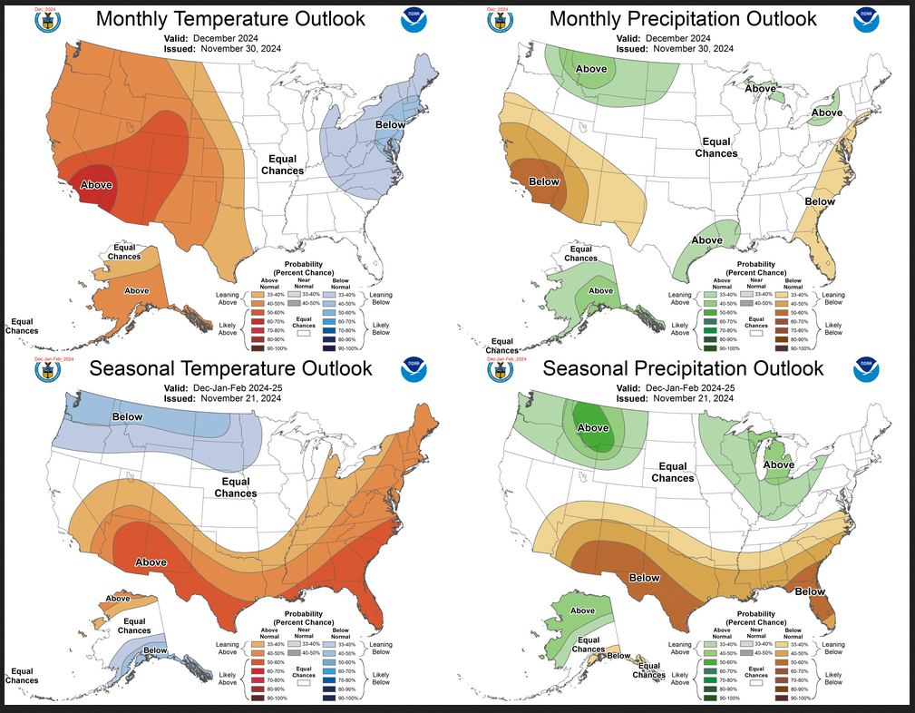
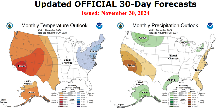
I am going to start with graphics that show the updated Outlook for September and the Mid-Month Outlook for September. This is followed by a graphic that shows both the Updated Outlook for September and the previously issued three-month outlook for SON 2024. So you get the full picture in three graphics.

Here is the updated Outlook for September 2024.


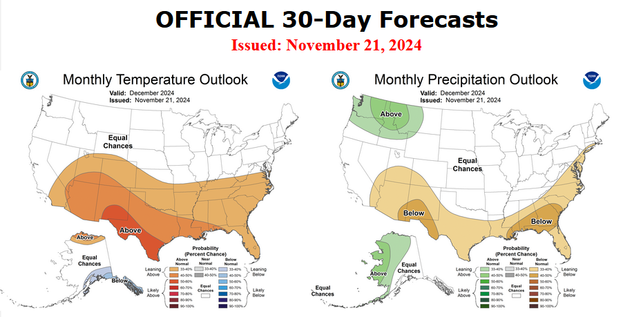
For Comparison Purposes, Here is the earlier Mid-Month Outlook for September.


It is important to remember that the maps show deviations from the current definition of normal which is the period 1991 through 2020.  So this is not a forecast of the absolute value of temperature or precipitation but the change from what is defined as normal or to use the technical term climatology.

It is a substantial change from what was issued on August 15, 2024. Remember, it is the first set of maps that are the current outlook for September.  One expects some changes  16 days later. However, the changes to the updated September Outlook are very significant.  This then gives us some reason to question the (August 15, 2024) three-month SON temperature and precipitation Outlooks which are shown in the following graphic.

NOAA provided a combination of the Updated Outlook for September and the Three-Month Outlook.

The top pair of maps are again the Updated Outlook for the new month. There is a temperature map and a precipitation map. The bottom row shows the three-month outlooks which includes August the new month. I think the outlook maps are self-explanatory.

To the extent that one can rely on a forecast, we would conclude that October and November will be very different than September, especially for precipitation. You can subtract September from the three-month Outlook and divide by two to get a combined October-November Outlook.

However given the major change in the new September outlook from what was issued on August 15,  2024, we might not trust the Seasonal Outlook issued on August 15, 2024. Something to think about. But the major factor is the projected slower onset of La Nina. Thus this change is consistent with the pattern the NOAA has been predicting although they have been playing catch-up.

I am still not convinced that there will be a La Nina Winter.

Some readers may need to click “Read More” to read the rest of the article.  Some will feel that they have enough information. But there is a lot more information in the rest of this article.