Updated at 3:35 p.m. January 13, 2023
Here is what we are paying attention to in the next 48 to 72 hours. This article also includes World weather forecasts.
We start with the U.S. Information.
Short Range Forecast Discussion
NWS Weather Prediction Center College Park MD
236 PM EST Fri Jan 13 2023

Valid 00Z Sat Jan 14 2023 - 00Z Mon Jan 16 2023

...Rounds of heavy rain and snow continue in the West through the
weekend...

...Unseasonably warm temperatures in the central U.S. through the
weekend...
![]()
First, the 48-Hour Forecast (It is a 48 to 72 Hour Forecast actually)
Daily weather maps
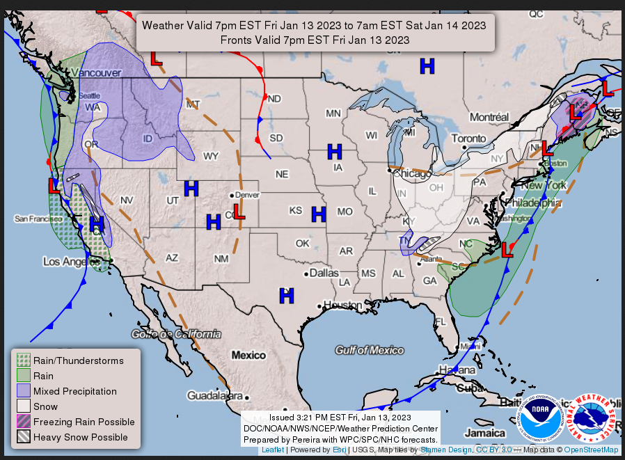
FRIDAY AFTERNOON, EVENING AND OVERNIGHT
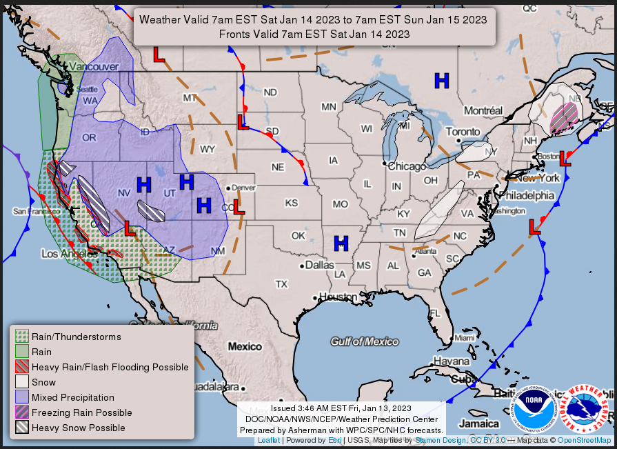
SATURDAY
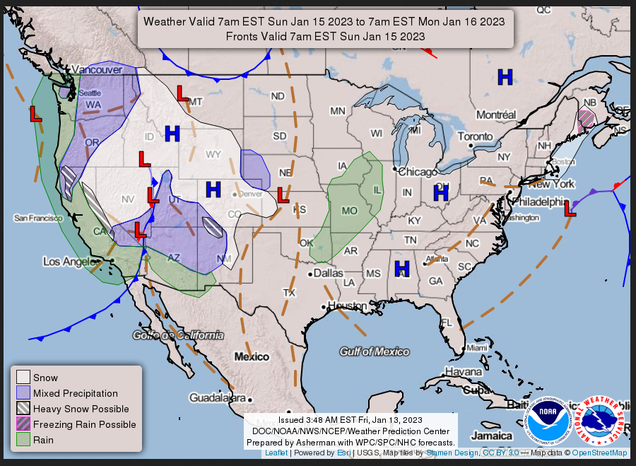
SUNDAY
I try to keep the above maps updated. They only update twice a day and in some cases once a day.
I will be doing the updating during the period described in the title of the article but if you happen to read this article later you can get updates by clicking HERE.
This animation shows how things may play out over the next 60 hours. To update click here.
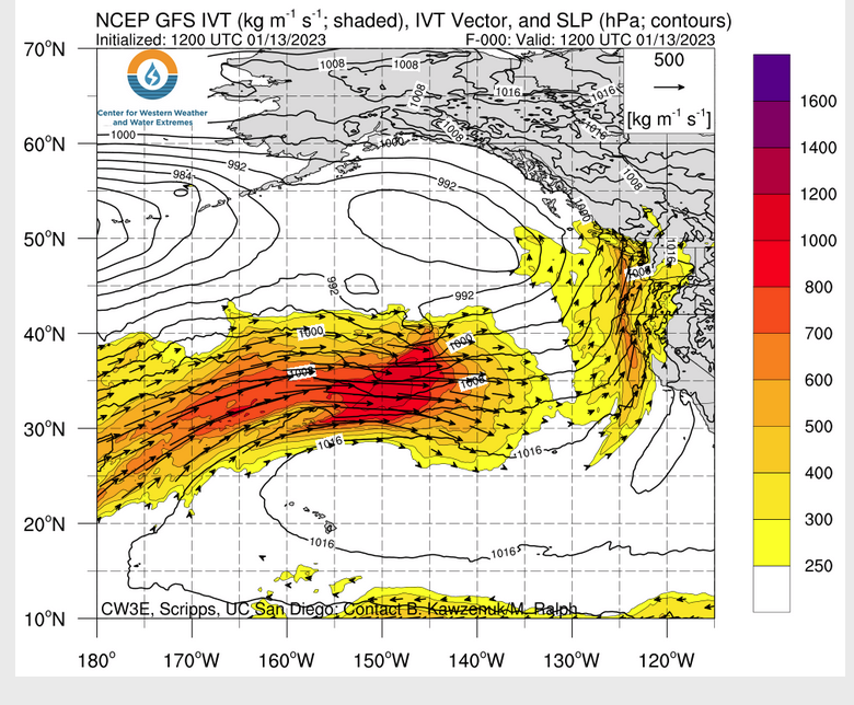
ATMOSPHERIC RIVERS
Continuation of the NWS Short Range Forecast (It is updated by NWS twice a day and these updates can be found here. We post at least one of those updates daily, sometimes both. The Highlights are shown in the lede paragraph of this article.
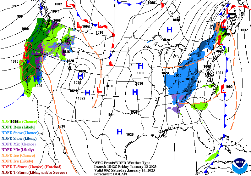
The main weather story through the weekend will be the continued heavy
precipitation in the West. Precipitation is currently being produced by a
frontal boundary that has stalled along the West Coast. This boundary is
expected to weaken and dissipate by tonight, then another storm system
will approach the coast this weekend. The second system will move inland
during the day on Saturday and push into the Intermountain West Saturday
night into Sunday. A third storm system is expected to approach the coast
late this weekend and move onshore on Monday. This pattern will produce
rounds of heavy rain at low elevations and heavy snow at high elevations.

California will be particularly susceptible to flooding since they have
received anomalous amounts of rain over the past few weeks. Soils are
nearly completely saturated, so any additional rainfall could cause
flooding concerns, especially near steep terrain and burn scars. There
will be a Slight Risk of Excessive Rainfall (level 2/4) for parts of
California tonight and Saturday, and scattered instances of flash flooding
will be possible. There will likely be a short break in precipitation
between the second and third storm systems late Saturday night into early
Sunday, which will lead to a slightly lower risk of flash flooding in
California on Sunday. In the Sierra Nevada region in California,
persistent heavy snow is expected to continue through the weekend,
creating extremely hazardous conditions. Precipitation will spread east
into the Intermountain West Saturday into Sunday, and heavy snow will be
possible for portions of the central and southern Rockies as well.

In the East, the low pressure system over the Northeast and trailing cold
front will push offshore into the Atlantic tonight, and any remaining
precipitation will gradually taper off on Saturday. The eastern U.S. will
be mainly dry through the rest of the weekend, but there could be some
light snow or mixed precipitation along the New England coast.
Temperatures will be cool across the East and Southeast in the wake of the
cold front, and below average temperatures are expected through Saturday.
Temperatures will gradually return to near normal values by the end of the
weekend.

In the central U.S., temperatures will be unseasonably warm through the
weekend into Monday. Broad southerly flow is expected to push warm moist
air into the region, which will push temperatures up to 15-25 degrees
above average. The northern Plains will be the first area to cool back to
seasonable values when a cold front nudges down from the north Sunday into
Monday. A wave of low pressure will push past the Rockies late this
weekend and spawn a surface low over the central and southern Plains,
which will bring temperatures back to near seasonable values in this area.
This low pressure system is forecast to track Northeast early next week.
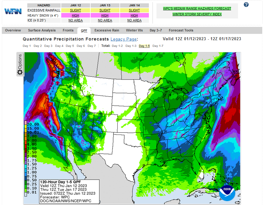
Below is the current five-day cumulative forecast of precipitation (Updates can be found HERE)
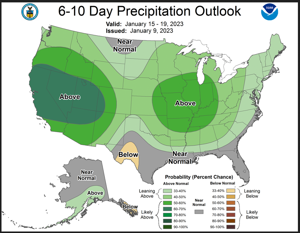
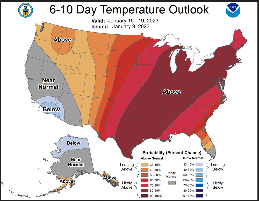
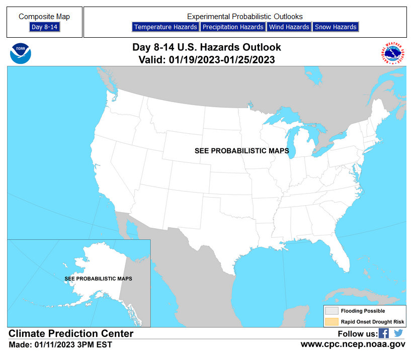
Now we look at Intermediate-Term “Outlook” maps for three time periods. Days 6 – 10, Days 8 – 14, and Weeks 3 and 4. An outlook differs from a forecast based on how NOAA uses these terms in that an “outlook” presents information as deviation from normal and the likelihood of these deviations.
Below are the links to obtain updates and additional information. They are particularly useful if you happen to be reading this article significantly later than when it was published. I always try to provide readers with the source of the information in my articles.
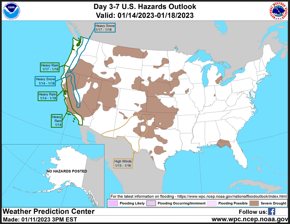
HAZARDS OUTLOOKS
Click here for the latest complete Day 3 -7 Hazards forecast which updates only on weekdays. Once a week probably Monday or Tuesday I will update the images. I provided the link for readers to get daily updates on weekdays. Use your own judgment to decide if you need to update these images. I update almost all the images Friday Night for the weekend edition of this Weather Report. So normally readers do not need to update these images but if the weather is changing quickly you may want to.
Month to Date Information
Temperature month to date can be found at https://hprcc.unl.edu/products/maps/acis/MonthTDeptUS.png
Precipitation month to date can be found at https://hprcc.unl.edu/products/maps/acis /MonthPNormUS.png
World Forecast
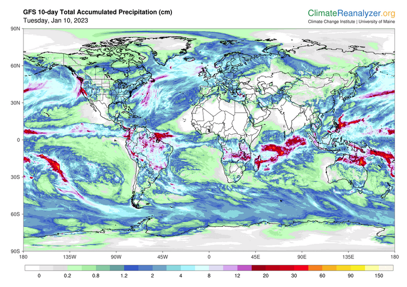
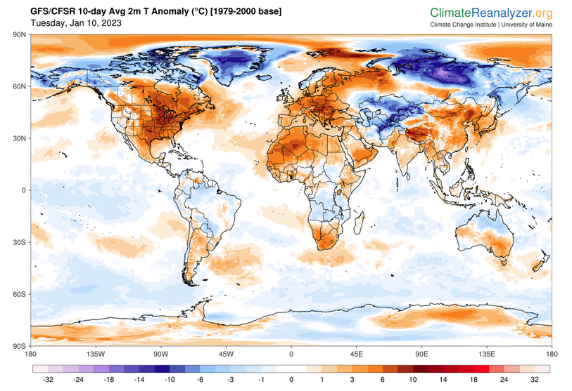
Below are the current precipitation forecast and the 10-Day forecasts for temperature and precipitation. Updates and additional information can be obtained HERE
Much of this information is provided by the University of Maine. They draw upon many different sources.
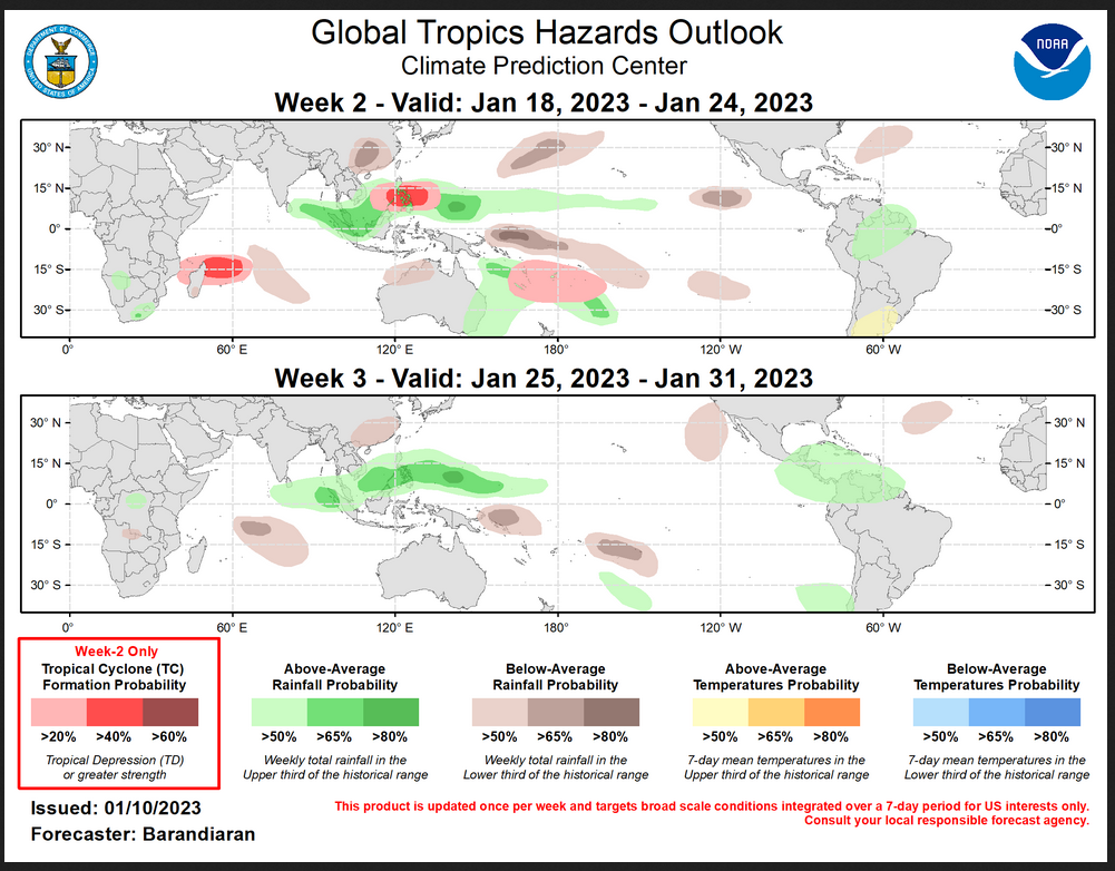
Worldwide Tropical Forecast (This is a NOAA Product)
This graphic updates on Tuesdays) If it has not been updated, you can get the update by clicking h ere Readers will only have to do that if they are reading this article much later than the date of it being published.
–
| I hope you found this article interesting and useful. |