Updated at 4:33 p.m. EST Friday, February 3, 2023

Here is what we are paying attention to in the next 48 to 72 hours. This article also includes World weather forecasts.
It also includes links for longer-term outlooks and sometimes (like today) we show the maps that one finds if one clicks on those links. But we can not update all of those maps each day so look at the date and the duration of the period of time involved. If you want a more up-to-date map, click on the provided link which may be located in a table of links. If the date in the title of the article is not today’s date. just go to Econcurrents.com and look for today’s weather article.
We start with the U.S. Information.
Short Range Forecast Discussion
NWS Weather Prediction Center College Park MD
306 PM EST Fri Feb 03 2023Valid 00Z Sat Feb 04 2023 – 00Z Mon Feb 06 2023
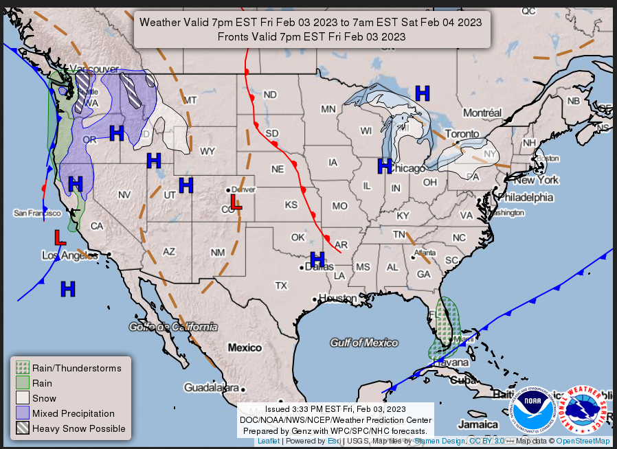
…A brief intense surge of arctic air expected across the Northeast
through Saturday followed by rapid moderation in temperatures on Sunday……Unsettled weather moving into the West Coast with heavy snow reaching
the Sierra Nevada Saturday night…
![]()
–
| The groundhogs in many places say six more weeks of winter. What does that mean? Meteorological Winter ends when March begins but Astronomical Winter ends on March 19. So it seems we have some very cagey groundhogs. It probably depends on where you live. For the U.S. we provide links in this daily report that show the outlook out through four Fridays and on Friday we show all the maps to make it easier for readers. And a few days ago we showed the updated outlook for February. I do not remember if we published the JAMSTEC outlook for the World but later today I will add the most recent JAMSTEC forecast for the next three months. The current Outlook for the next three months for the U.S. is included in what we published a few days ago. It was issued on January 19 but is included in the End of Month report which you can access HERE. Have fun with this but we have to wait six weeks to assign a grade to the various groundhogs who provided us with their wisdom. |
Now, the 48-Hour Forecast (It is a 48 to 72 Hour Forecast actually)
Daily weather maps. I try to keep the below three maps updated. The Day 1 map updates twice a day and the Day 2 and 3 maps update only once a day. I will be doing the updating during the period described in the title of the article but if you happen to read this article later, you can get updates by clicking HERE.
FRIDAY AFTERNOON, EVENING, AND OVERNIGHT
SATURDAY

SUNDAY
This animation shows how things may play out over the next 60 hours. To update click here.
ATMOSPHERIC RIVERS
Continuation of the NWS Short Range Forecast (It is updated by NWS twice a day and these updates can be found here. We post at least one of those updates daily, sometimes both. The Highlights are shown in the lede paragraph of this article.
An intense surge of arctic air from eastern Canada is currently in
progress across the northeastern part of the country. In addition, strong
pressure gradient between a rapidly intensifying cyclone in eastern Canada
and a cold high pressure system centered near the Great Lakes will result
in very blustery north to northwest winds, dropping wind chill
temperatures to dangerously low levels. Northern Maine is forecast to
experience wind chill as low as -60 degrees with ground blizzard
conditions into tonight. Bitterly cold and biting winds will extend
southward into the Mid-Atlantic into tonight. This cold snap will be
relatively short-lived however, as much milder air from the Great Plains
is forecast to make its way east toward New England and down into the
eastern U.S. during the weekend behind a pair of warm fronts. Some
lake-effect snow is expected downwind from the Great Lakes into Saturday
before the arrival of the mild air effectively shut off the snow by
Saturday night. However, an Alberta clipper is forecast to reach the
upper Great Lakes late Saturday into Sunday morning before heading toward
northern New England later on Sunday. This clipper will set off another
round of snow across the upper Great Lakes Saturday night followed by
mixed rain and snow across the lower Great Lakes and light snow across
northern new England on Sunday.In the meantime, moisture associated with a Pacific cyclone and its cold
front has already moved into the Pacific Northwest and portions of
California. Additional energy arriving behind the system will expand the
unsettled weather along the West Coast and then farther inland. Sierra
Nevada will begin to see heavy snow by Saturday night while periods of
moderate rain are forecast for the lower elevations of northern and
central California and the Pacific Northwest through the weekend. The
snow will result in reduced visibility and hazardous driving conditions
for the higher elevations. The mountain snows will begin spreading
farther inland into the Intermountain West, the northern Rockies, and the
Great Basin on Sunday.
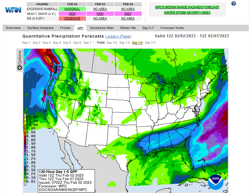
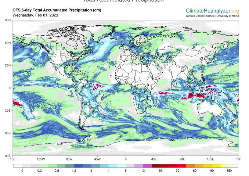
Below is the current five-day cumulative forecast of precipitation (Updates can be found HERE)
Now we look at Intermediate-Term “Outlook” maps for three time periods. Days 6 – 10, Days 8 – 14, and Weeks 3 and 4. An outlook differs from a forecast based on how NOAA uses these terms in that an “outlook” presents information as deviation from normal and the likelihood of these deviations.
Below are the links to obtain updates and additional information. They are particularly useful if you happen to be reading this article significantly later than when it was published. I always try to provide readers with the source of the information in my articles.
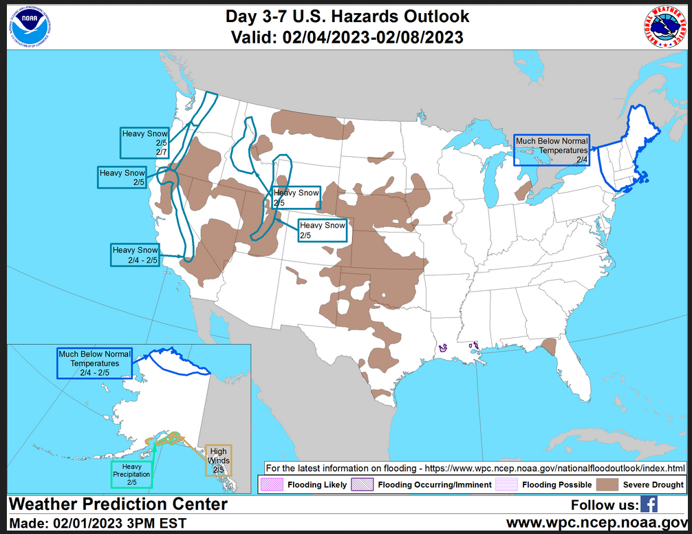
HAZARDS OUTLOOKS
Click here for the latest complete Day 3 -7 Hazards forecast which updates only on weekdays. Once a week probably Monday or Tuesday I will update the images. I provided the link for readers to get daily updates on weekdays. Use your own judgment to decide if you need to update these images. I update almost all the images Friday Night for the weekend edition of this Weather Report. So normally readers do not need to update these images but if the weather is changing quickly you may want to.
Month to Date Information
Temperature month to date can be found at https://hprcc.unl.edu/products/maps/acis/MonthTDeptUS.png
Precipitation month to date can be found at https://hprcc.unl.edu/products/maps/acis /MonthPNormUS.png
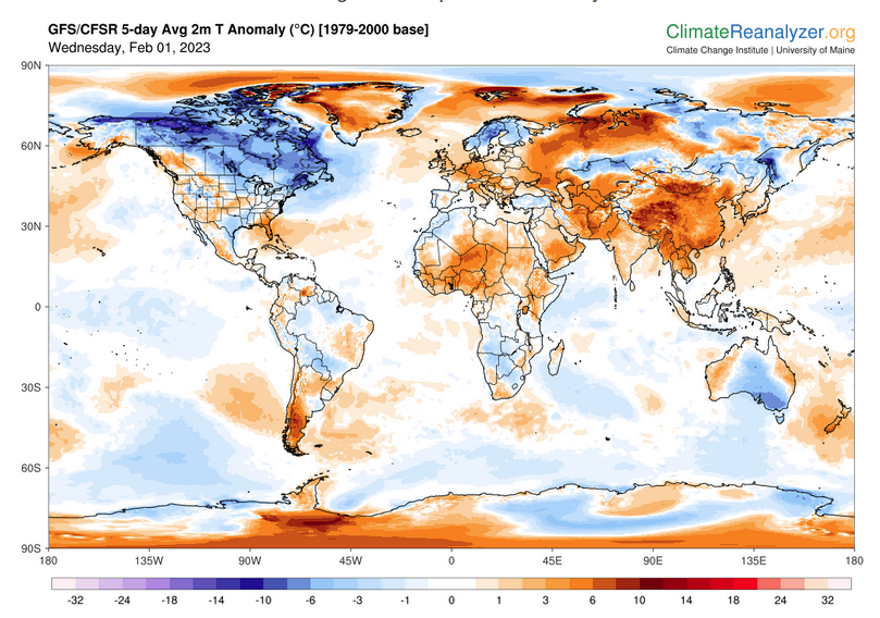
World Forecast
Below are the 5-Day forecasts for temperature and precipitation. Updates and much additional information can be obtained HERE
This information is provided by the University of Maine. They draw upon many different sources. There is a lot of information available at the link provided. I have just provided two useful forecasts. There are probably over a hundred different forecasts available from this source.
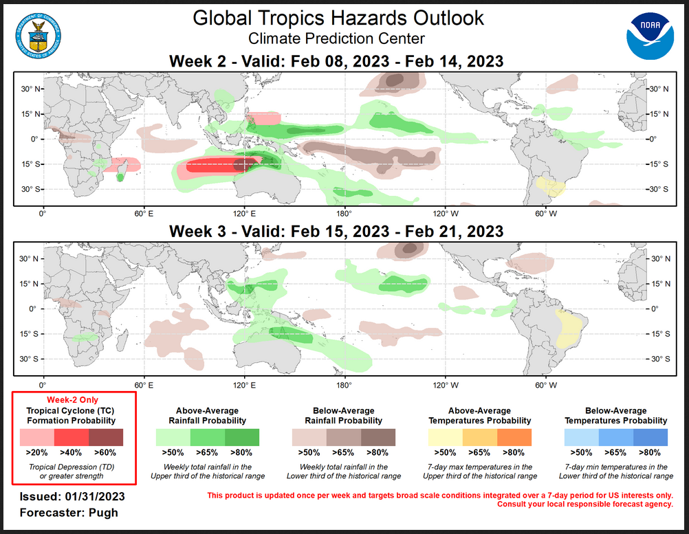
Worldwide Tropical Forecast (This is a NOAA Product)
This graphic updates on Tuesdays) If it has not been updated, you can get the update by clicking h ere Readers will only have to do that if they are reading this article much later than the date of it being published.-
–
| I hope you found this article interesting and useful. |