In this article, I present NOAA articles about the Atlantic Hurricane Season. One is the Outlook for this season and the other is a review of the 2023 Hurricane Season with an informative YouTube. I interweave these two a bit and hope that I do not confuse the reader. Then I provide some additional information on Atlantic Hurricanes and how they are influenced by the Atlantic Multidecadal Oscillation (AMO), the Bermuda High, and the phase of ENSO.
Some may have to click on “Read More” to access the remainder of this article.
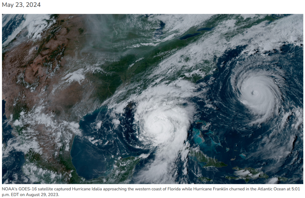
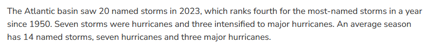
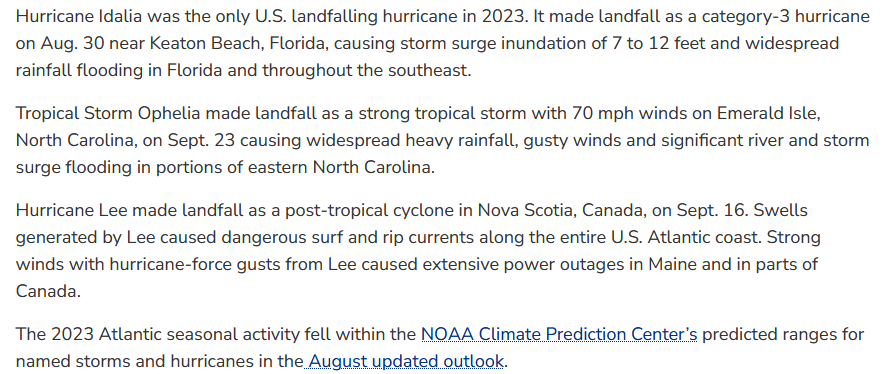
A review of the 2023 Hurricane Season shows why there is such interest in the 202class4 Hurricane Season
You can access this YouTube HERE. That will take you to a dashboard that looks like the above but it will be live and you can click on the YouTube at that point.
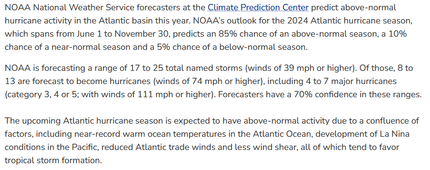
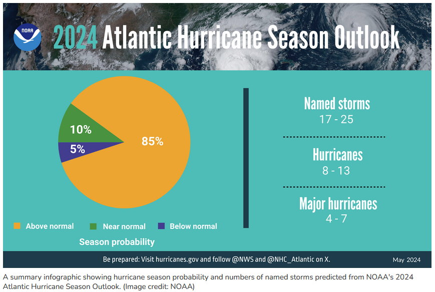
Now let us look at the predictions for this summer; 2024.

Now let us introduce some additional science into the discussion
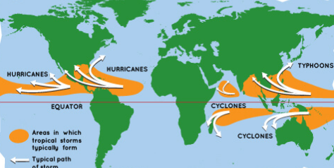
| This shows that tropical storms including powerful ones occur all around Earth just north and south of the Equator. They happen with warm (greater than 27.5C) water and the needed tilt of the Earth’s axis. |
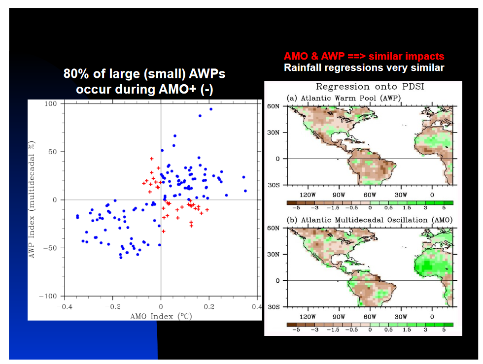
| Warm Pools include the impacts of ENSO but also the corresponding not talked about warm pool in the Atlantic. The AMO and the Bermuda High with is NASH if you are picky about it pretty much are in a dance. I discuss this more later. Actually, everything pretty much is interconnected with everything else. |
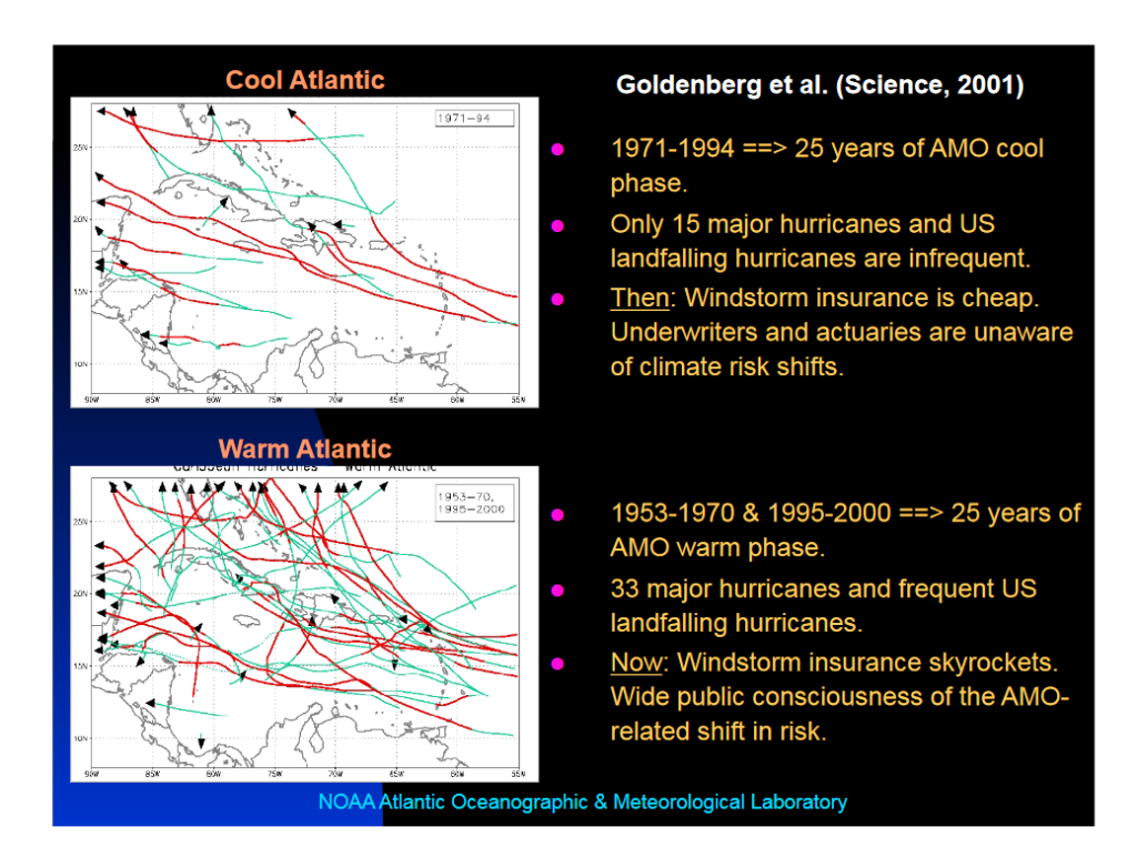
| We are in the Warm Phase of the AMO |
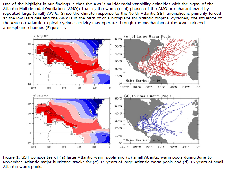
| The warm pools and the AMO are pretty much in sync so one can focus on the AMO and you see the difference in the storm tracks. I guess it is better to think about the warm pools but there may be better data on the phase of the AMO. |
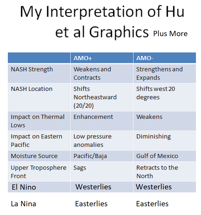
| Here I used a graphic from an old presentation of mine and added two more rows and it shows a lot. The conclusion is that AMO+ and La Nina are a formula for lots of Hurricanes. I also impact the Southwest Monsoon because the impact from tropicals will tend to be from the Caribbean during El Nino and the Sea of Cortez during La Nina. It has to do with the strength of the Easterlies. Where I say Westerlies above, it means a westerly anomaly namely weaker Easterlies during El Nino |
–
| I hope you found this article interesting and useful. |
–
Useful References
https://www.noaa.gov/news-release/noaa-predicts-above-normal-2024-atlantic-hurricane-season
https://spaceplace.nasa.gov/hurricanes/en/
https://weather.com/storms/hurricane/news/2023-09-05-what-are-cape-verde-hurricanes-cabo-verde
https://www.noaa.gov/news-release/2023-atlantic-hurricane-season-ranks-4th-for-most-named-storms-in-year
https://journals.ametsoc.org/view/journals/clim/24/21/2011jcli4060.1.xml
Some of my images are without citations in this article. They are from my photo library i.e. from previous articles so I assume they are from NOAA. I try not to violate copyrights. I will remove any graphics upon request.