Last month there was some concern that we were having a Sudden Stratospheric Warming Event. It seems that it did happen but in a fairly minor way and the resulting cold intrusions of Arctic air seem to have not lasted for very long. I came across this posted article on Climate.Gov attributed to Laura Cisto and Amy Butler. I am reproducing their article here except for the comments it received. You can access the article with the comments HERE. The comments are always quite interesting and the authors typically reply to those comments. And that process can continue for some time which is why I have provided the link to the Post by Laura Cisto and Amy Butler.
It is difficult reading and not everyone will want to dig into it but it is here for those with a deep interest in weather. Where I have comments, I have put them in boxes within the article. For those with an insatiable curiosity, THIS explanation of Sudden Stratospheric Warming Events will probably quench your thirst. The blog post that I have in this article describes a recent mini-SSW event that was somewhat unusual.
To read the full article you may need to click on “Read More”.
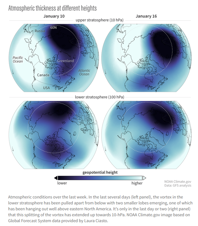
| Their article was posted on January 16 so I think they are discussing the weekend of January 13 and 14. |
–
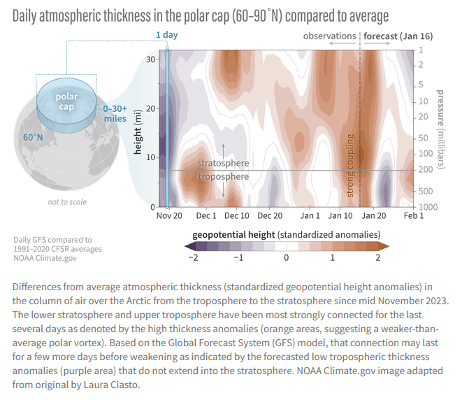
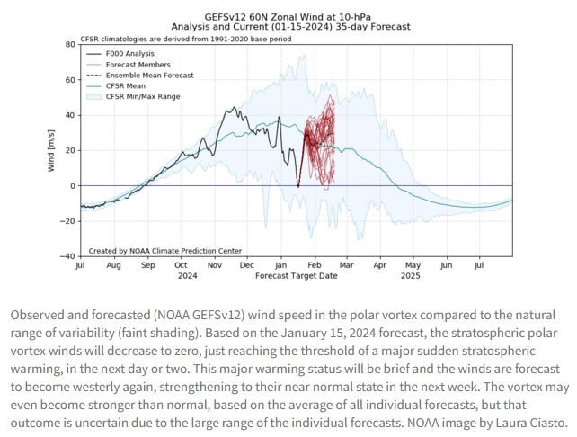
| I have been having a problem understanding this graphic. I think it is simply showing where the cold air is. Cold air takes up less space so the altitude to where the air pressure is 100 hPa or 10 hPa is less. I think the next graphic is more useful. BTW we published at least part of the first post in this series and you can access my article HERE. |
| It seems that the forecast was on target as it is now warmer than normal in the Northeast. |
–
| I hope you found this article interesting and useful. |
–