I used to report on Reservoir Levels. I think it is time to do that again. The article this evening is a first attempt at doing this.
It contains a lot of information. I will be republishing this article periodically and adding and improving to it. What I am providing today has images that should update automatically. But I also have provided links to those images and additional information.
At this point, it is far from perfect but a start. It is particularly important because in many cases the water in reservoirs comes from last year’s precipitation. So with uncertainty as to how this El Nino winter will evolve, we need to monitor the amount of water we have in storage.

Let’s get started.
Many but not all reservoirs are managed by the Bureau of Reclamation or BOR. This LINK goes to the master list. But it does not include all reservoirs just Bureau of Reclamation Reservoirs.
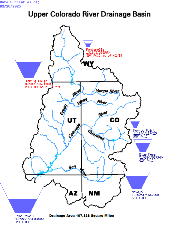
Upper Colorado River Drainage Basin
I was able to find teacup diagrams for the Upper Colorado River Drainage Basin. These images should update automatically but if not HERE is the link.

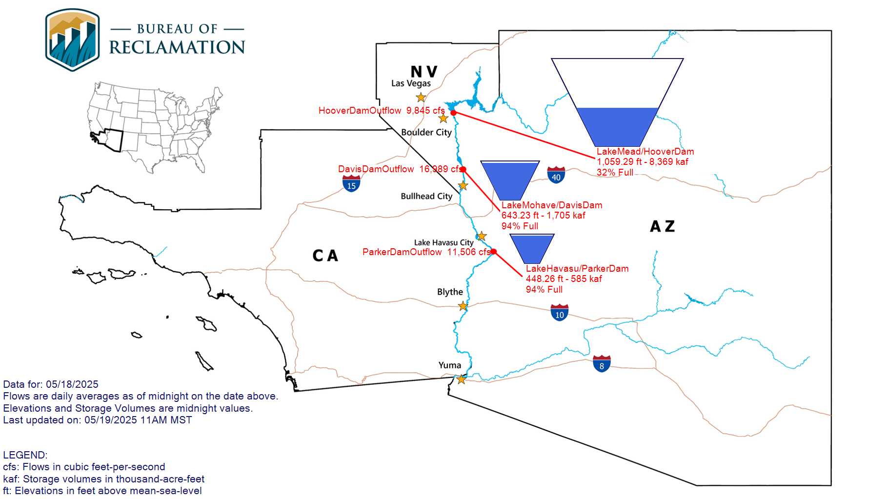
Lower Colorado Region

This map should update automatically. But if not. here is the LINK.
This LINK will take you to similar information for California
This LINK will take you to similar information for the Columbia-Pacific Northwest Region
This Link will take you to similar information for the Missouri Basin and Arkansas-Rio Grande-Texas Gulf Regions.
–
| I hope you found this article interesting and useful. |
–