Updated at 3:30 p.m. EST Saturday, January 21, 2023
Here is what we are paying attention to in the next 48 to 72 hours. This article also includes World weather forecasts.
It also includes links for longer-term outlooks and sometimes we show the maps that one finds if one clicks on those links. But we can not update all of those maps each day so look at the date and the duration of the period of time involved. If you want a more up-to-date map, click on the provided link which may be located in a table of links. NOAA makes it difficult for us to have maps that auto-update. We are trying to make it convenient for readers but NOAA wants us to steer traffic to a large number of their websites which would make it very difficult for readers.
We start with the U.S. Information.
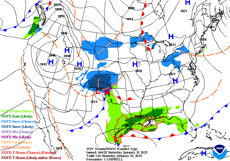
Short Range Forecast Discussion
NWS Weather Prediction Center College Park MD
300 PM EST Sat Jan 21 2023

Valid 00Z Sun Jan 22 2023 - 00Z Tue Jan 24 2023

...Moderate to heavy snow from the Ohio Valley into the Lower Great Lakes
and heavy snow over parts of New England...

...There is a Marginal Risk of severe thunderstorms and excessive rainfall
over parts of Central Gulf Coast and Southeast...

...Pockets of rain/freezing rain over parts of the Central Appalachians on
Sunday and parts of New England on Monday...
First, the 48-Hour Forecast (It is a 48 to 72 Hour Forecast actually)
Daily weather maps. I try to keep the below three maps updated. The Day 1 map updates twice a day and the Day 2 and 3 maps update only once a day. I will be doing the updating during the period described in the title of the article but if you happen to read this article later, you can get updates by clicking HERE.
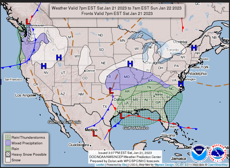
SATURDAY AFTERNOON, EVENING AND OVERNIGHT
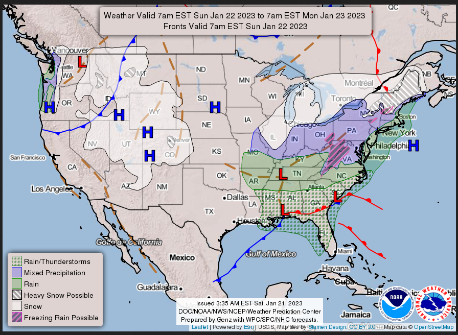
SUNDAY
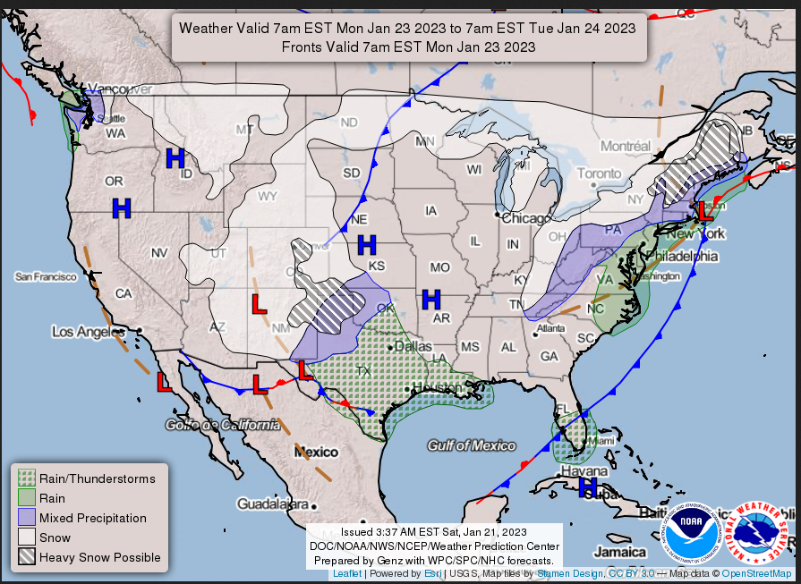
MONDAY
This animation shows how things may play out over the next 60 hours. To update click here.
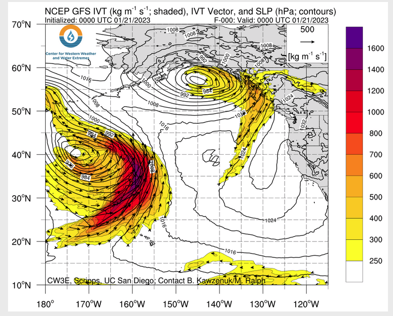
ATMOSPHERIC RIVERS
Continuation of the NWS Short Range Forecast (It is updated by NWS twice a day and these updates can be found here. We post at least one of those updates daily, sometimes both. The Highlights are shown in the lede paragraph of this article.
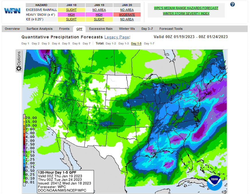
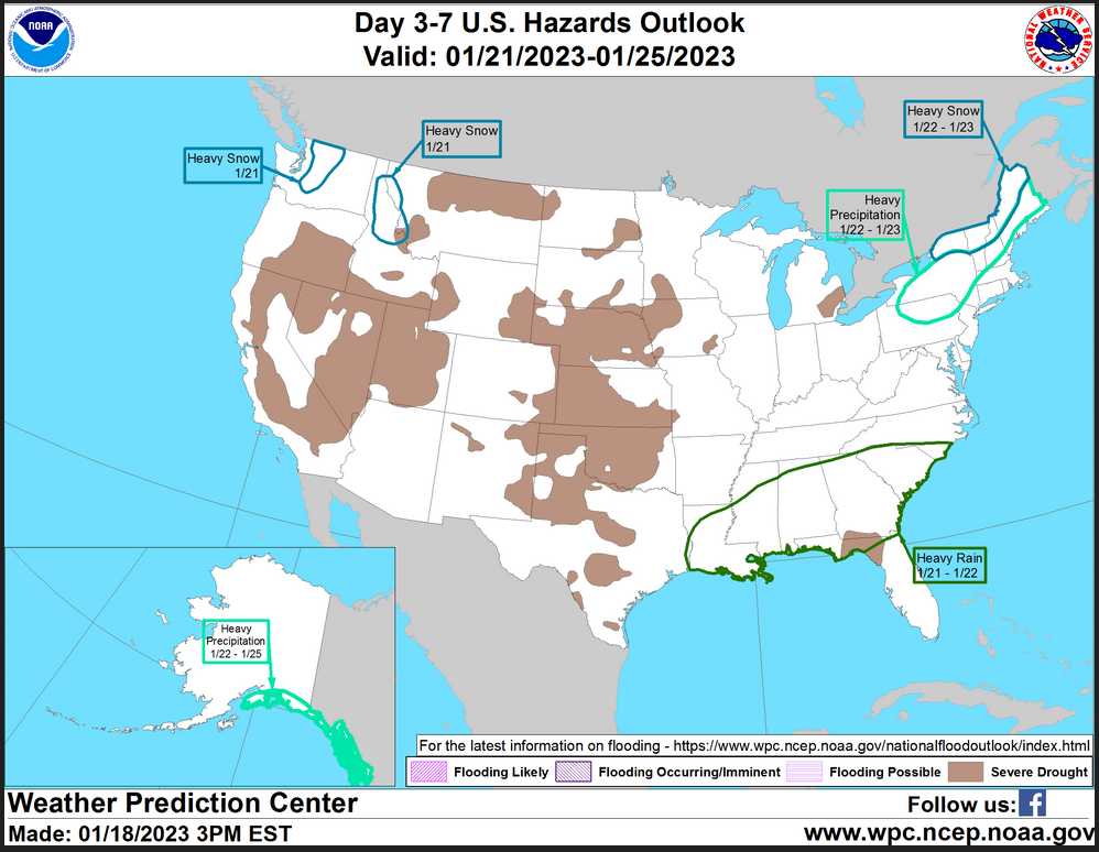
A storm over the Southern Plains will merge with a front and low pressure
over Central Gulf Coast by Sunday morning, moving northward along the East
Coast to Cape Cod by Monday. The system will produce light to moderate
snow over parts of the Central Plains/Middle Mississippi Valley on
Saturday afternoon into the early evening. Overnight Saturday, the storm
will produce moderate to heavy snow over parts of the Ohio Valley. By
Sunday afternoon, the system makes moderate to heavy snow over parts of
the Northeast and heavy snow over parts of Northern New England from
Sunday evening into Monday evening. Pockets of rain/freezing rain will
also develop overnight Sunday into Monday over parts of New England.

Meanwhile, the storm will produce rain over parts of the Lower Mississippi
and Tennessee Valleys on Saturday evening into Sunday and showers/moderate
to severe thunderstorms over the Central Gulf Coast. Therefore, the SPC
has issued a Marginal Risk of severe thunderstorms over parts of the
Central Gulf Coast through Sunday morning. The hazards associated with
these thunderstorms are frequent lightning, severe thunderstorm wind
gusts, a few tornadoes, and a minimal threat of hail.

Likewise, the storms will produce areas of moderate to heavy rain.
Therefore, the WPC has issued a Marginal Risk of excessive rainfall over
parts of the Central Gulf Coast into the Southeast through Sunday morning.
The associated heavy rain will create localized areas of flash flooding,
affecting areas that experience rapid runoff with heavy rain.

Furthermore, as the storm moves eastward, rain will develop over parts of
the Tennessee and Ohio Valleys on Sunday, moving into the Mid-Atlantic by
Sunday evening. Moreover, pockets of rain/freezing rain will develop over
parts of the Central Appalachians from early Sunday morning into Sunday
afternoon. Finally, showers and moderate to severe thunderstorms will
develop closer to the gulf coast on Sunday. Therefore, the SPC has issued
a Marginal Risk of severe thunderstorms over parts of the Eastern Gulf
Coast/Southeast from Sunday through Monday morning. The hazards associated
with these thunderstorms are frequent lightning, severe thunderstorm wind
gusts, a few tornadoes, and a minimal threat of hail.

In addition, the storm will produce moderate to heavy rain. Therefore, the
WPC has issued a Marginal Risk of excessive rainfall over parts of the
Eastern Gulf/Southeastern Coast from Sunday through Monday morning. The
associated heavy rain will create localized areas of flash flooding,
affecting areas that experience rapid runoff with heavy rain.

In the meantime, a front will move onshore over the Pacific Northwest and
move southward to Northwest Mexico by Monday. The system will produce
coastal rain and higher-elevation snow over the Northwest on Saturday
evening. Overnight Saturday, the snow will move into the Intermountain
Region/Great Basin and the Central Rockies on Sunday. Overnight Sunday,
the snow will develop over parts of the Southwest and into the
Central/Southern Rockies on Monday.
Below is the current five-day cumulative forecast of precipitation (Updates can be found HERE)
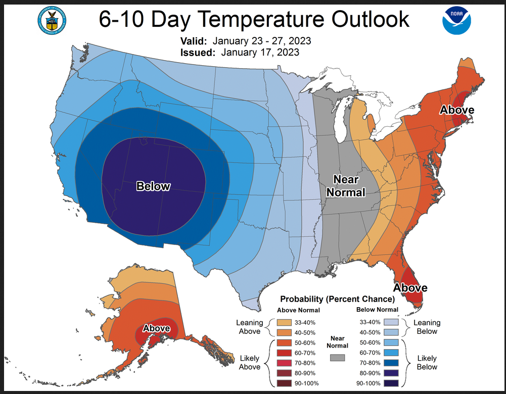
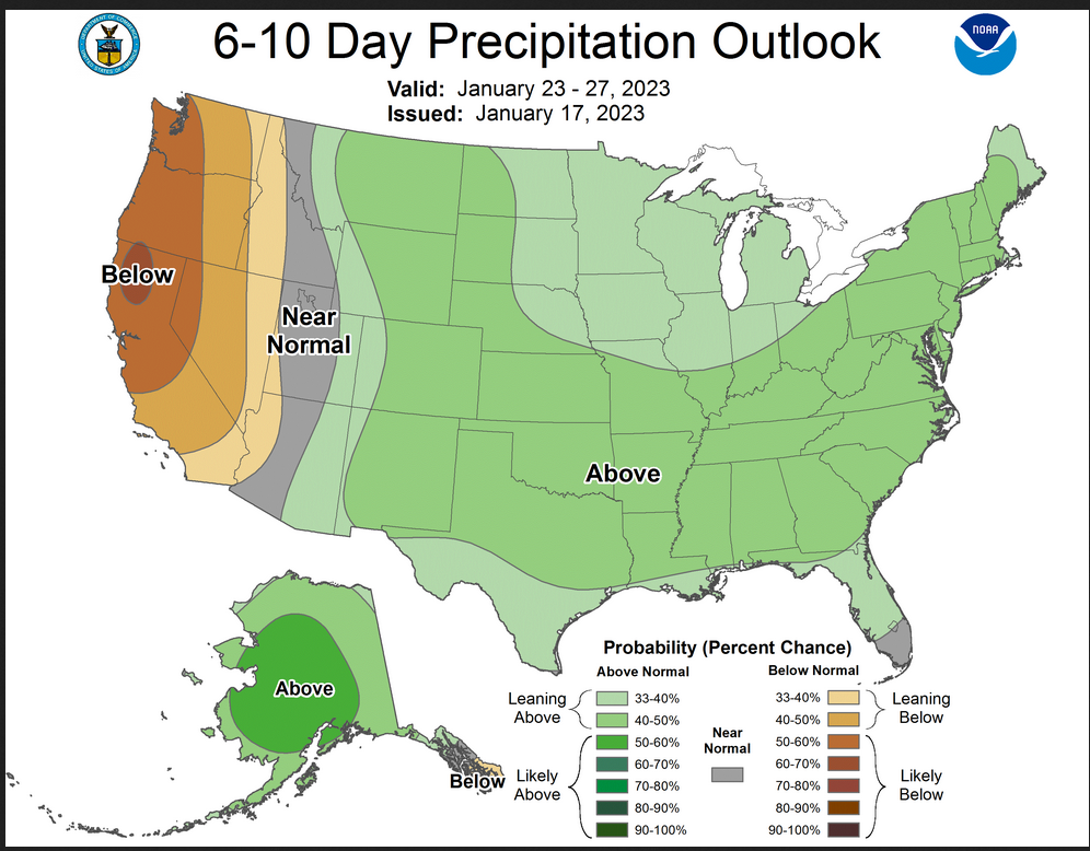
Now we look at Intermediate-Term “Outlook” maps for three time periods. Days 6 – 10, Days 8 – 14, and Weeks 3 and 4. An outlook differs from a forecast based on how NOAA uses these terms in that an “outlook” presents information as deviation from normal and the likelihood of these deviations.
Below are the links to obtain updates and additional information. They are particularly useful if you happen to be reading this article significantly later than when it was published. I always try to provide readers with the source of the information in my articles.
Starting with the 6 to 10 Day Outlooks
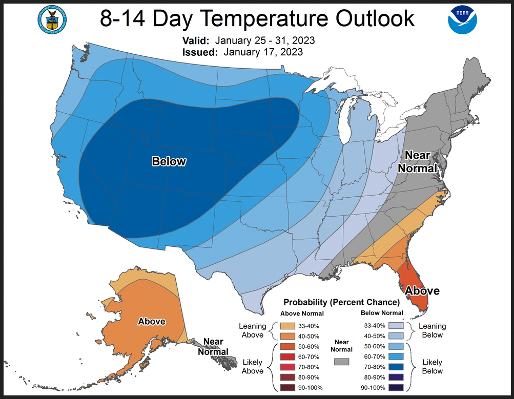
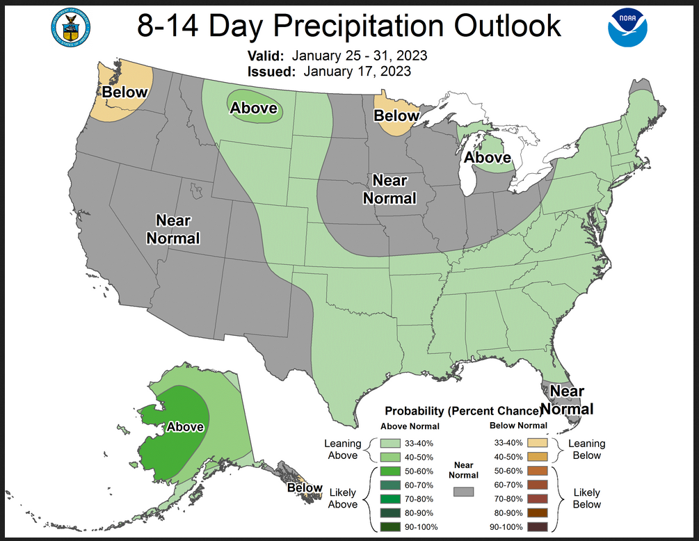
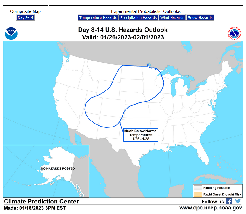
Now let us look a bit farther out to 8 to 14 days. Notice the overlap which reflects the difficulty of predicting exactly when events with happen.
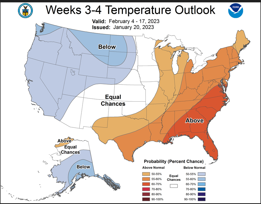
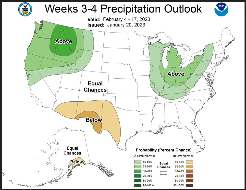
On Friday’s, the Week 3 – 4 Outlook updates. So let us take a look.
HAZARDS OUTLOOKS
Click here for the latest complete Day 3 -7 Hazards forecast which updates only on weekdays. Once a week probably Monday or Tuesday I will update the images. I provided the link for readers to get daily updates on weekdays. Use your own judgment to decide if you need to update these images. I update almost all the images Friday Night for the weekend edition of this Weather Report. So normally readers do not need to update these images but if the weather is changing quickly you may want to.
 Month to Date Information
Temperature month to date can be found at https://hprcc.unl.edu/products/maps/acis/MonthTDeptUS.png
Precipitation month to date can be found at https://hprcc.unl.edu/products/maps/acis /MonthPNormUS.png
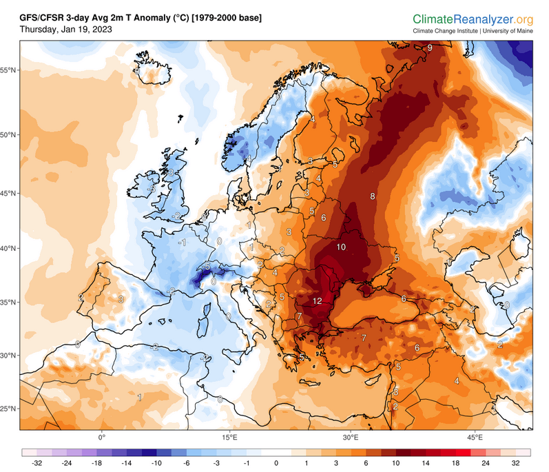
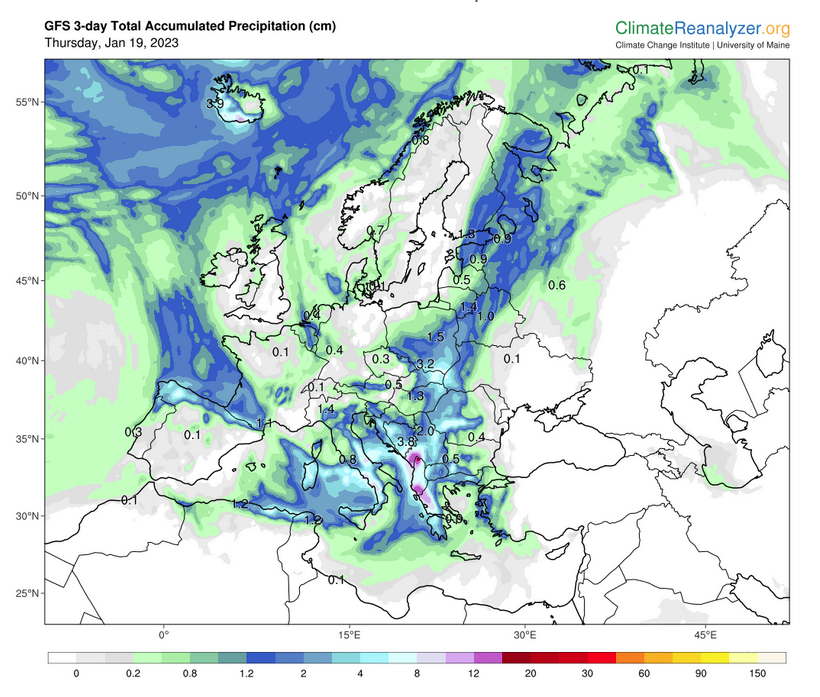
World Forecast
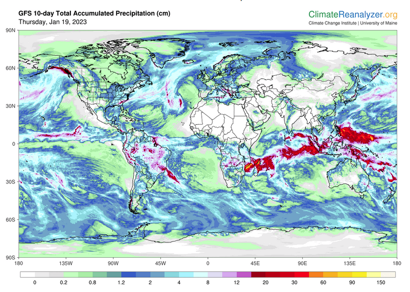
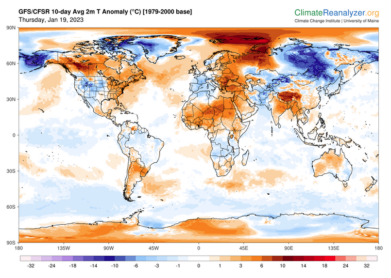
Below are the current precipitation forecast and the 10-Day forecasts for temperature and precipitation. Updates and additional information can be obtained HERE
Much of this information is provided by the University of Maine. They draw upon many different sources.
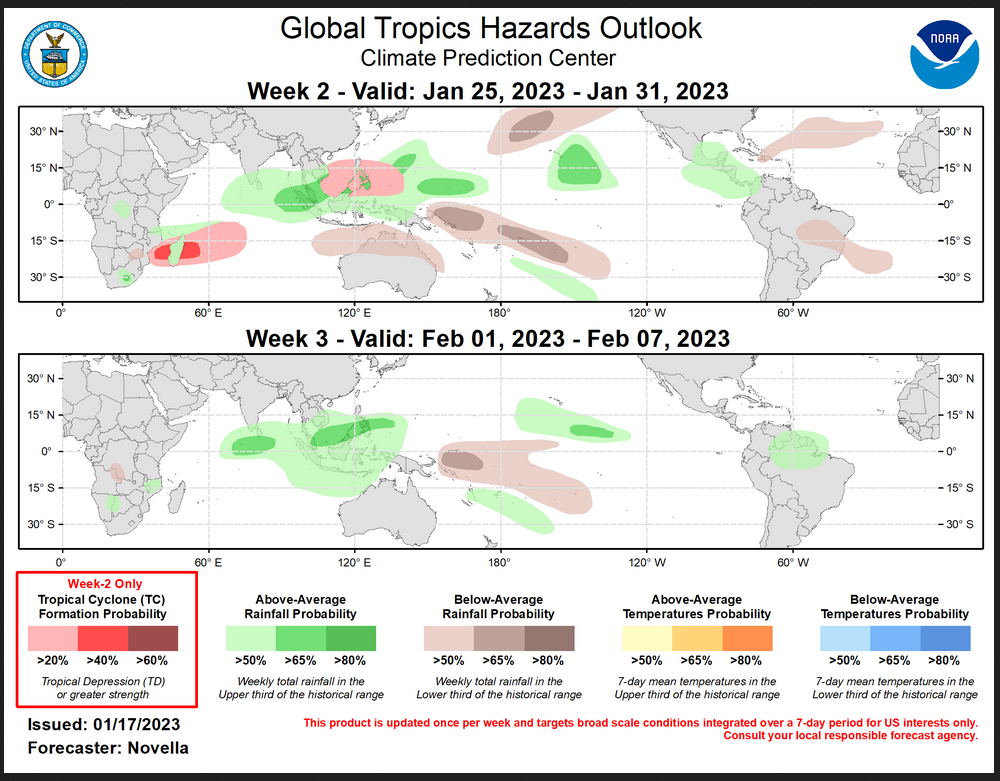
 Worldwide Tropical Forecast (This is a NOAA Product)
This graphic updates on Tuesdays) If it has not been updated, you can get the update by clicking here Readers will only have to do that if they are reading this article much later than the date of it being published.
–
| I hope you found this article interesting and useful. |