Updated at 3:48 p.m. Friday, January 20, 2023
Here is what we are paying attention to in the next 48 to 72 hours. This article also includes World weather forecasts.
We start with the U.S. Information.
Short Range Forecast Discussion
NWS Weather Prediction Center College Park MD
224 PM EST Fri Jan 20 2023

Valid 00Z Sat Jan 21 2023 - 00Z Mon Jan 23 2023

...New storm system to bring heavy snow to portions of the central High
Plains through Saturday...

...Unsettled weather with heavy showers and thunderstorms expected across
the Gulf Coast states and Southeast this weekend...

...Developing East Coast coastal low to bring a new winter storm to the
Northeast by Sunday night and Monday...

First, the 48-Hour Forecast (It is a 48 to 72 Hour Forecast actually)
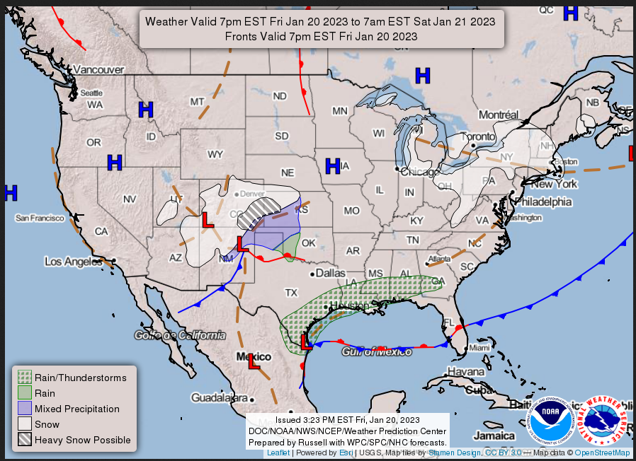
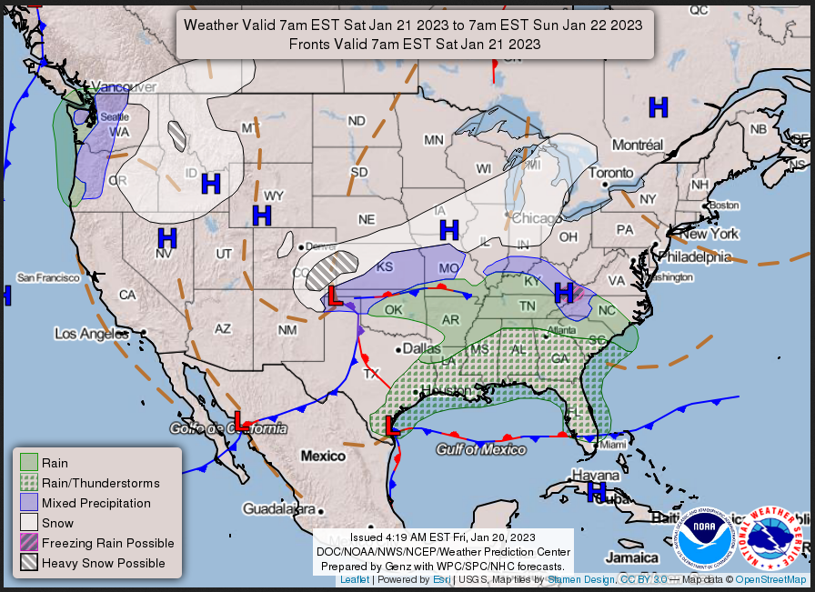
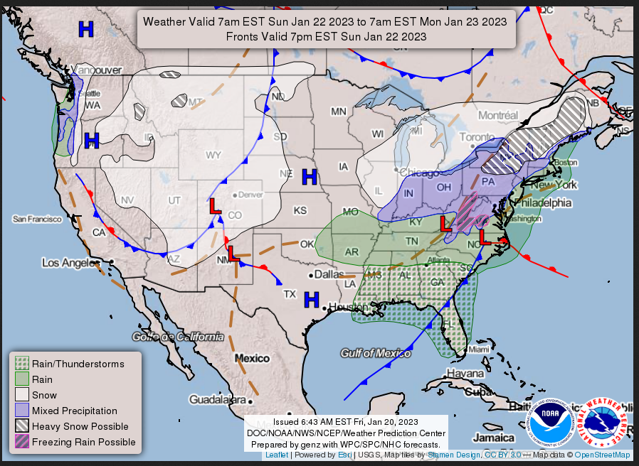
Daily weather maps. I try to keep the below three maps updated. The Day 1 map updates twice a day and the Day 2 and 3 maps update only once a day. I will be doing the updating during the period described in the title of the article but if you happen to read this article later, you can get updates by clicking HERE.
FRIDAY AFTERNOON, EVENING, AND OVERNIGHT
SATURDAY
SUNDAY
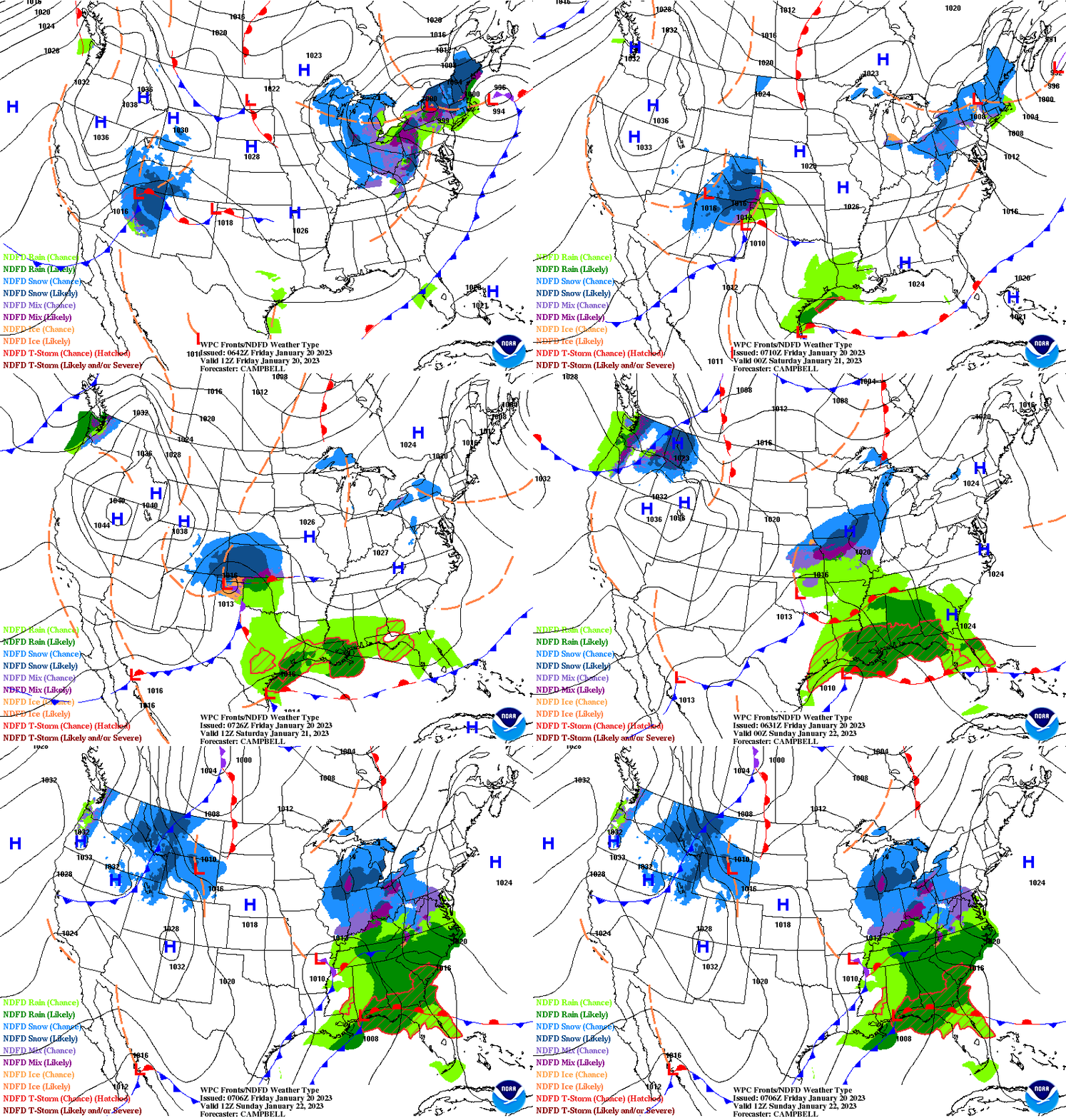
This animation shows how things may play out over the next 60 hours. To update click here.
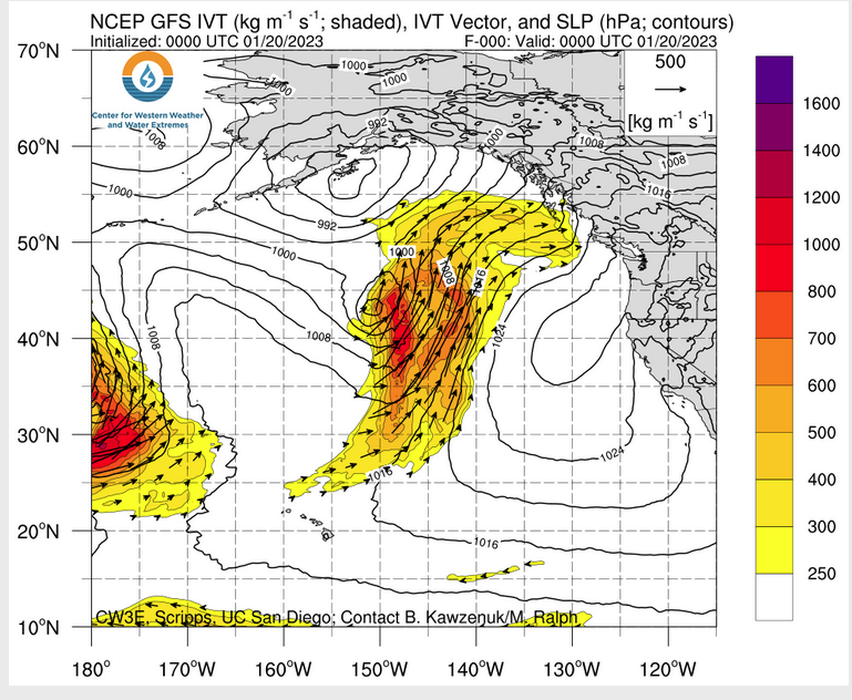
ATMOSPHERIC RIVERS
Continuation of the NWS Short Range Forecast (It is updated by NWS twice a day and these updates can be found here. We post at least one of those updates daily, sometimes both. The Highlights are shown in the lede paragraph of this article.
Some lingering light snow and snow showers can be expected this evening
across the Great Lakes and New England in the wake of low pressure exiting
well offshore of the Northeast. High pressure will be building across much
of the Midwest and stretching east across the Ohio Valley and toward the
East Coast by Saturday which will yield drying conditions and temperatures
that will actually be a bit above normal given a lack of cold air
advancing south from Canada.

While the Northeast gradually begins to dry out, the next storm system
will be dropping southeast across the Four Corners states tonight through
Saturday, and this will bring an axis of accumulating snowfall initially
across the central Rockies. A swath of heavy snow is then expected to
develop and spread east across portions of the central High Plains, and
areas of southeast Colorado and western Kansas are expected to see as much
as 6 to 10 inches of snow by Saturday evening. The northern portion of
this storm system will advance east and weaken somewhat as it crosses the
Midwest, Ohio Valley and Great Lakes through Sunday, but will still be
capable of producing a fairly large swath of at least light snow with
locally an inch or two possible by Sunday evening given at least
marginally cold enough temperatures.

However, farther south, the energy with this system will be focusing a
developing area of low pressure across the western Gulf of Mexico which
will advance northeast and cross the central and eastern Gulf Coast by
Sunday morning before then lifting up across the Southeast and the coastal
plain of the Mid-Atlantic states by Sunday night. This will yield a
sufficient return flow of warm air and moisture for areas of locally heavy
showers and thunderstorms to impact the Gulf Coast states and the
Southeast going through the weekend. As much as 1 to 2 inches of rain can
be expected with isolated heavier amounts. A very localized threat of
flash flooding and severe weather be possible on Sunday as a few stronger
thunderstorms cross the Southeast, and the Weather Prediction Center and
Storm Prediction Center respectively have issued a Marginal Risk of these
specific hazards. As this area of low pressure deepens along the East
Coast Sunday night and approaches the Northeast by Monday, there will be
an expanding area of moderate to locally heavy snow across the interior
sections of New York and New England just in time to start the new week.

Across the West, as the initial system dropping through Four Corners
region pulls away, strong high pressure will follow and temperatures
across much of the Great Basin and the Southwest will be below normal.
High temperatures will locally be as much as 10 to 20 degrees below normal
this weekend and the overnight lows are expected to drop low enough that
some of the interior valleys of California, including the San Joaquin
Valley, may see subfreezing temperatures. Precautions should be taken
accordingly to protect any sensitive outdoor agricultural interests. A new
cold front will dive southeast across the Intermountain West by the end of
the weekend, and this will help to reinforce below normal temperatures
heading into early next week.
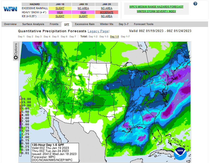
Below is the current five-day cumulative forecast of precipitation (Updates can be found HERE)
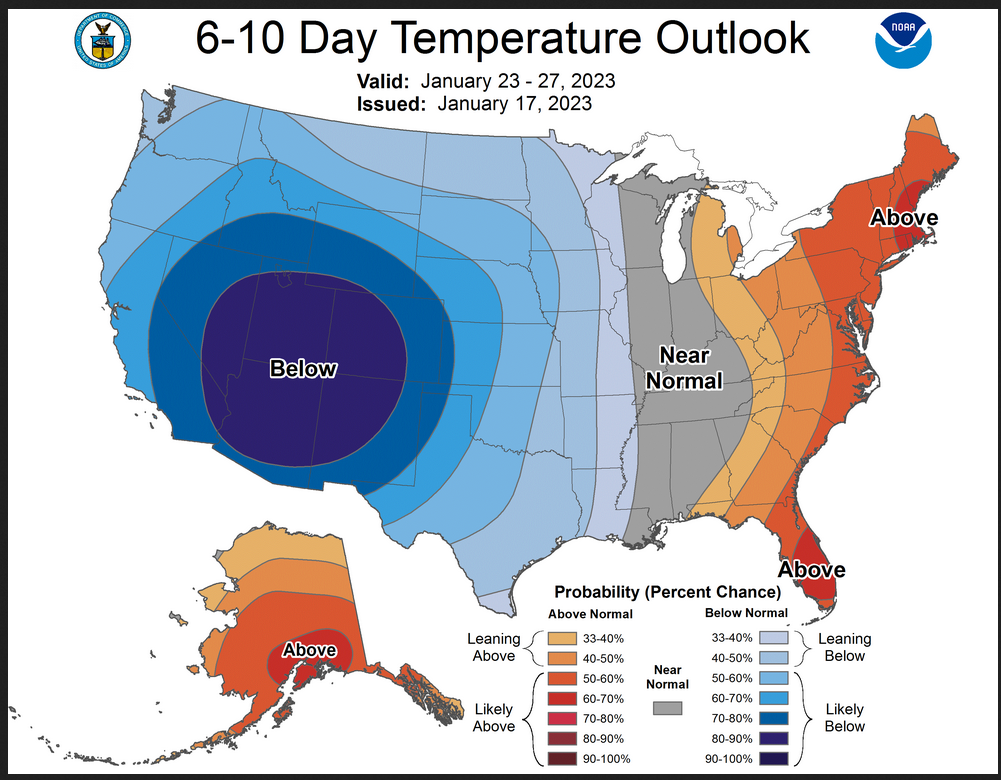
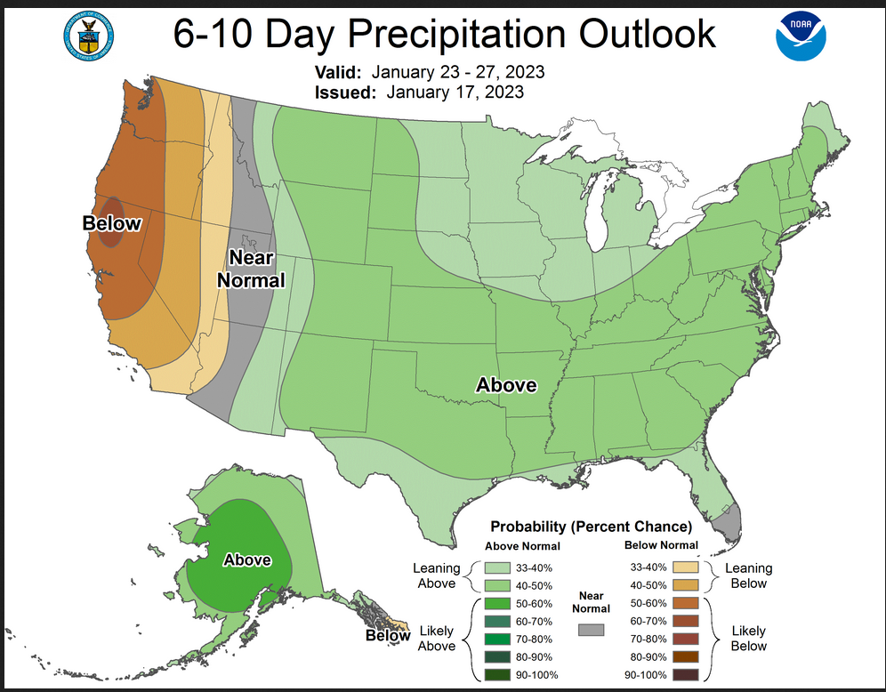
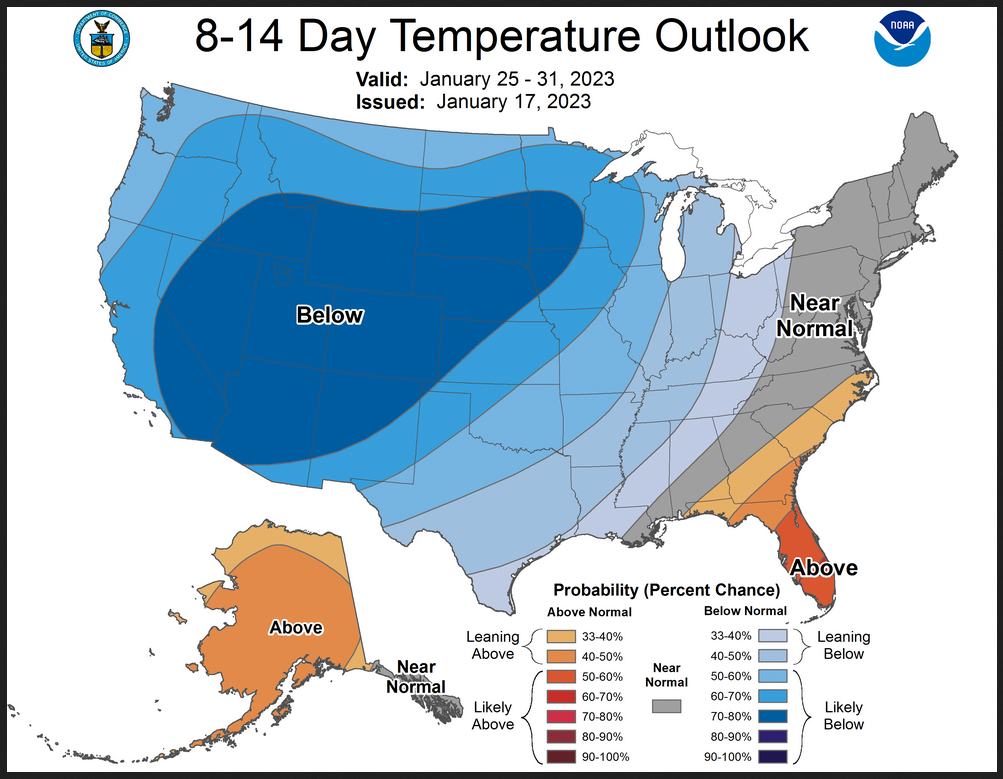
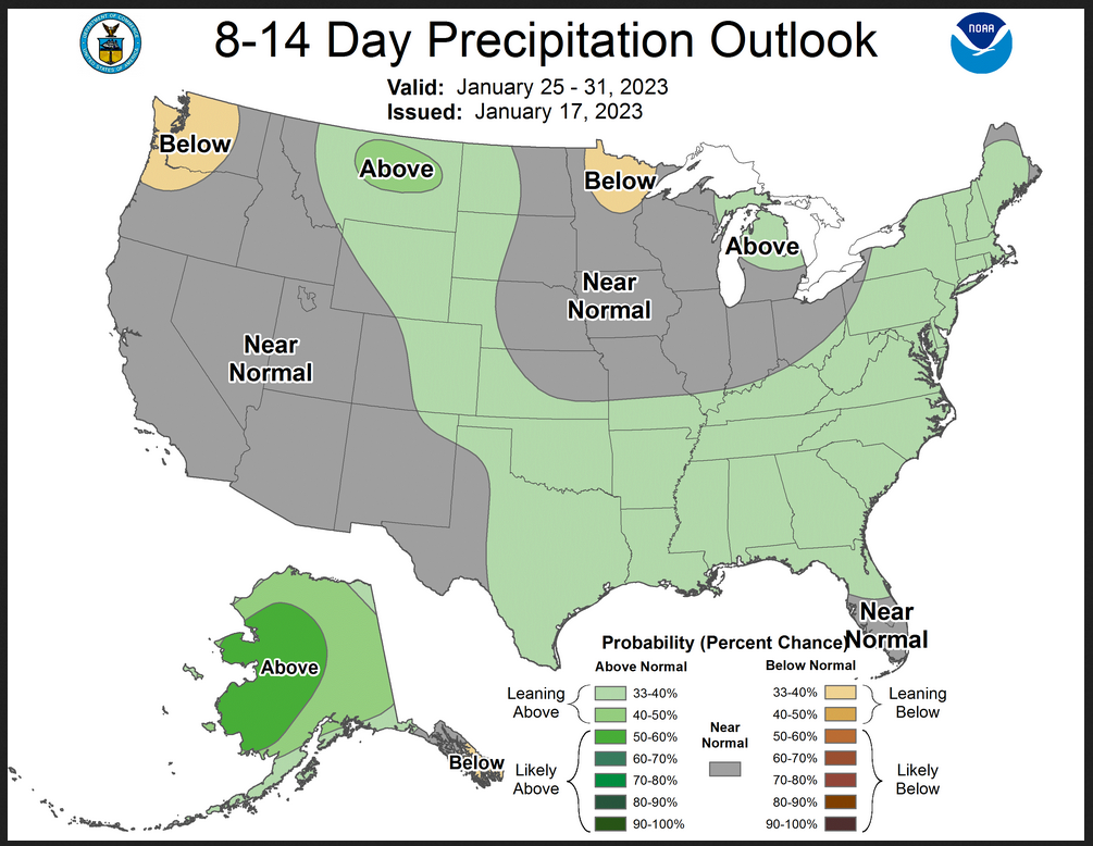
Now we look at Intermediate-Term “Outlook” maps for three time periods. Days 6 – 10, Days 8 – 14, and Weeks 3 and 4. An outlook differs from a forecast based on how NOAA uses these terms in that an “outlook” presents information as deviation from normal and the likelihood of these deviations.
Below are the links to obtain updates and additional information. They are particularly useful if you happen to be reading this article significantly later than when it was published. I always try to provide readers with the source of the information in my articles.
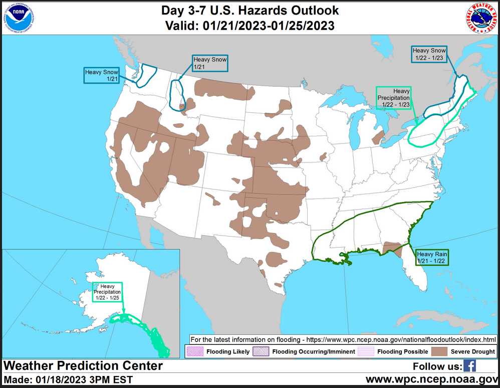
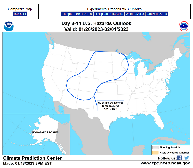
HAZARDS OUTLOOKS
Click here for the latest complete Day 3 -7 Hazards forecast which updates only on weekdays. Once a week probably Monday or Tuesday I will update the images. I provided the link for readers to get daily updates on weekdays. Use your own judgment to decide if you need to update these images. I update almost all the images Friday Night for the weekend edition of this Weather Report. So normally readers do not need to update these images but if the weather is changing quickly you may want to.
 Month to Date Information
Temperature month to date can be found at https://hprcc.unl.edu/products/maps/acis/MonthTDeptUS.png
Precipitation month to date can be found at https://hprcc.unl.edu/products/maps/acis /MonthPNormUS.png
World Forecast
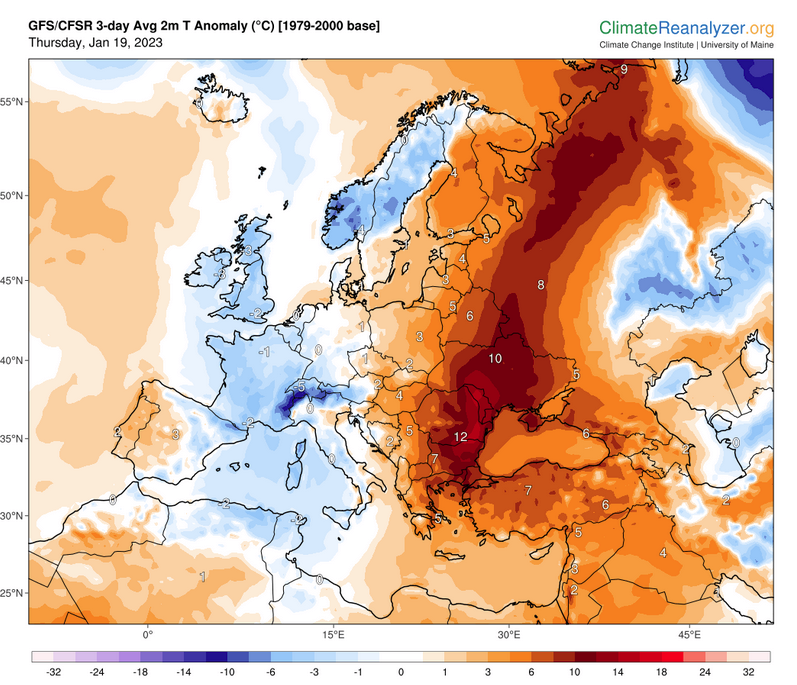
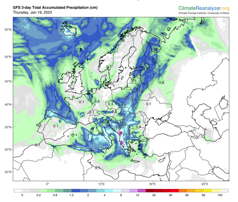
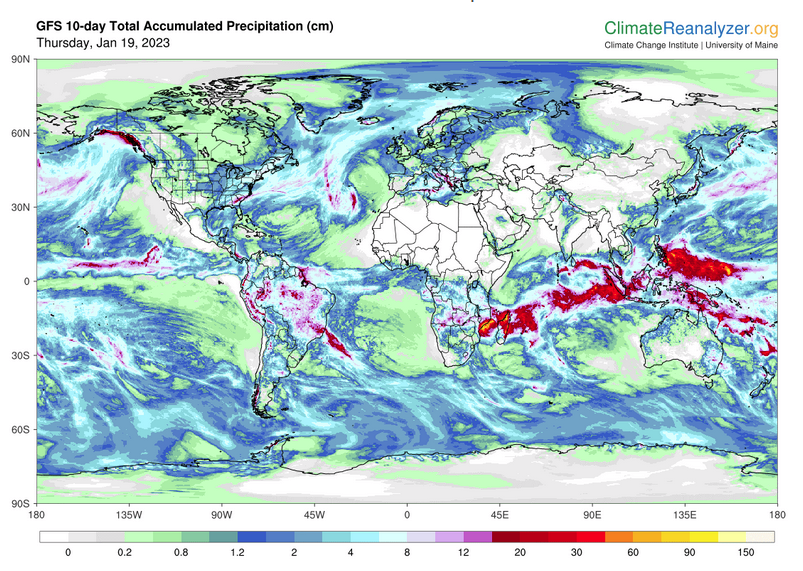
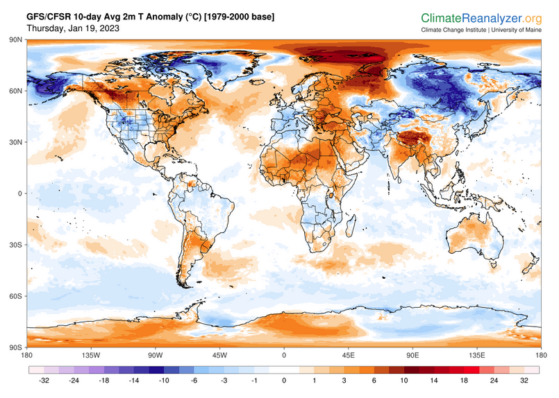
Below are the current precipitation forecast and the 10-Day forecasts for temperature and precipitation. Updates and additional information can be obtained HERE
Much of this information is provided by the University of Maine. They draw upon many different sources.
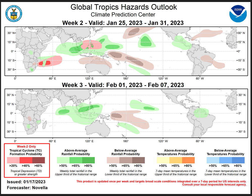
This graphic updates on Tuesdays) If it has not been updated, you can get the update by clicking here Readers will only have to do that if they are reading this article much later than the date of it being published.
–
| I hope you found this article interesting and useful. |
