Updated at 3:50 p.m. EST January 16, 2023
Here is what we are paying attention to in the next 48 to 72 hours. This article also includes World weather forecasts.
We start with the U.S. Information.
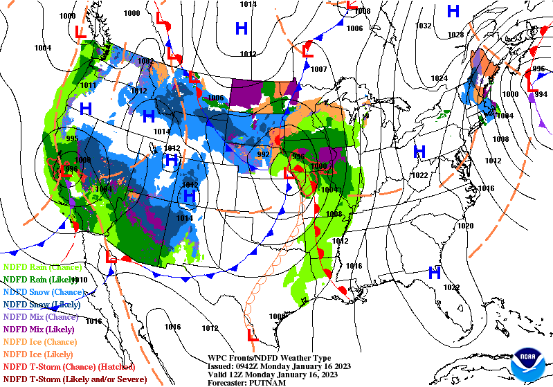
Short Range Forecast Discussion
NWS Weather Prediction Center College Park MD
223 PM EST Mon Jan 16 2023

Valid 00Z Tue Jan 17 2023 - 00Z Thu Jan 19 2023

...New storm system to bring heavy snowfall for the higher terrain of the
Four Corners region through Tuesday before advancing east into the Central
Plains on Wednesday...

...Severe thunderstorms are forecast to impact portions of the Lower
Mississippi Valley on Wednesday...

...Heavy rainfall and a localized threat of flash flooding is expected
from the Lower Mississippi Valley to the Lower Ohio Valley on Wednesday...

...Much above normal temperatures are expected to overspread many areas of
the southern and eastern U.S. through midweek...
![]()
First, the 48-Hour Forecast (It is a 48 to 72 Hour Forecast actually)
Daily weather maps. I try to keep the above maps updated. They only update twice a day and in some cases once a day.
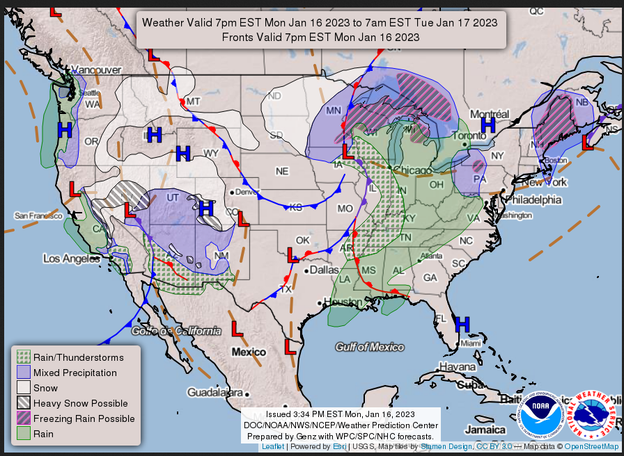
MONDAY AFTERNOON, EVENING AND OVERNIGHT
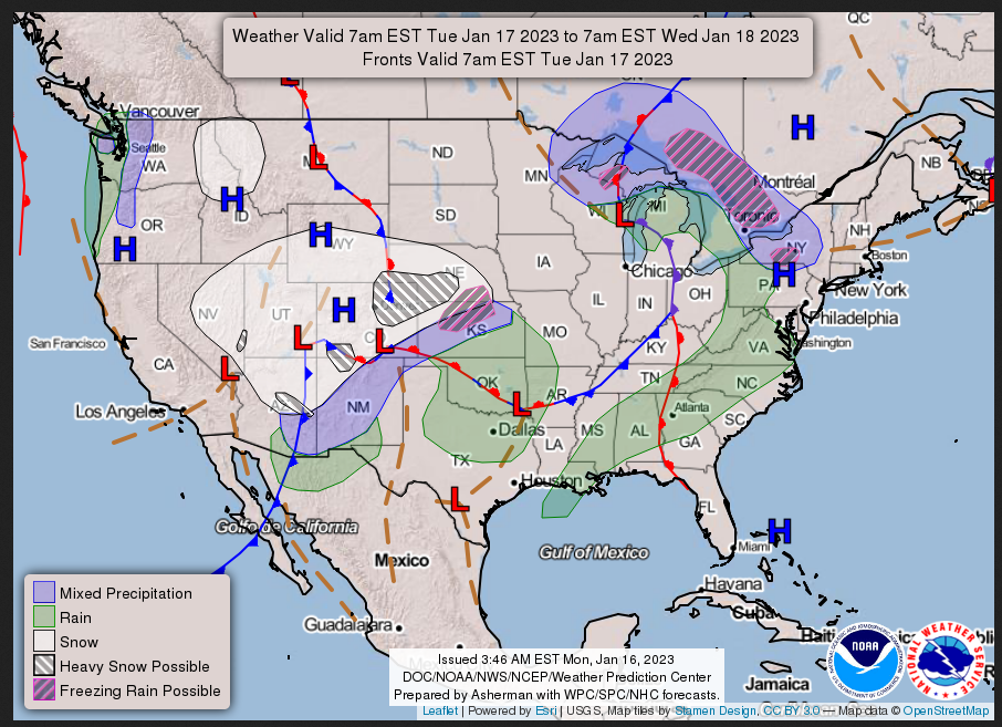
TUESDAY
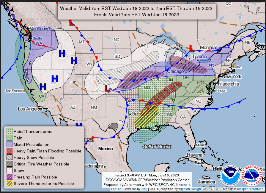
WEDNESDAY
I will be doing the updating during the period described in the title of the article but if you happen to read this article later you can get updates by clicking HERE.
This animation shows how things may play out over the next 60 hours. To update click here.
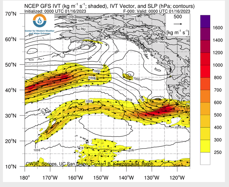
ATMOSPHERIC RIVERS
Continuation of the NWS Short Range Forecast (It is updated by NWS twice a day and these updates can be found here. We post at least one of those updates daily, sometimes both. The Highlights are shown in the lede paragraph of this article.
Unsettled weather will continue across much of the Intermountain West and
including the Four Corners region tonight and Tuesday as a storm system
currently crossing California advances farther inland. This will bring
locally heavy snowfall to the higher elevations including the Sierra
Nevada, Wasatch, Mogollon Rim and especially the San Juan mountains of
southwest Colorado as moist upslope flow arrives ahead of the associated
wave of low pressure. Expected locally as much as 1 to 2 feet of new
snowfall for portions of southwest Colorado by Tuesday evening. Meanwhile,
beneficial rains are expected for the lower elevations of much of the
Southwest. Colder temperatures will be arriving to as the storm system
advances into the Four Corners region, and most of the Great Basin and the
Southwest can expect high temperatures going through the middle of the
week to be as much as 10 to 15 degrees below normal.

This same storm system will be ejecting out into the Plains by Wednesday
and will set the stage for a much broader area of active weather. This
will include a developing area of heavy snow north of the low center
across much of north-central to northeast Colorado and extending east
across much of Nebraska and far northwest Kansas. By Wednesday evening,
many of these areas are expected to be receive as much as 6 to 12 inches
of snow. A narrow swath of sleet and some freezing rain will be possible
just to the southeast of the heavy snow axis. Meanwhile, areas much
farther south and east across the Lower/Middle Mississippi Valley and into
Lower Ohio Valley will see a resurgence of warmer air and moisture from
the Gulf of Mexico that will set the stage for rather widespread shower
and thunderstorm activity. In fact, the ingredients are expected to be in
place for severe weather, and the Storm Prediction Center has depicted a
Slight Risk of severe weather from east Texas through central and northern
Louisiana, southern Arkansas, and western Mississippi. Strong damaging
wind gusts are expected to accompany at least some of the thunderstorm
activity as it develops along and ahead of a cold front pushing east
across the southern Plains. Heavy rainfall will also be another concern,
and locally as much as 1 to 3 inches of rain will be possible across
portions of the Lower Mississippi Valley and the Lower Ohio Valley. The
Weather Prediction Center has highlighted portions of this region in a
Slight Risk of excessive rainfall, and some localized flash flooding may
occur from the developing areas of heavy rain.

Much warmer than normal temperatures will become a theme across much of
the southern and eastern U.S. by the middle of the week ahead the storm
system over the Plains. High temperatures are expected to rise to as much
as 15 to 25 degrees above normal, and especially across the South where
temperatures should rise well into the 70s with a few locations across
south Texas seeing highs into the 80s. Somewhat cooler temperatures by
comparison will be noted over the Ohio Valley, Mid-Atlantic and Southeast,
but still well above normal for the middle of January.

Elsewhere, there will be a new storm system arriving across the Pacific
Northwest by Tuesday night and advancing inland by Wednesday. This will
bring a new surge of Pacific moisture and a round of heavy rainfall for
especially the coastal ranges and the foothills of the Cascades. However,
the higher terrain of the Cascades will see heavy snowfall.
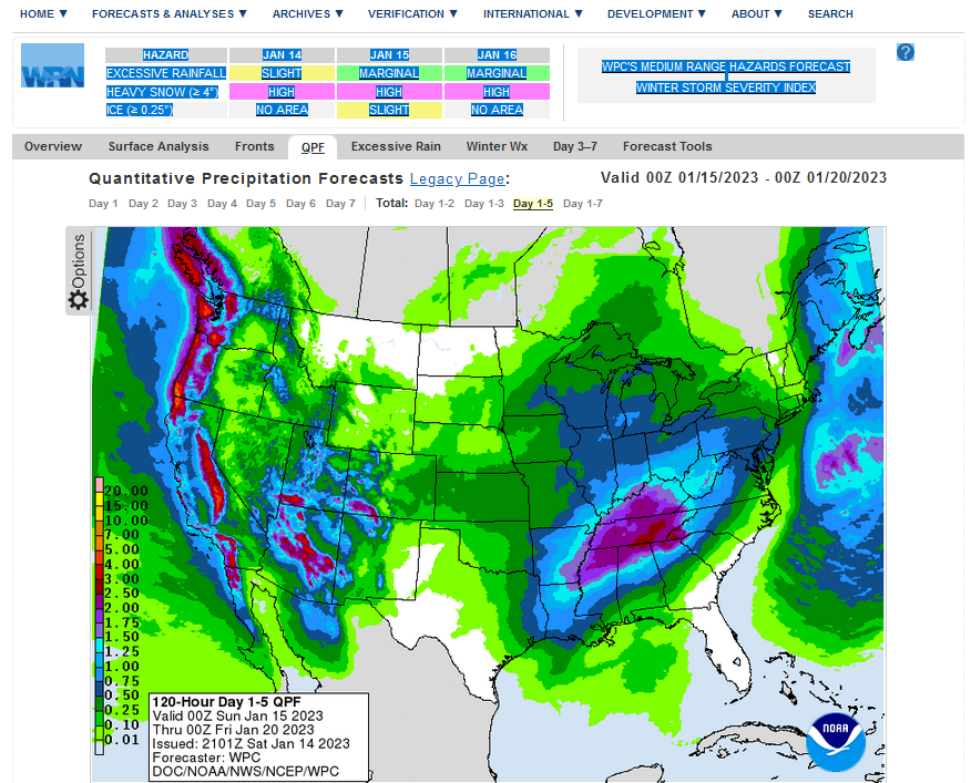
Below is the current five-day cumulative forecast of precipitation (Updates can be found HERE)
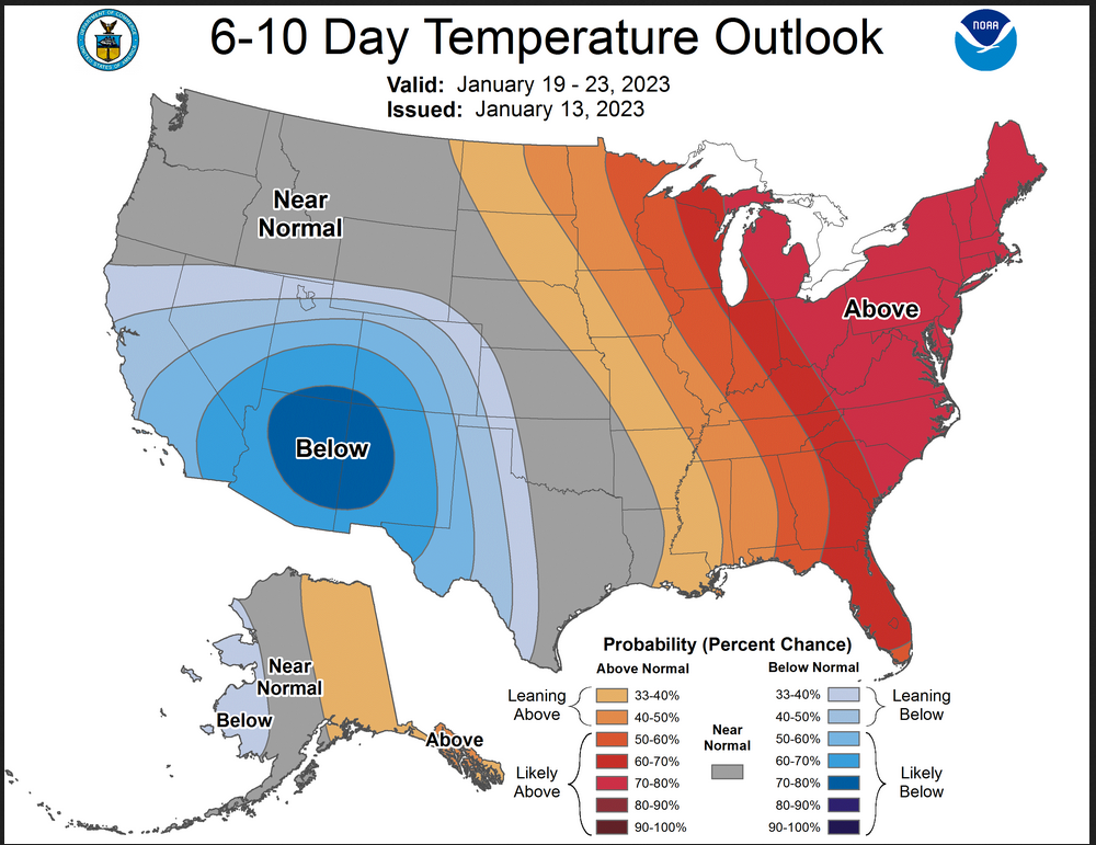
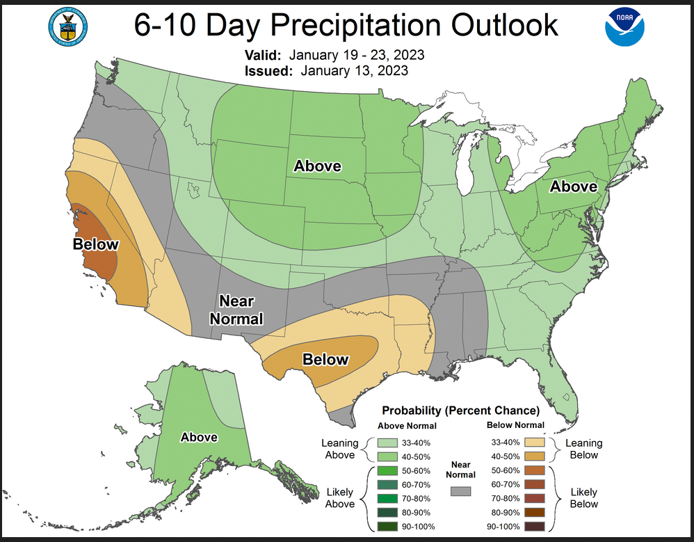
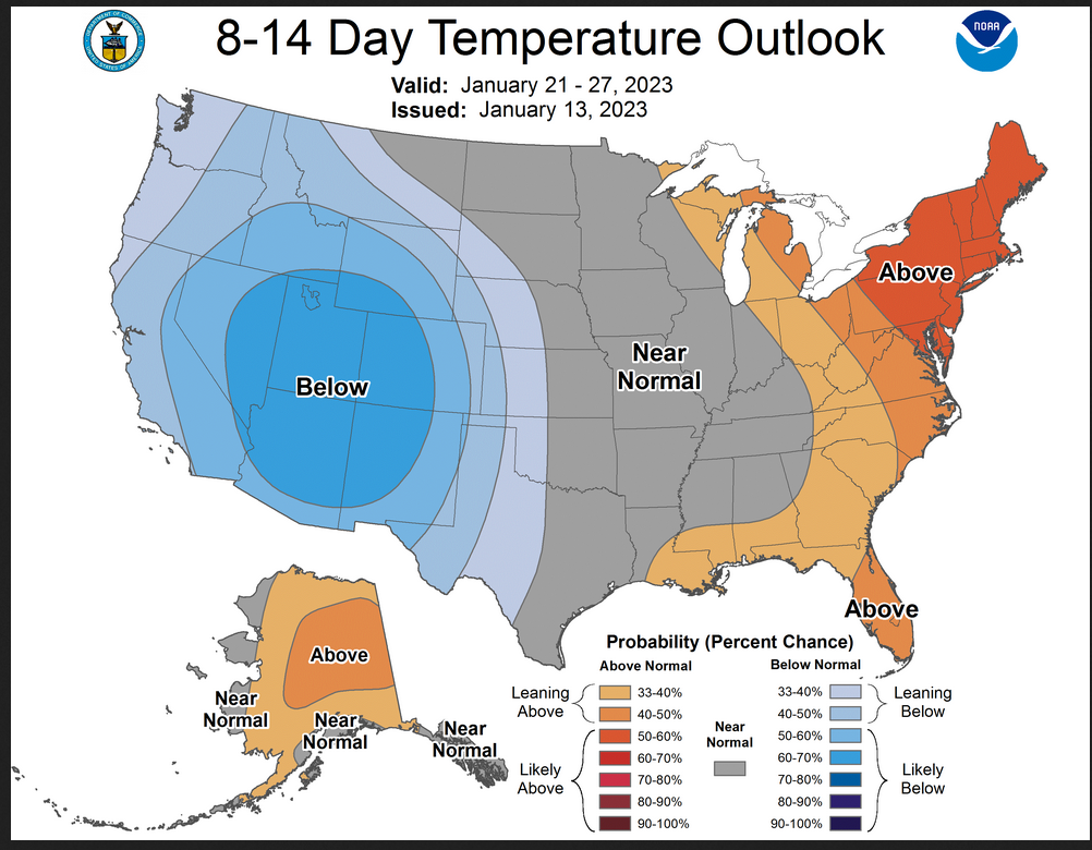
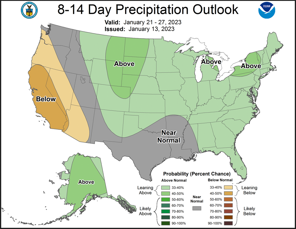
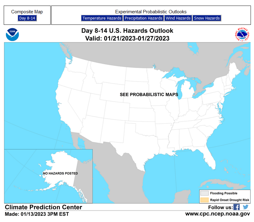
Now we look at Intermediate-Term “Outlook” maps for three time periods. Days 6 – 10, Days 8 – 14, and Weeks 3 and 4. An outlook differs from a forecast based on how NOAA uses these terms in that an “outlook” presents information as deviation from normal and the likelihood of these deviations.
Below are the links to obtain updates and additional information. They are particularly useful if you happen to be reading this article significantly later than when it was published. I always try to provide readers with the source of the information in my articles.
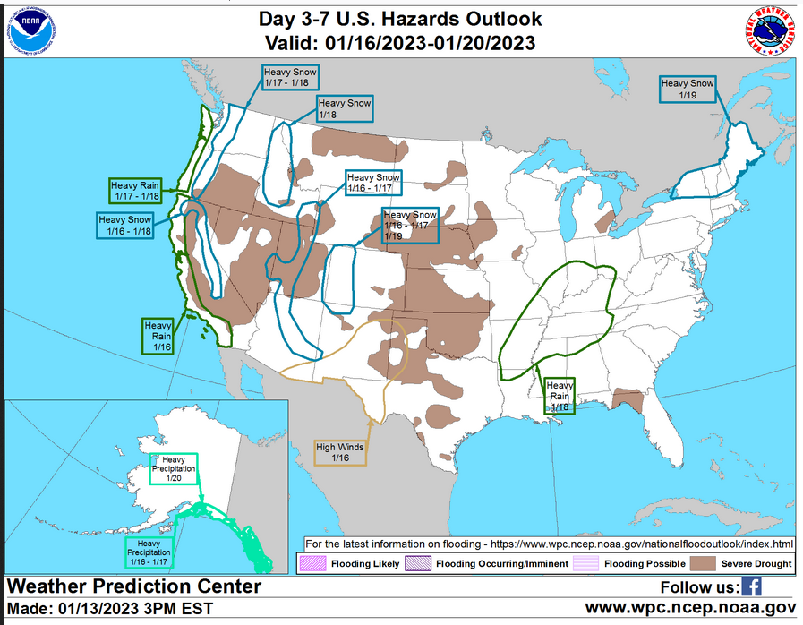
HAZARDS OUTLOOKS
Click here for the latest complete Day 3 -7 Hazards forecast which updates only on weekdays. Once a week probably Monday or Tuesday I will update the images. I provided the link for readers to get daily updates on weekdays. Use your own judgment to decide if you need to update these images. I update almost all the images Friday Night for the weekend edition of this Weather Report. So normally readers do not need to update these images but if the weather is changing quickly you may want to.
Month to Date Information
Temperature month to date can be found at https://hprcc.unl.edu/products/maps/acis/MonthTDeptUS.png
Precipitation month to date can be found at https://hprcc.unl.edu/products/maps/acis /MonthPNormUS.png
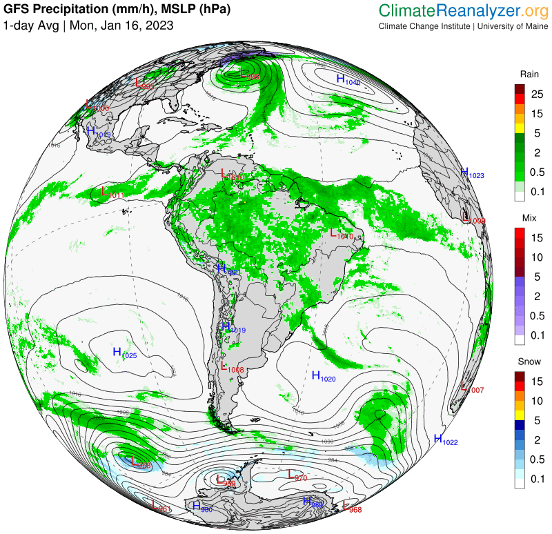
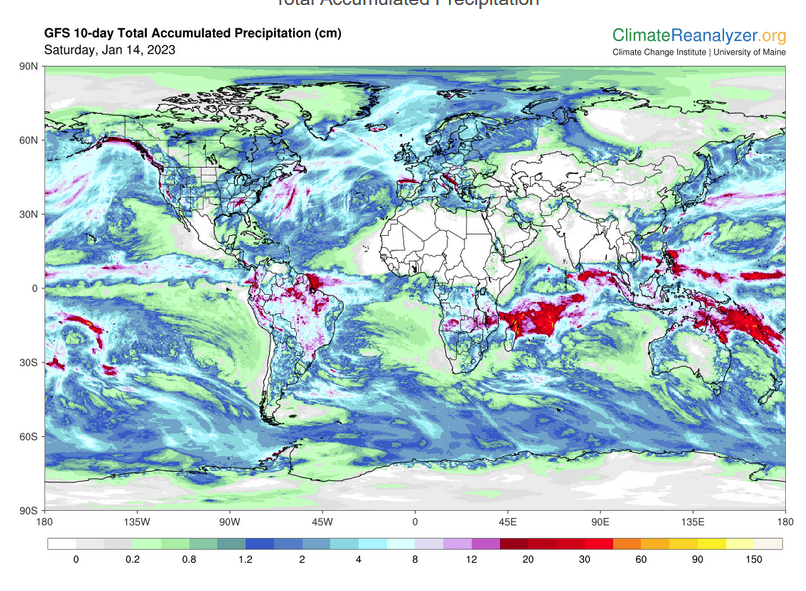
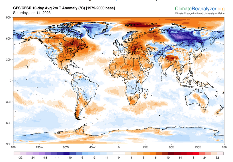
World Forecast
Below are the current precipitation forecast and the 10-Day forecasts for temperature and precipitation. Updates and additional information can be obtained HERE
Much of this information is provided by the University of Maine. They draw upon many different sources.
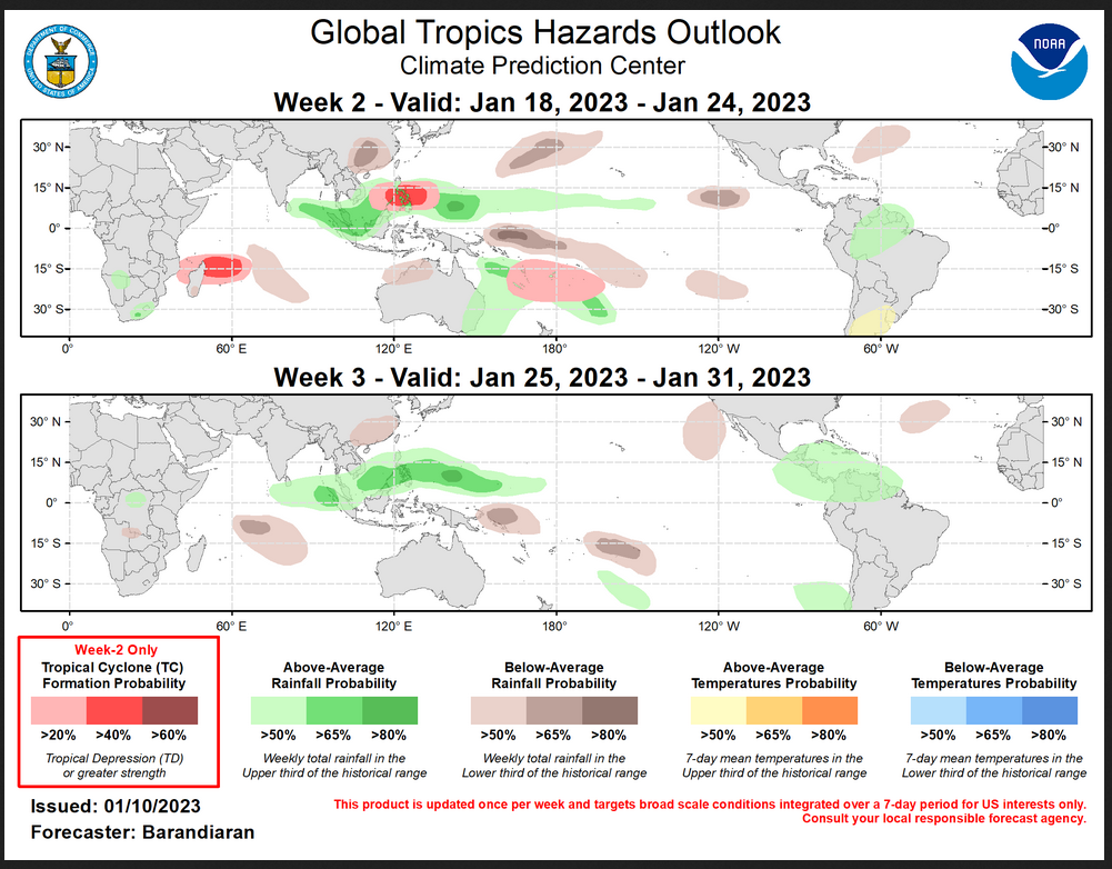
 Worldwide Tropical Forecast (This is a NOAA Product)
This graphic updates on Tuesdays) If it has not been updated, you can get the update by clicking h ere Readers will only have to do that if they are reading this article much later than the date of it being published.
–
| I hope you found this article interesting and useful. |