Updated at 7:28 p.m. Friday January 6, 2023
Here is what we are paying attention to in the next 48 to 72 hours from Friday Afternoon’s NWS Forecast. This article also includes World weather forecasts.
We start with the U.S. Information.
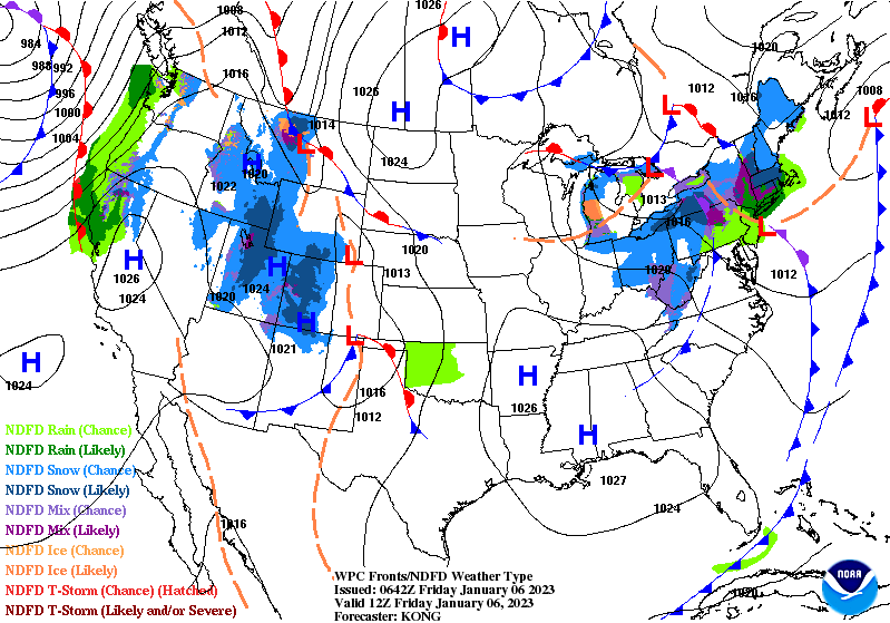
Short Range Forecast Discussion
NWS Weather Prediction Center College Park MD
300 PM EST Fri Jan 06 2023

Valid 00Z Sat Jan 07 2023 - 00Z Mon Jan 09 2023

...Next round of excessive rainfall to enter northern California tonight
before gradually expanding southward this weekend...

...Showers and Thunderstorms expected from Texas into the Ohio Valley and
South ahead of a frontal system...
Just Out, the Spring Western water supply forecast; I will discuss it in more depth tonight but here is the key graphic.

Back to what we usually present, first, the 48-Hour Forecast (It is a 48 to 72 Hour Forecast actually)
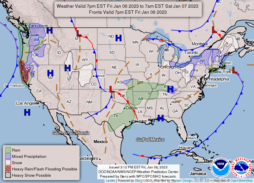
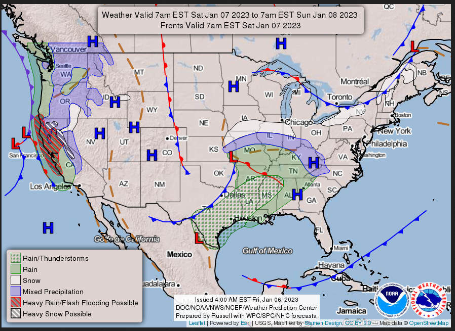
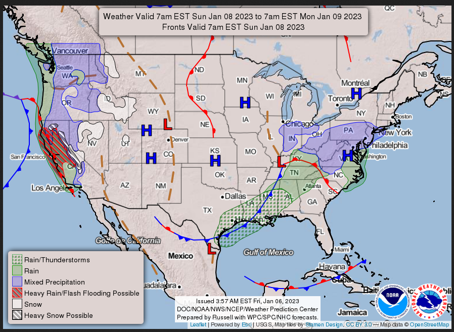
Daily weather maps
FRIDAY EVENING AND OVERNIGHT
SATURDAY
SUNDAY
I try to keep the above maps updated. They only update twice a day and in some cases once a day.
I will be doing the updating during the period described in the title of the article but if you happen to read this article later you can get updates by clicking H ERE.
This animation shows how things may play out over the next 60 hours. To update click here.
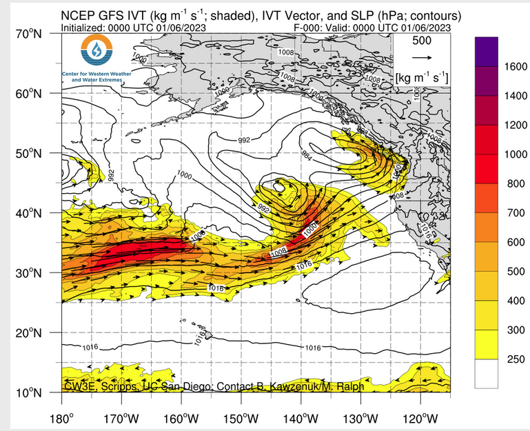
ATMOSPHERIC RIVERS
Continuation of the NWS Short Range Forecast (It is updated by NWS twice a day and these updates can be found here. We post at least one of those updates daily, sometimes both. The Highlights are shown in the lede paragraph of this article.
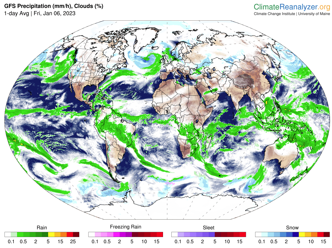
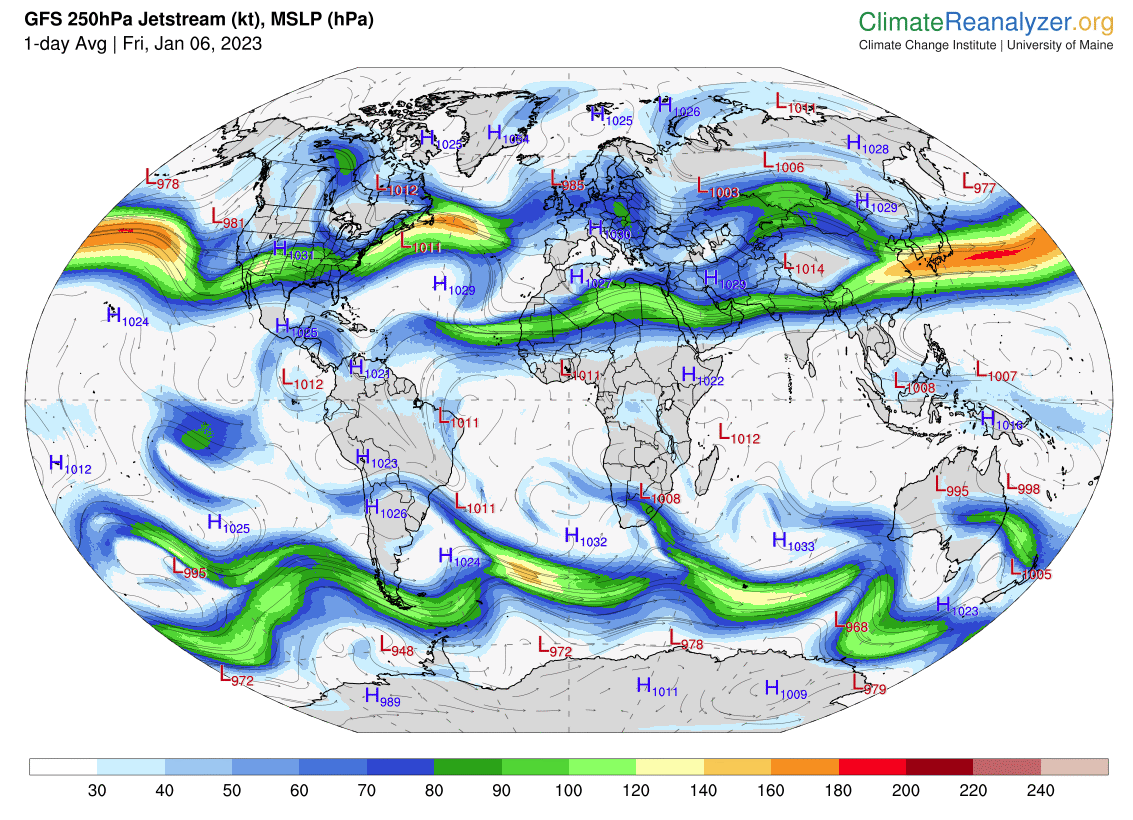
Unfortunately, the stormy weather over the West Coast continues to be the
main weather story as we head into the weekend, with yet another
Atmospheric River event forecast to impact the region. Heavy precipitation
will continue today and into Saturday for the Pacific Northwest and
northern California as the mid-week storm system lingers along the coast
and another wave of anomalously high moisture from the Pacific pushes
inland.  A localized Moderate Risk (level 3/4) and broader Slight Risk
(level 2/4) of Excessive Rainfall remain in effect through Saturday
morning and will continue through the day Saturday for portions of far
southern coastal Oregon and northern California. Several more inches of
rain are expected on top of already extremely saturated soils. In
addition, rain rates at times of 0.5"+  will exacerbate flooding concerns.
There looks to be a brief reprieve from the heaviest rainfall at some
point on Saturday before another storm system reaches the West Coast late
Saturday night and brings a renewed influx of higher moisture. The trend
will be for the heaviest rainfall to shift southward during the period,
centered more on northern California initially and then central California
on Sunday. A Slight Risk of Excessive Rainfall is in effect Sunday over
portions of northern and central California as rounds of heavy rainfall
continue. Heavy snow is also expected in the higher elevations of the
Sierra and northern Coastal Ranges of California. Winter Storm Warnings
are in effect for 6-12 inches of snow above about 4000-5000 feet
elevation, and 1-2 feet of snow, locally higher, above about 7000 feet.
Strong, gusty winds are possible, especially along the coast and in
terrain favored areas. Discouragingly, this pattern looks to continue,
with another, likely stronger, Atmospheric River event on the horizon for
Monday just past the current forecast period.

Some of this moisture will also continue to spread further inland over
portions of the Pacific Northwest and northern Great Basin as a wave of
upper-level energy passes by. Lower elevation/valley rainfall and a few
inches of snow will be possible for the Cascades, Blue Mountains of
Oregon, and Sawtooth Range of Idaho. Temperatures will generally be within
about 10 degrees of average across the West, with temperatures a bit above
normal across the northern tier and below average where the unsettled
weather continues over California. Highs will be in the 30s and 40s for
the Rockies and Great Basin, the 50s for the Pacific Northwest and
northern/central portions of California, and the 60s for southern
California and the Desert Southwest.

Further east, a compact upper-level wave aloft and low pressure/frontal
system at the surface currently over the Southern Plains will push
eastward into the Ohio Valley and South through the weekend. Showers and
thunderstorms are forecast to develop along the eastward progressing cold
front from the Mid-South southwestward through southern Texas on Saturday,
and continue into the Lower Mississippi Valley Saturday evening. Some
locally heavy rainfall will be possible. The thunderstorms will continue
into the Ohio/Tennessee Valleys and South on Sunday, though will tend to
taper off through the day. A light amount of snow and sleet may briefly
mix in with the rain in the colder air just to the north of the surface
low track from the Central Plains eastward into the Midwest. A wintry mix
also looks possible for the Mid-Atlantic Sunday where moist air from the
Atlantic overruns the northward moving warm front. Regardless of if any
snow or sleet mix in, light showers are still expected. Some light snow
showers are also forecast for portions of the Interior Northeast Saturday
as a cold front pushes through the region.

Highs will remain in the 20s and 30s for the Northern and Central Plains
Saturday before warming up into the 50s Sunday for the Central Plains.
Highs along the High Plains immediately east of the Rockies will be
running 10-20 degrees warmer due to downsloping winds. Unseasonably warm
highs will precede the cold front passage over Texas and the South, with
some low to mid-70s expected. Highs will cool a bit Sunday to the 60s
across the southern tier outside of Florida, where 70s are forecast.
Temperatures will be a bit more seasonable across the Midwest, Northeast,
and Mid-Atlantic with mostly 30s and 40s forecast.
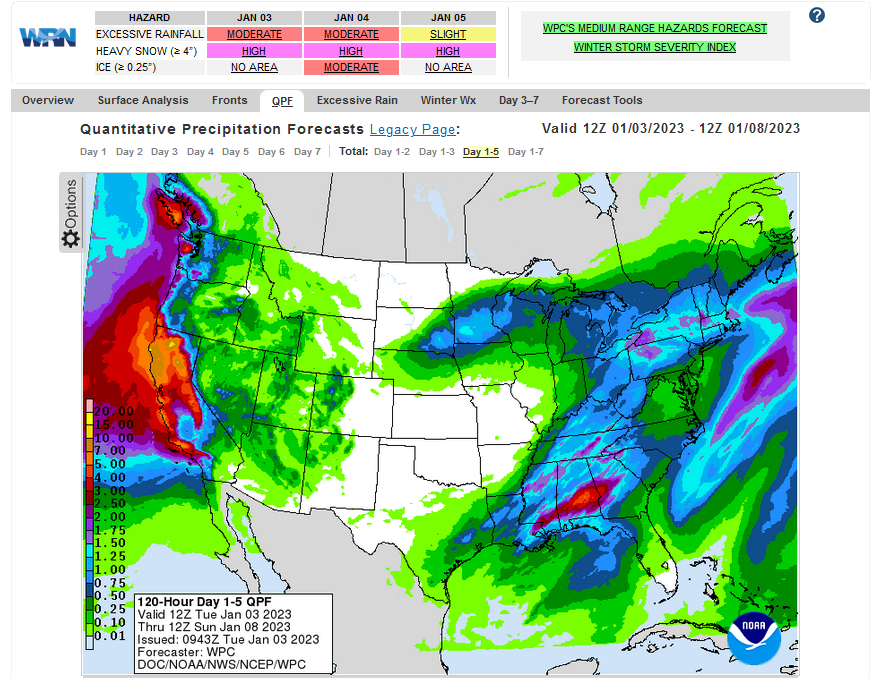
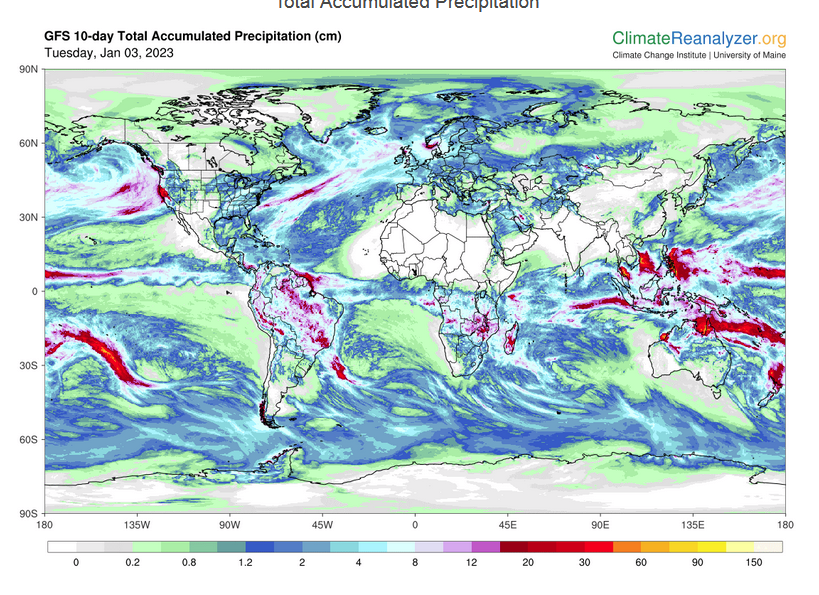
Below is the current five-day cumulative forecast of precipitation (Updates can be found HERE)
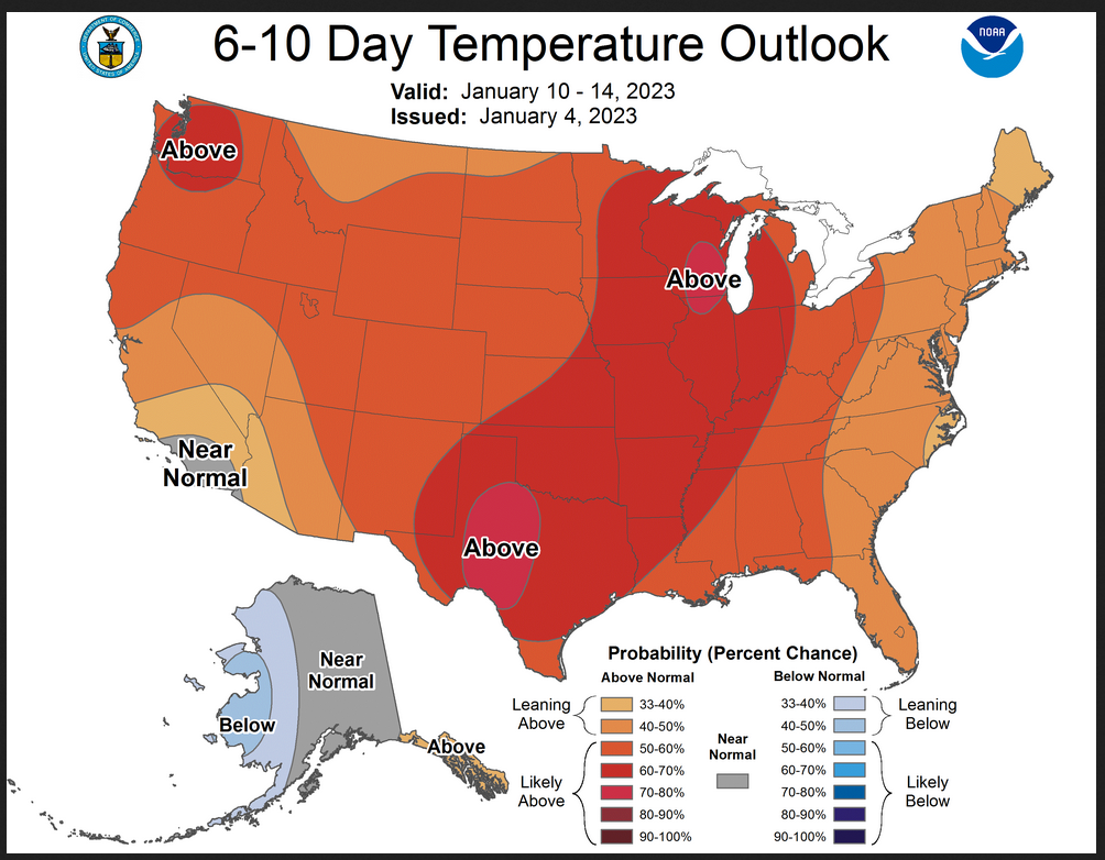
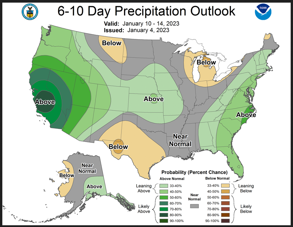
Now we look at Intermediate-Term “Outlook” maps for three time periods. Days 6 – 10, Days 8 – 14, and Weeks 3 and 4. An outlook differs from a forecast based on how NOAA uses these terms in that an “outlook” presents information as deviation from normal and the likelihood of these deviations.
Below are the links to obtain updates and additional information. They are particularly useful if you happen to be reading this article significantly later than when it was published. I always try to provide readers with the source of the information in my articles.
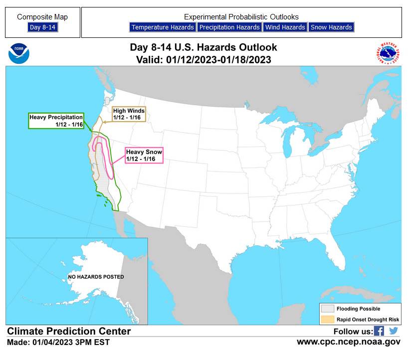
HAZARDS OUTLOOKS
Click here for the latest complete Day 3 -7 Hazards forecast which updates only on weekdays. Once a week probably Monday or Tuesday I will update the images. I provided the link for readers to get daily updates on weekdays. Use your own judgment to decide if you need to update these images. I update almost all the images Friday Night for the weekend edition of this Weather Report. So normally readers do not need to update these images but if the weather is changing quickly you may want to.

Month to Date Information
Temperature month to date can be found at https://hprcc.unl.edu/products/maps/acis/MonthTDeptUS.png
Precipitation month to date can be found at https://hprcc.unl.edu/products/maps/acis /MonthPNormUS.png
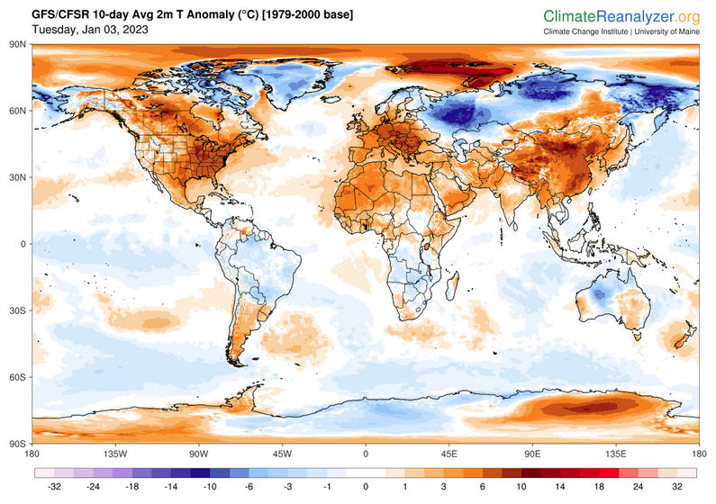
World Forecast
Below are the current precipitation forecast and the 10-Day forecasts for temperature and precipitation. Updates and additional information can be obtained HERE
Much of this information is provided by the University of Maine. They draw upon many different sources.
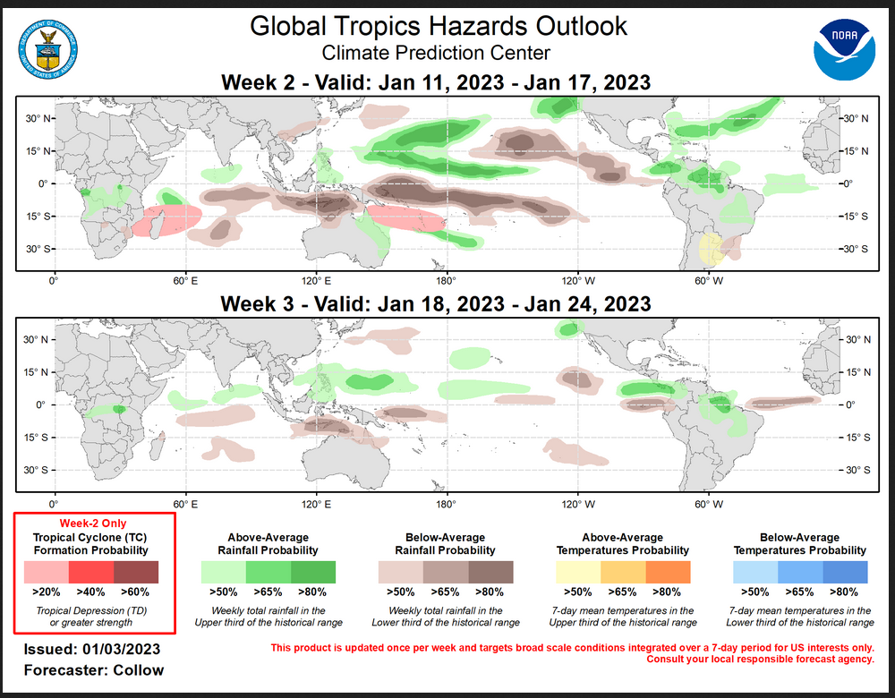
Worldwide Tropical Forecast (This is a NOAA Product)
This graphic updates on Tuesdays) If it has not been updated, you can get the update by clicking here Readers will only have to do that if they are reading this article much later than the date of it being published.
| I hope you found this article interesting and useful. |