Updated at 7:19 p.m. Wednesday January 4, 2023
Here is what we are paying attention to in the next 48 to 72 hours from Wednesday Afternoon’s NWS Forecast. This article also includes World weather forecasts.
We start with the U.S. Information.
Short Range Forecast Discussion
NWS Weather Prediction Center College Park MD
256 PM EST Wed Jan 04 2023

Valid 00Z Thu Jan 05 2023 - 00Z Sat Jan 07 2023

...Heavy rain, damaging winds, and heavy mountain snow to impact
California as an atmospheric river moves onshore tonight...

...Light to moderate snowfall continues across parts of the Upper
Midwest/Great Lakes through Thursday, while a wintry mix spreads into
northern New England..
First, the 48-Hour Forecast (It is a 48 to 72 Hour Forecast actually)
Daily weather maps
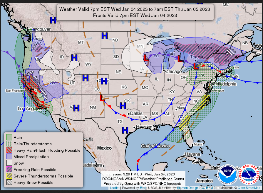
WEDNESDAY
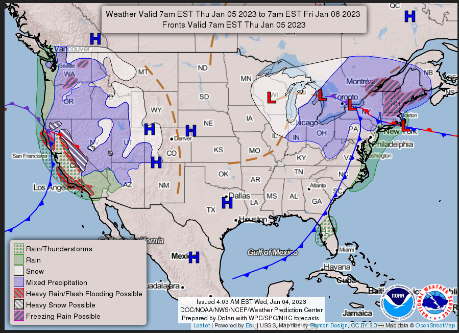
THURSDAY
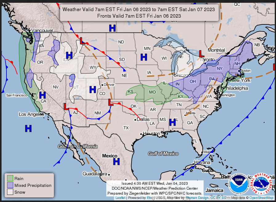
FRIDAY
I try to keep the above maps updated. They only update twice a day and in some cases once a day.
I will be doing the updating during the period described in the title of the article but if you happen to read this article later you can get updates by clicking HERE .
This animation shows how things may play out over the next 60 hours. To update click here.
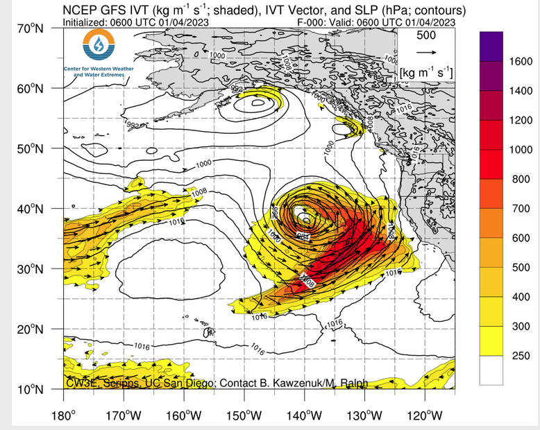
ATMOSPHERIC RIVERS
Continuation of the NWS Short Range Forecast (It is updated by NWS twice a day and these updates can be found here. We post at least one of those updates daily, sometimes both. The Highlights are shown in the lede paragraph of this article.
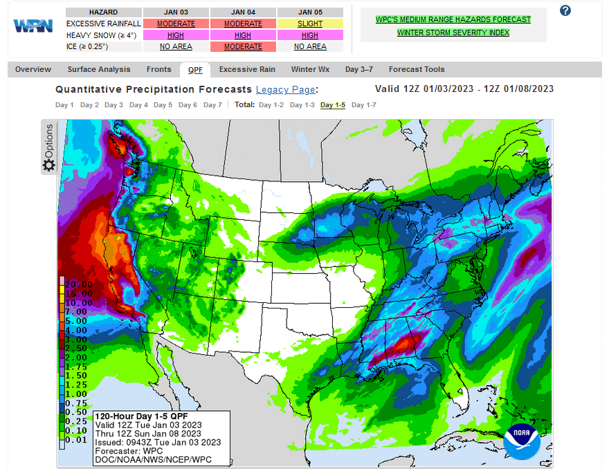
A powerful hurricane force low pressure system located over the eastern
Pacific is set to surge a plume of moisture and damaging winds into the
West Coast beginning tonight. The greatest impacts, which include damaging
winds, excessive rainfall, and extremely heavy snow, is forecast to occur
over much of California and into southern Oregon through Thursday.
Widespread rainfall amounts of 3 to 6 inches, with locally higher totals,
occurring within a relatively short period of time will have the potential
to lead to several instances of flooding throughout the already saturated
region. The highest precipitation amounts are expected to occur over the
coastal ranges of California as far south as the Transverse Ranges and
throughout the Sierra foothills. Recent burn scars and other sensitive
terrain will have the greatest chances for rapid runoff and mudslides as
rain rates potentially exceed 1 inch per hour. A Moderate Risk (level 3/4)
of Excessive Rainfall is in effect along coastal sections of California,
where numerous instances of flash flooding are most likely. For the high
terrain of the Sierra Nevada, precipitation will fall mostly as snow and
add up to at least 3 feet over the peaks. Gusty winds will add to the
hazardous heavy snow, resulting in potential tree damage and white out
conditions. Strong southerly winds will occur across the remainder of the
region as well, with rough surf along the coast and potentially damaging
winds spreading into the central valley. High winds combined with
saturated ground conditions could lead to additional downed trees and
resulting power outages. Flood and Flash Flood Watches, High Winds
Warnings, and Winter Storm Warnings are in effect from southern Oregon to
southern California. Residents and visitors are urged to check their local
forecast before traveling and prepare for potential power outages and/or
flooding impacts. The next system to impact the Golden State is
anticipated to spread heavy rain into northern California by Friday night,
which could lead to additional flooding concerns.

The other major weather story over the Lower 48 includes an unwinding
winter storm stretching from the Upper Midwest to northern New England.
Light to locally moderate snow is possible throughout the Upper
Midwest/Great Lakes as a meandering low pressure system weakens.
Additional snowfall accumulations up to a few inches are possible through
Thursday, particularly over the U.P of Michigan. Farther east, a surge of
precipitation and a developing coastal low off southern New England will
allow for a wintry mix to spread into northern New England tonight. Light
snowfall amounts are possible across central Maine, with freezing rain and
sleet likely from the northern Adirondacks of New York State to northern
Massachusetts. Ice accretion could add up to a quarter of an inch before
concluding on Thursday, which could lead to isolated power outages, as
well as potentially dangerous travel conditions. Otherwise, light snow
showers are forecast to traverse the Great Lakes and into the
northern/central Appalachians on Friday as the system finally begins to
exit the East Coast.

For the rest of the Nation, light to moderate snow may extend into parts
of the Intermountain West and central Rockies on Thursday and Friday as
leftover moisture from the aforementioned atmospheric river moves inland.
Temperatures for the most part are forecast to remain near or above
average outside of the northern Plains and Southwest. Record-breaking warm
minimum temperatures are expected across Florida and the Mid-Atlantic on
Thursday, with anomalous warmth shifting to the southern Plains by Friday.
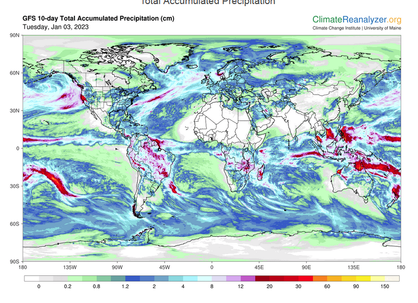
Below is the current five-day cumulative forecast of precipitation (Updates can be found HERE)
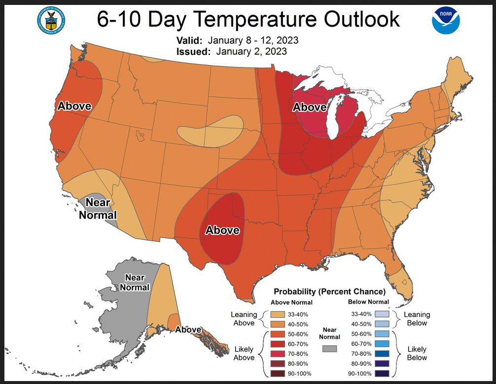
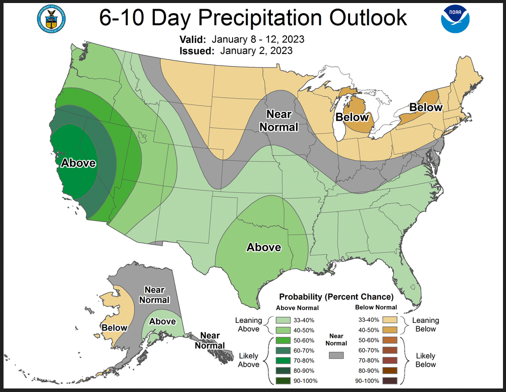
Now we look at Intermediate-Term “Outlook” maps for three time periods. Days 6 – 10, Days 8 – 14, and Weeks 3 and 4. An outlook differs from a forecast based on how NOAA uses these terms in that an “outlook” presents information as deviation from normal and the likelihood of these deviations.
Below are the links to obtain updates and additional information. They are particularly useful if you happen to be reading this article significantly later than when it was published. I always try to provide readers with the source of the information in my articles.
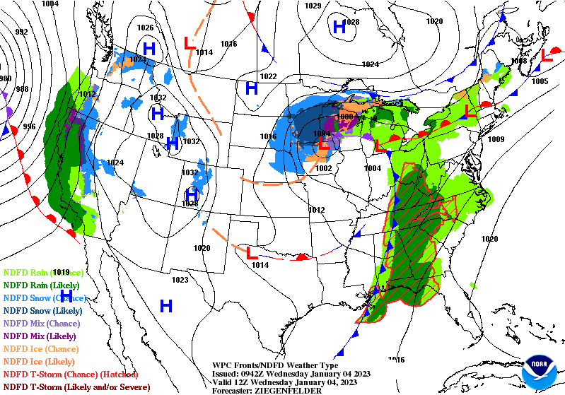
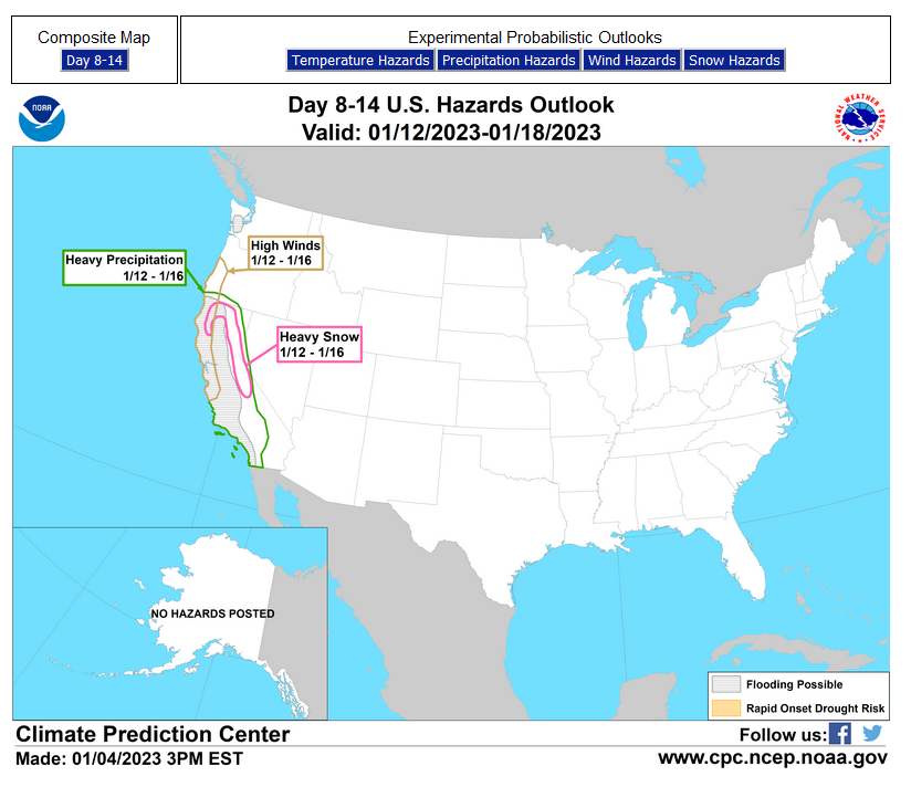
HAZARDS OUTLOOKS
Click here for the latest complete Day 3 -7 Hazards forecast which updates only on weekdays. Once a week probably Monday or Tuesday I will update the images. I provided the link for readers to get daily updates on weekdays. Use your own judgment to decide if you need to update these images. I update almost all the images Friday Night for the weekend edition of this Weather Report. So normally readers do not need to update these images but if the weather is changing quickly you may want to.

Month to Date Information
Temperature month to date can be found at https://hprcc.unl.edu/products/maps/acis/MonthTDeptUS.png
Precipitation month to date can be found at https://hprcc.unl.edu/products/maps/acis /MonthPNormUS.png
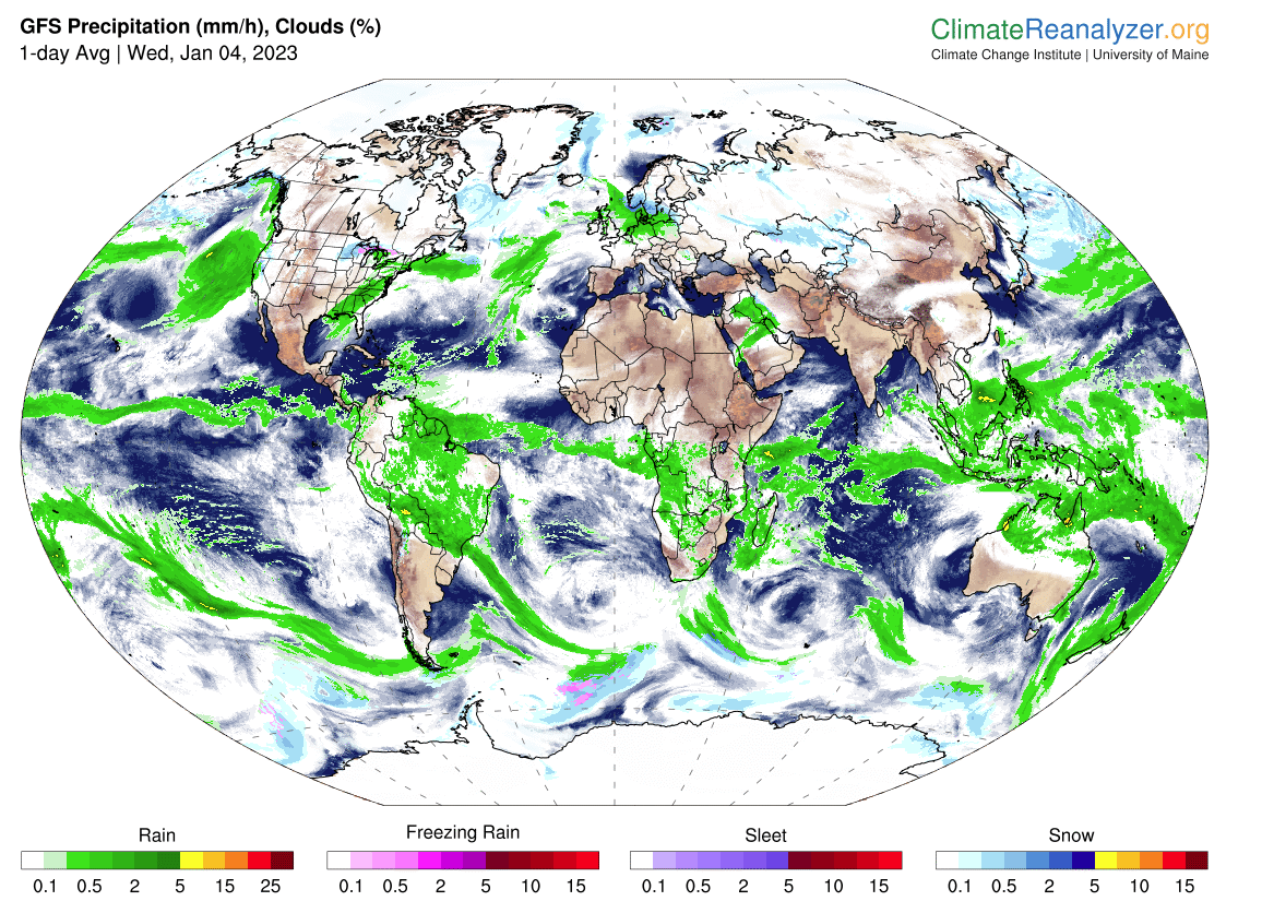
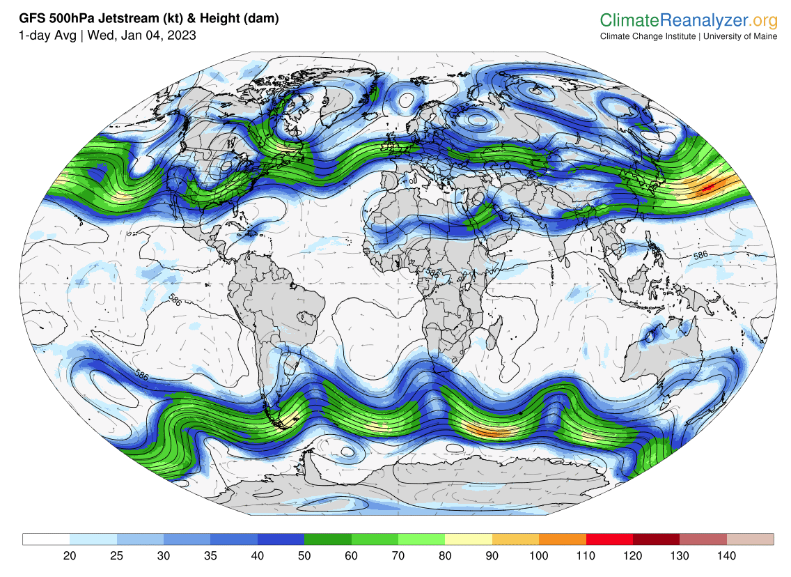
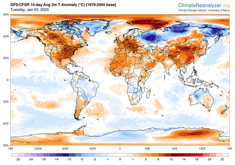
World Forecast
Below are the current precipitation forecast and the 10-Day forecasts for temperature and precipitation. Updates and additional information can be obtained HERE
Much of this information is provided by the University of Maine. They draw upon many different sources.
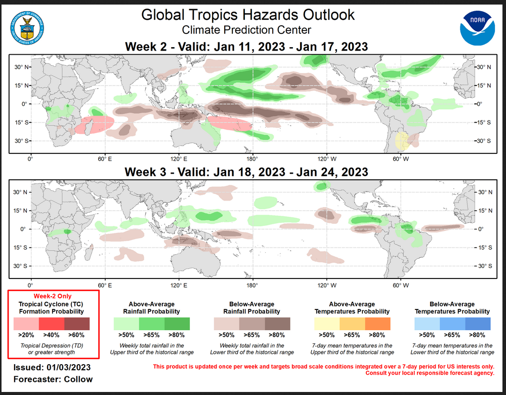
Worldwide Tropical Forecast (This is a NOAA Product)
This graphic updates on Tuesdays) If it has not been updated, you can get the update by clicking here Readers will only have to do that if they are reading this article much later than the date of it being published.
| I hope you found this article interesting and useful. |