Here is what we are paying attention to this evening and the next 48 hours from this afternoon’s NWS Forecast.
...Temperatures plunging across the Central U.S. as strong cold front
pushes southward...

...Much improved conditions in the Northeast through Friday before cooler
air filters in behind cold front...

...Daily showers and thunderstorms continue for the Southern Rockies/High
Plains and the Southwest, with isolated instances of flash flooding
possible...

...Pleasant weather across much of the West through the end of the week...
Continuation of the NWS Short Range Forecast (It is updated twice a day and these updates can be found here.
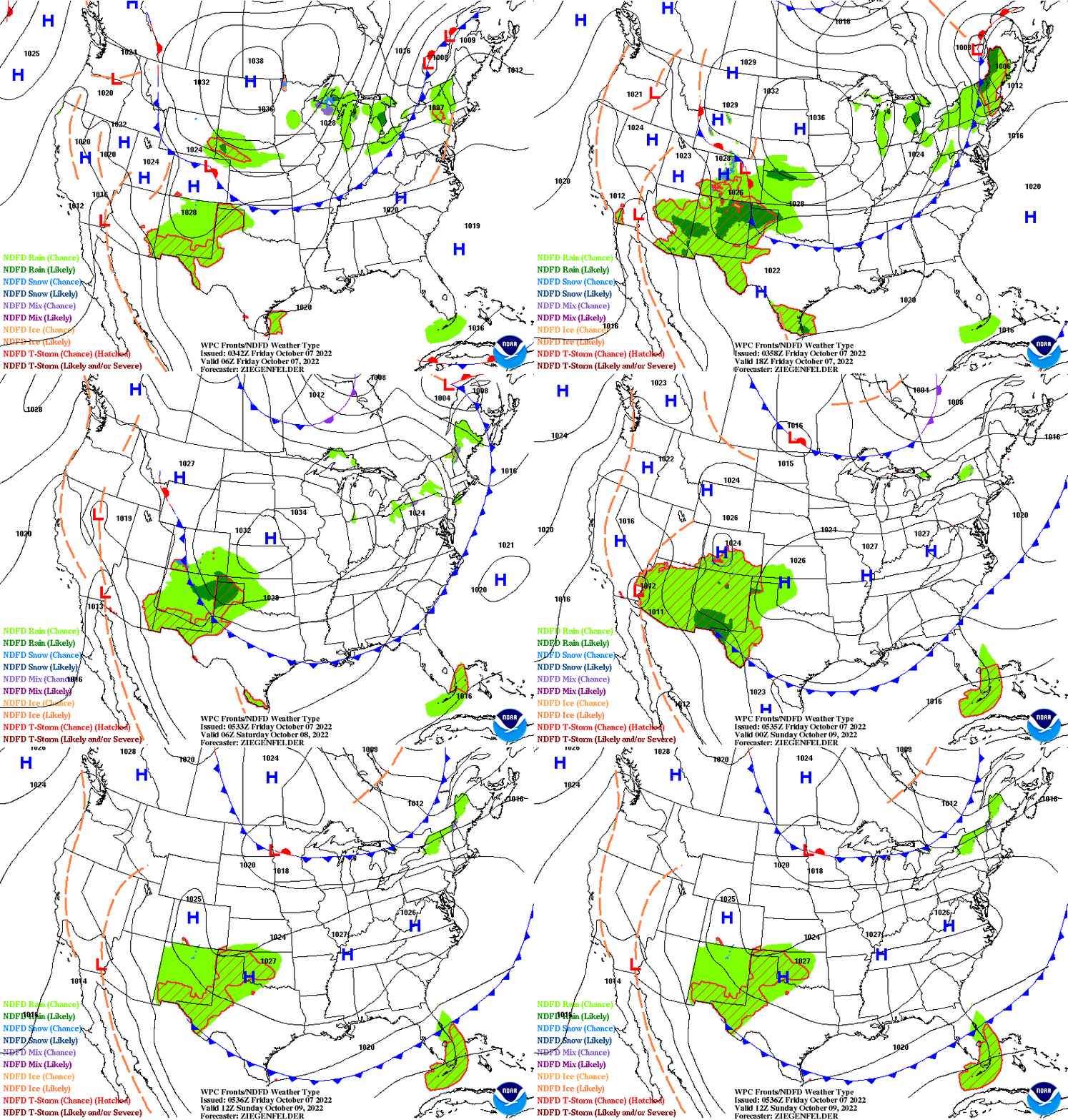
The main story through Saturday will be the potent cold front moving
southward across central and eastern CONUS, with temperatures plunging as
unseasonably cold air filters in from Canada. Highs today across the
northern Plains will struggle to reach the 50-degree mark behind the
frontal boundary, with temperatures dipping below freezing tonight,
leading to the issuance of Freeze Warnings and Freeze Watches across the
Dakotas. Isolated areas in North Dakota may even see temperatures as low
as the upper teens on Friday morning. In addition to the frigid air,
breezy conditions will follow with the passage of the front and gusts may
reach 20-30 miles per hour. Lake-effect showers are also in the forecast
for the Upper Great Lakes as a result of the cold, northwest flow across
the warmer lake water. Some wet snow may mix in for higher elevations of
Wisconsin and the Upper Peninsula of Michigan on Thursday night, though no
accumulation is expected. Below-average temperatures will continue
spreading south on Friday, with highs in the 50s and low-60s as far south
as the southern Plains and Mississippi Valley. Highs will remain even
cooler to the north as a strong Canadian high presses southward, with
mid-to-upper 40s expected for the Upper Midwest and Great Lakes. Lows near
freezing are again possible on Saturday morning for the Great Lakes Region
and Upper Mississippi Valley, with temperatures beginning to rebound
across the northern Plains as more seasonable highs in the low 60s return.

Beautiful weather is in store for the Northeast and Mid-Atlantic through
Saturday, as the upper-level low that brought dreary conditions this past
week has finally slid well offshore. Sunny skies, dry conditions, and
seasonable temperatures in the low-to-mid 70s for highs are expected
through Friday throughout the region, with highs slightly warmer in the
upper 70s to mid-80s across the Southeast and Florida. The warm-up will be
short-lived, as the aforementioned potent cold front makes its way through
the region Friday evening, bringing cooler, fall-like temperatures in its
wake, with highs in the mid-to-upper 60s expected on Saturday. Unlike this
past week, the unseasonably cool air will not be accompanied by wet and
cloudy conditions, with dry weather following in its wake and providing
residents in the Northeast with the perfect weather to view the emergence
of fall foliage in interior New England.

Similarly to the Northeast, pleasant conditions will continue across the
Pacific Northwest, California, and the Great Basin through Saturday as an
upper-level ridge remains in place over the region. Highs are forecast to
remain in the upper 70s and low 80s for the Pacific Northwest and Great
Basin, lower 90s for the central California Valleys, low to mid-70s along
the California coast, and mid-90s to near 100 for the Desert Southwest.
Moreover, conditions will remain dry during this span, resulting in
overall pleasant conditions through the end of the week.

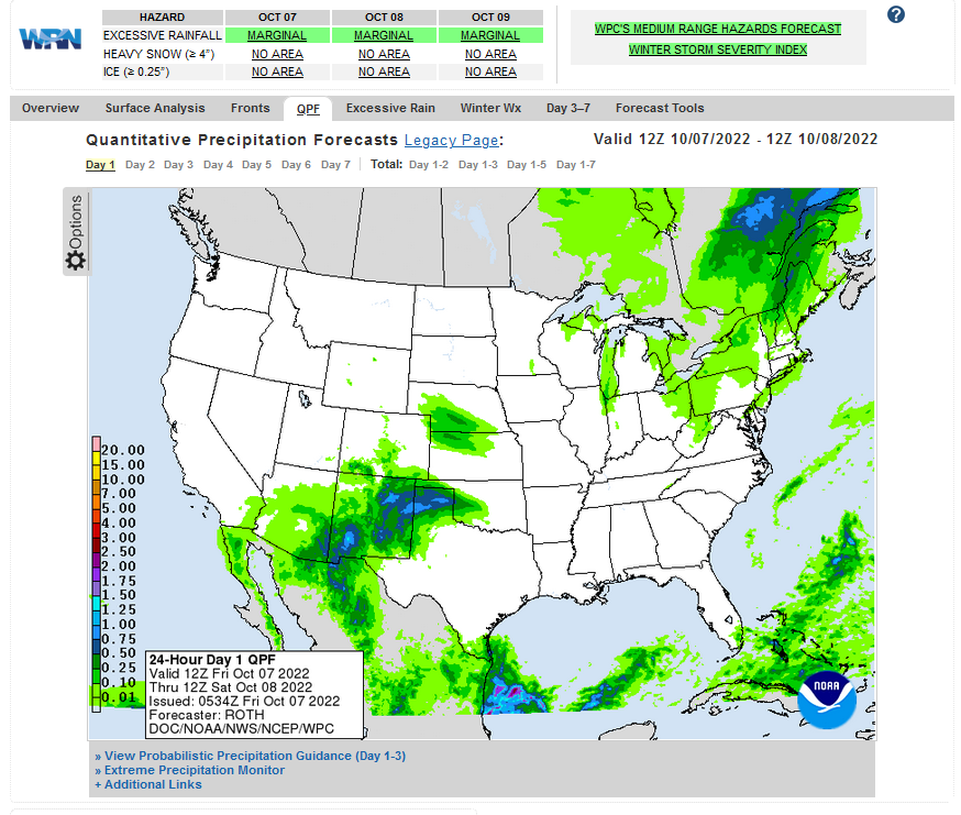
Further south, daily showers and thunderstorms will continue across the
Southern Rockies and Southwest on the east side of a lingering upper-level
low drifting over the Southwest. Anomalously high moisture that remains
pooled across the area will help enhance storm rainfall rates and totals,
and isolated instances of flash flooding are possible, particularly for
areas of sensitive terrain and across burn scars. As a result, a Marginal
Risk of Excessive Rainfall has been issued for much of Arizona and New
Mexico through Saturday. High temperatures will remain below normal with
mid-60s to low 70s expected.
Current forecast of heavy precipitation (Updates can be found HERE)
Maps that relate the forecast to geography can be found by clicking Here for Day 1 and Here for Day 2.
Here is a 60-hour animated forecast map that shows how the short-term forecast is expected to play out
If it needs to be updated click here.
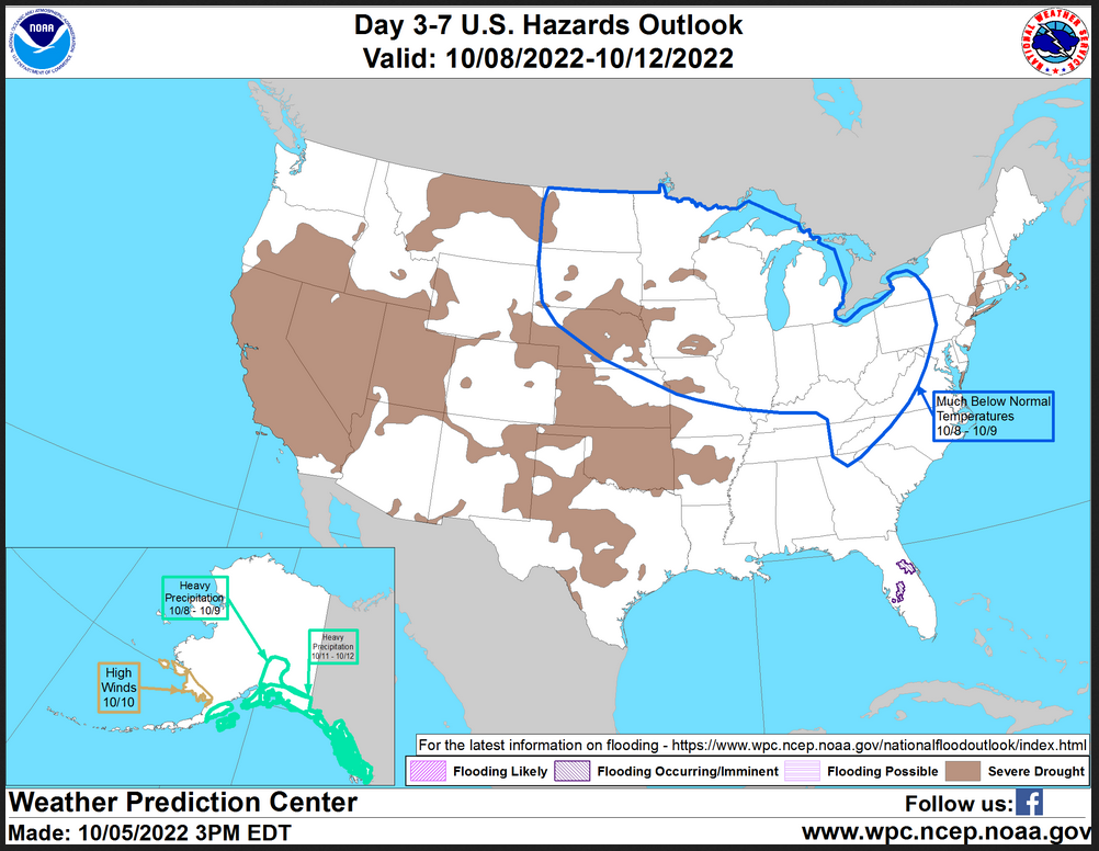
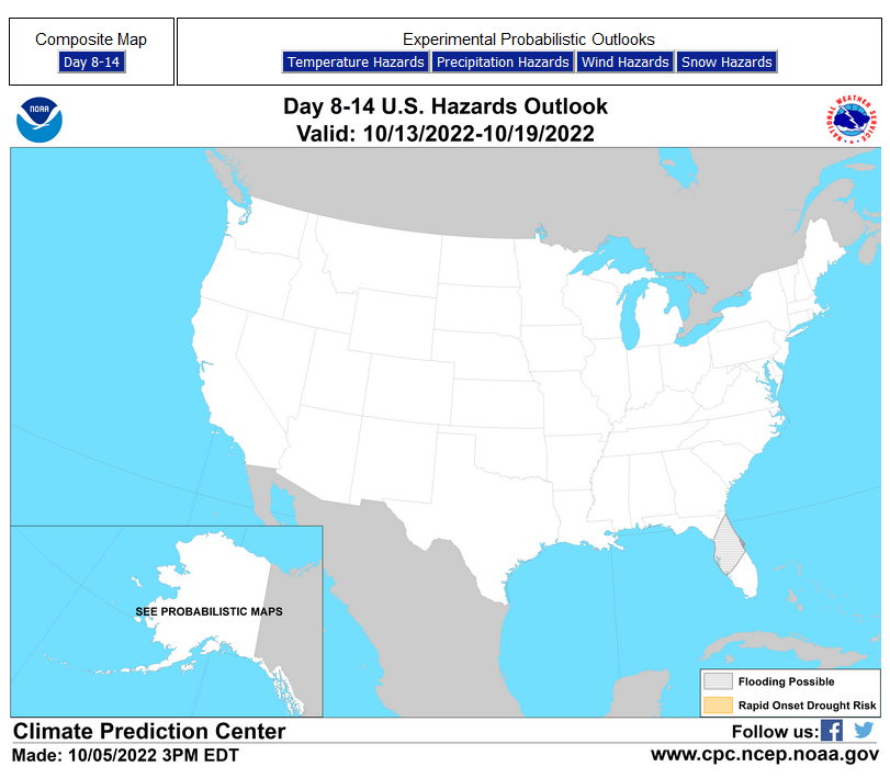
HAZARDS OUTLOOKS
Click here for the latest complete Day 3 -7 Hazards forecast which updates only on weekdays. Once a week probably Monday or Tuesday I will update the images. I provided the link for readers to get daily updates on weekdays. Use your own judgment to decide if you need to update these images.
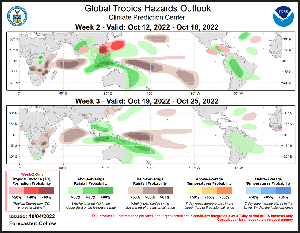
Worldwide Tropical Forecast
(This graphic updates on Tuesdays) If it has not been updated, you can get the update by clicking here This is a new approach and covers weeks 2 and 3 not weeks 1 and 2. It has more information but I am having trouble getting used to it. As usual, it comes with a discussion which is below
Detailed Maps and Reports for the Western Atlantic and the Pacific Oceans
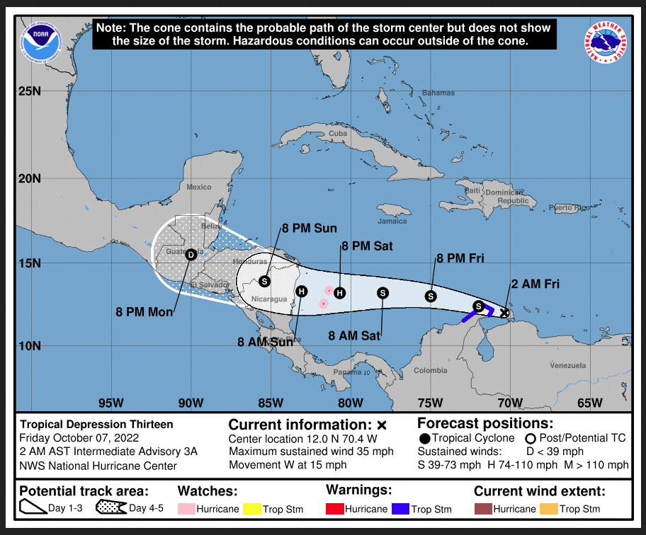
Below are three maps that summarize the situation for the Atlantic, Eastern and Central Pacific. Additional information can be accessed by clicking HERE
First the Atlantic
Click to view the forecast map and have access to additional information https://www.nhc .noaa.gov/gtwo.php?basin= atlc&fdays=5
Then Eastern Pacific
Click to view the forecast map and have access to additional information https://www.nhc.noaa.gov/gtwo.php?basin=epac&fdays=5
Then Central Pacific
Click to view the forecast map and have access to additional information https://www.nhc.noaa.gov/gtwo.php?basin=cpac&fdays=5
And the Western Pacific
Click to view the forecast map and have access to additional information https://www.metoc.navy.mil/jtwc/jtwc.html
Some Intermediate-Term Outlooks
Links to “Outlook” maps and discussions for three time periods. Days 6 – 10, Days 8 – 14, and Weeks 3 and 4. An outlook differs from a forecast based on how NOAA uses these terms in that an “outlook” presents information from deviation from normal and the likelihood of these deviations.
You have to click on the links because they do not update automatically and I do not want to have stale images in the article. But it is not difficult to click on a link and you get a large image plus a discussion. On Fridays in a separate article, we will show the images and provide a link in this article that article. But remember what you will see is the images as of Friday. But here you can get the current images simply by clicking on them. Then hit the return arrow at the upper left of your screen to return to the article. You will not find this information easily anywhere else.
Right now you can find these maps here (We show them every Friday there but you can click above and find them).
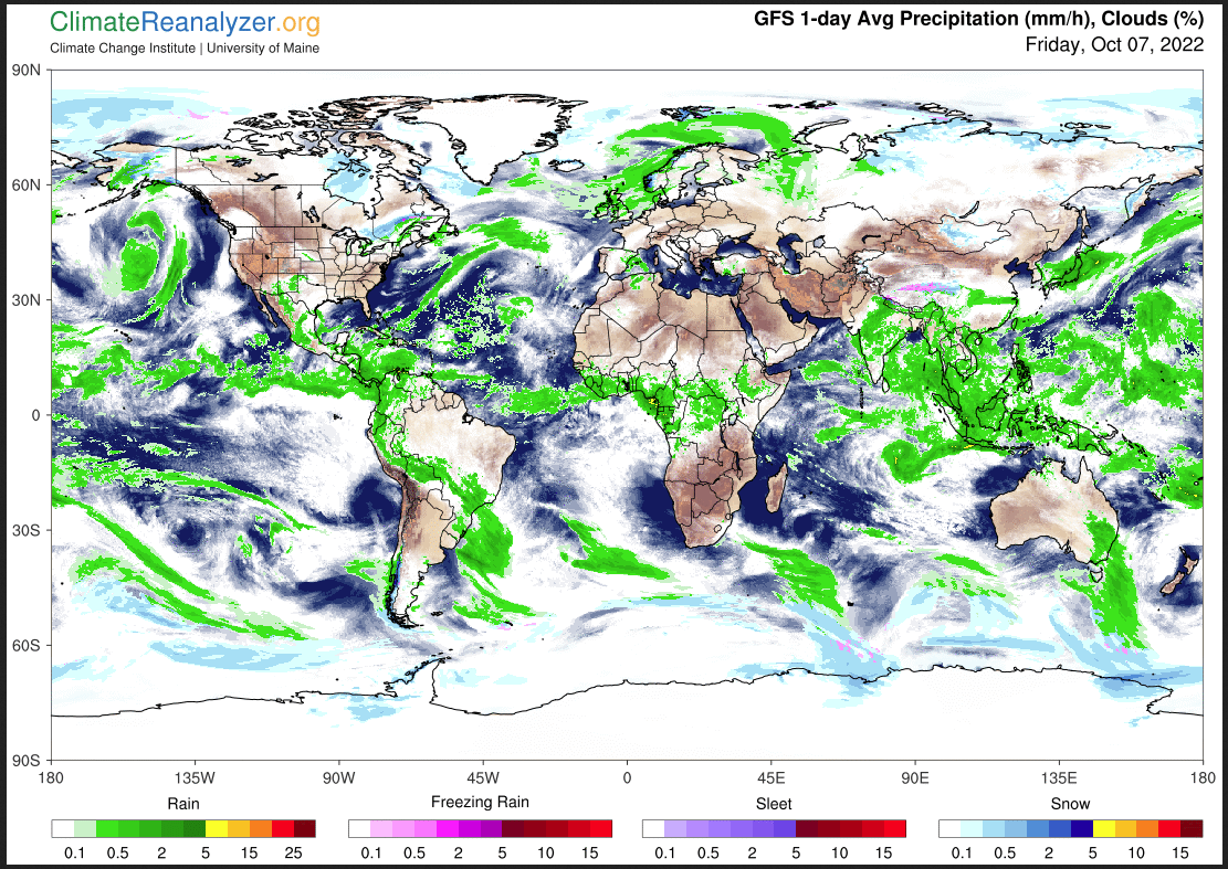
Worldwide Weather
Below is the current or short-term precipitation forecast which can be updated by clicking HE RE Additional maps can be obtained HERE.
Month to Date Information
Month to date Temperature can be found at https://hprcc.unl.edu/products/maps/acis/MonthTDeptUS.png
Month to date Precipitation can be found at https://hprcc.unl.edu/products/maps/acis/MonthPNormUS.png

